Bachelor diploma in Architecture and Urbanism I Faculty of Architecture and Urbanism of the University of São Paulo 2019.1/2024.2
WORK EXPERIENCE
Architectural intern - Strategic Office of the Department of Urban Planning and Licensing, of São Paulo’s City Hall Support to the team responsible for developing the first Waterway Plan for the city of São Paulo.
(Sep/2023 - March/ 2024)
Architecture Intern – São Paulo
Urbanismo, Urban Landscape Departament of the Project Superintendency of the city hall of São Paulo. Actively participated in the design of important urban infrastructure projects for the city of São Paulo.
(Sep/2021 - Apr/2023)
Ana Carolina Tiecher Martins
acarolinatiecher@gmail.com + 31 6 39082947
2333BG, Leiden
www.linkedin.com/in/ana-t-a915b0232
Freelance, Visual graphic installation intern at the São Paulo 35th Art BIENAL Installation work and graphic visual communication for the event assembly.
(Ago/2023)
Operations Analyst, Call Center– ClearSale
S/A Began as an intern and achieved four promotions with in different levels of the Call Center Operator position.
(Apr/2015 - Jul/2017)
ACADEMIC EXPERIENCE
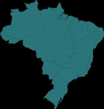
USP Scholarship project on the Fluvial Metropolis Group: Architectural project of urban fluvial infrastructures: The Billings Reservoir, in São Paulo. (Sep/2020 - Aug/2021)
Brasiliana Guita and José Mindlin’s Library – USP Scholarship: Research, production and dissemination of the “Boletim 3x22” , a magazine project. (Sep/2019 - Aug/2020)
CERTIFICATES
SIICUSP 29th International Symposium on Scientific and Technological Research at University of São Paulo-USP - SIICUSP
Course on Water Resources Management in the State of São Paulo, by the Environmental Company of the State of São Paulo- CETESP
PUBLIC PROJECTS
Urban Redevelopment Project – Rua das Motos, São Paulo, Brazil - 2022. Intern, São Paulo Urbanimo, City Hall Office. Available at https://gestaourbana.prefeitura.sp.gov.br/noticias/ruas-das-motos-sera-requalificada-pela-prefeitura-de-sp-em-2024/
WaterWay Plan of the Municipality of São Paulo, – PlanHidro SP São Paulo, Brazil – 2023. Intern. Secretaria Municipal de Urbanismo e Licenciamento (SMUL). Available at https://gestaourbana.prefeitura.sp.gov.br/ marco-regulatorio/plano-municipal-hidroviario/
SUMMARY
Urban Architectures and Everyday Life: Várzea do Palácio’s Neighborhood-Park
Urban Fluvial Infrastructure Project: Pedreira Compartiment of the Billings ReservoirCocaia branch São Paulo, SP LABPROJ/FLUVIAL METROPOLIS GROUP/ FAUUSP/2021
URBAN ARCHITECTURES AND EVERYDAY LIFE: VÁRZEA DO PALÁCIO’S PARK- NEIGHBORHOOD
Final Project Graduation/FAUUSP/2024
Solo Project
Várzea do Palácio, Guarulhos, São Paulo, Brazil
Final Graduation Project, FAUUSP
Semester/Year: 2/2023- 2/2024
Date: 05/12/2024
Advisor: Prof. Dr.Milton Braga I miltonbraga@usp.br
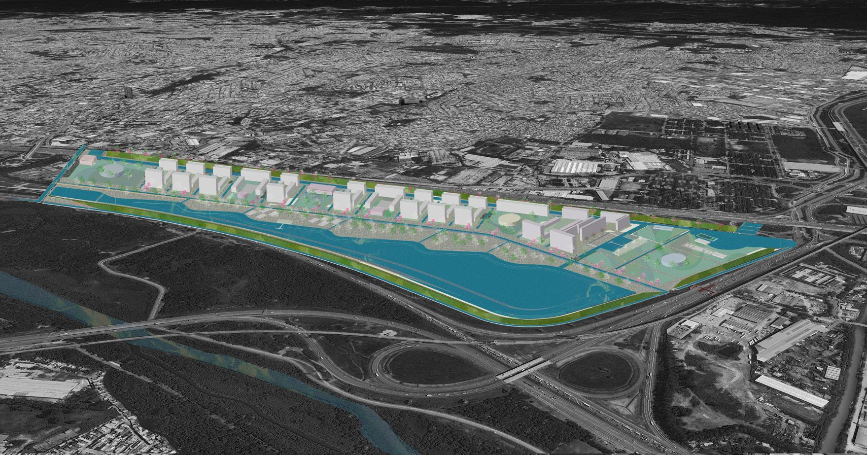
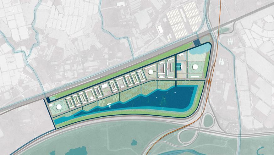
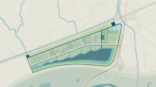
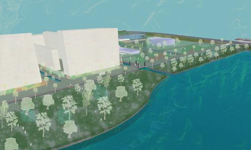
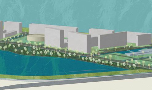
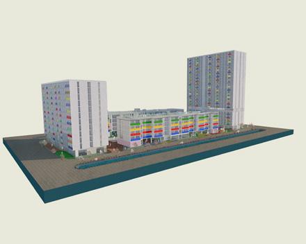
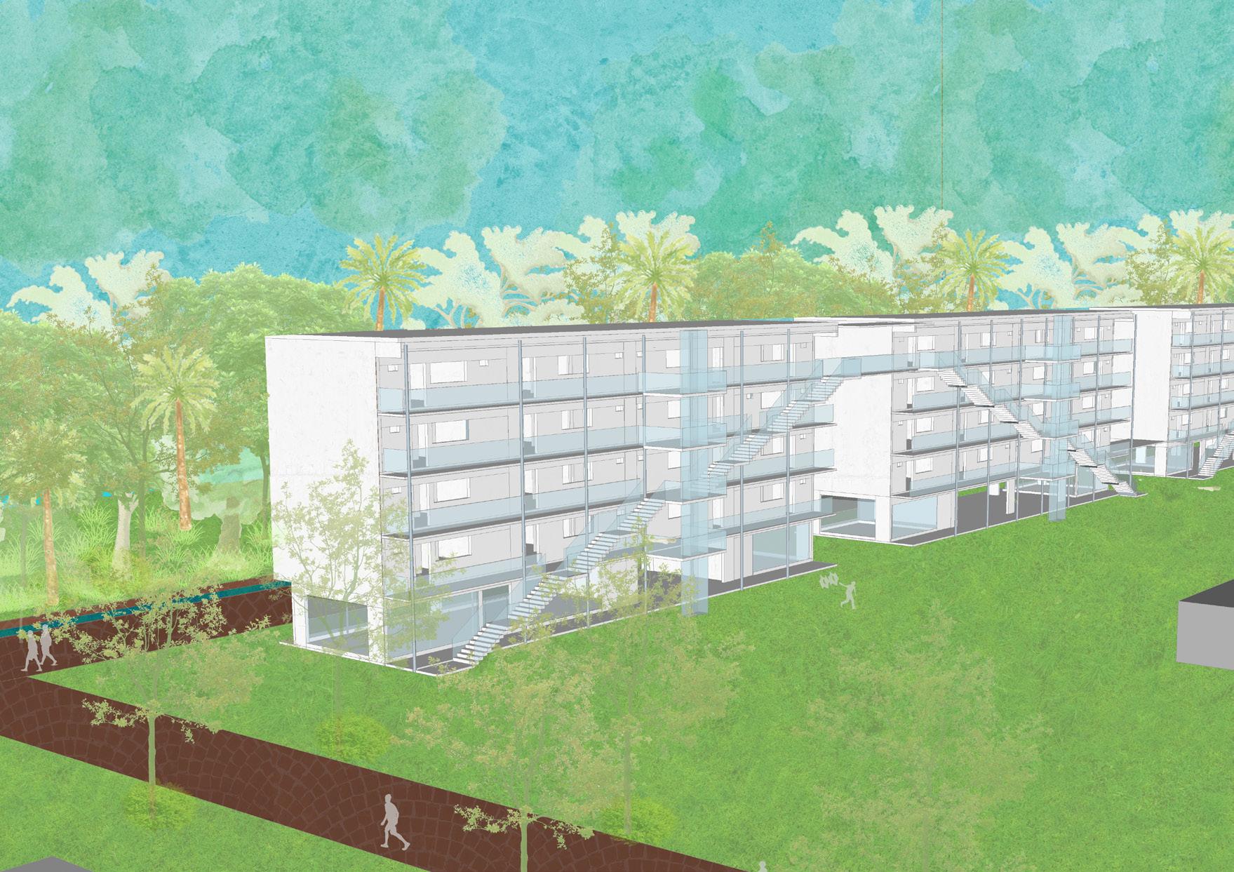
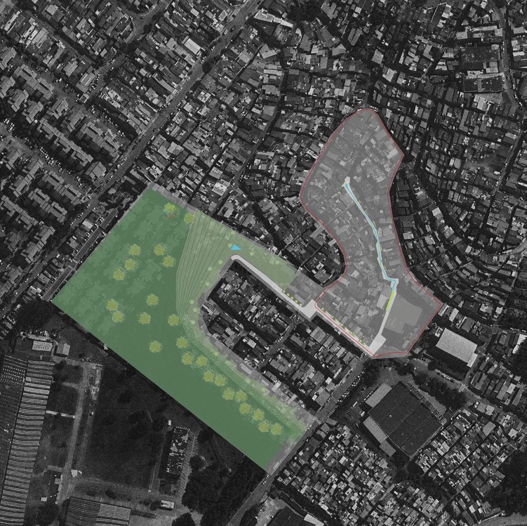
This project, developed a study of a neighborhood model, addressing urban and environmental needs of a modern metropolis. Developed in Guarulhos, on a floodplain of the Tietê River, one of the most strategic areas of the metropolis, fragmented by highways, railways, and lowimpact urban occupations. The urban, metropolitan, and environmental impact of an area like this is undeniable. Its timeless infrastructures, such as highways and railways, continue to expand their reach, intensifying their dynamics, presenting the challenge of transforming their impact into a positive contribution . With climate change increasing the necessity of green and blue solutions, reconciling their metropolitan potential with a sustainable urban model is crucial. Therefore, canals, streets, parks and buildings were designed and linked to the scope of a new urban dynamic that aims to improve drainage and flood control, balancing urban growth and environmental resilience.
THE
MASTER PLAN OF VÁRZEA DO PALÁCIO’S
PARK- NEIGHBORHOOD
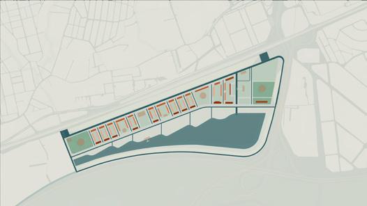
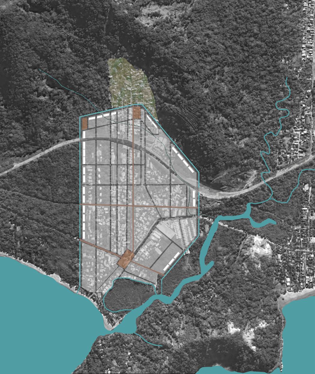
THE MASTER PLAN
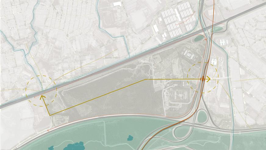
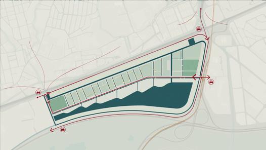
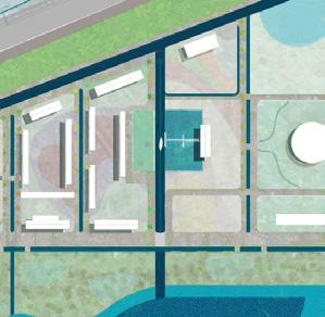
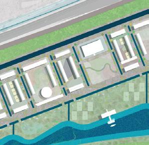
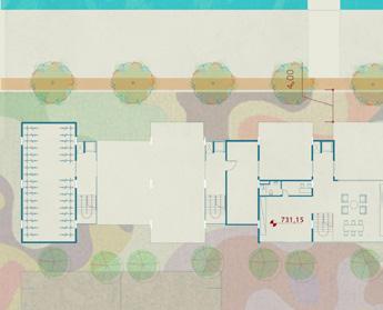
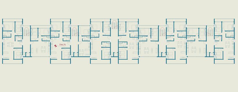
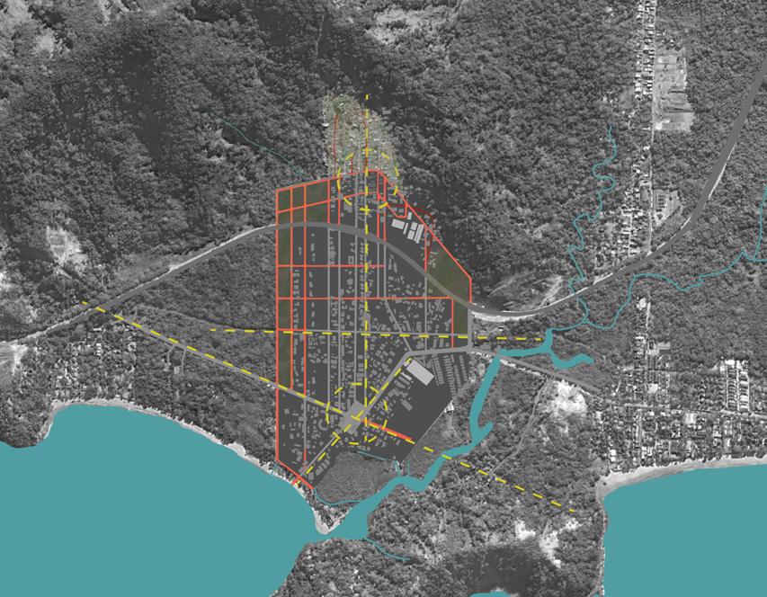
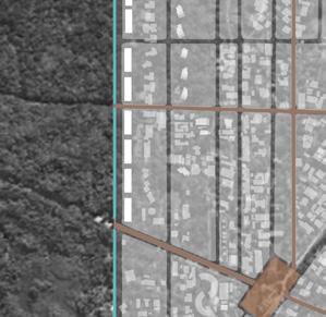
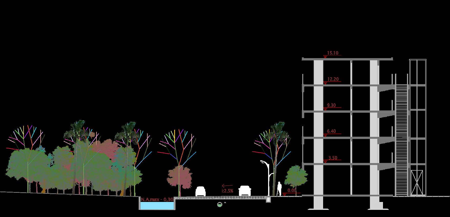
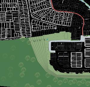
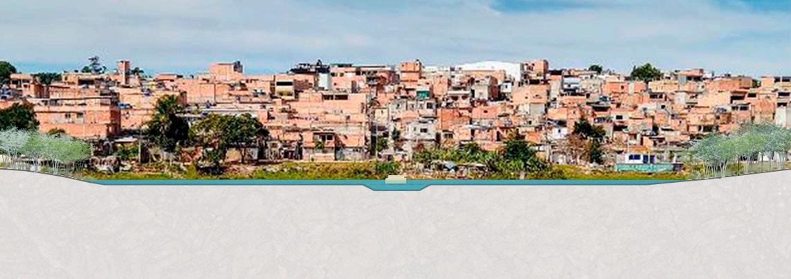
The infrastructure project needed to be modern and metropolitan, to meet the dynamics that the area demands, as well as resilient and river-friendly, and this was guided not only by climate change, but mainly by the characteristics of a floodplain area, occupied in an urban and environmentally reckless manner, in a city with a history of high flooding and droughts, which lacks river-related urban treatment in its public architecture. Canals and lakes were part o f a large small sytems od green and blue urban infrastrucutes. The equipment was designed to meet the basic demands of the project density scale, with its insertion region, also responding to the needs of scale and demand. There are 139 hectares of neighborhood, 72 hectares of which are destined for urbanization, with 200 inhabitants/hectare and 14,457 people.
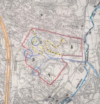
Area present-day situation: potential mobility hubs and axes - Penitentiaries
THE MASTER PLAN- CONCEPTS
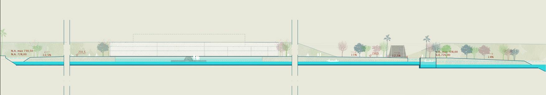
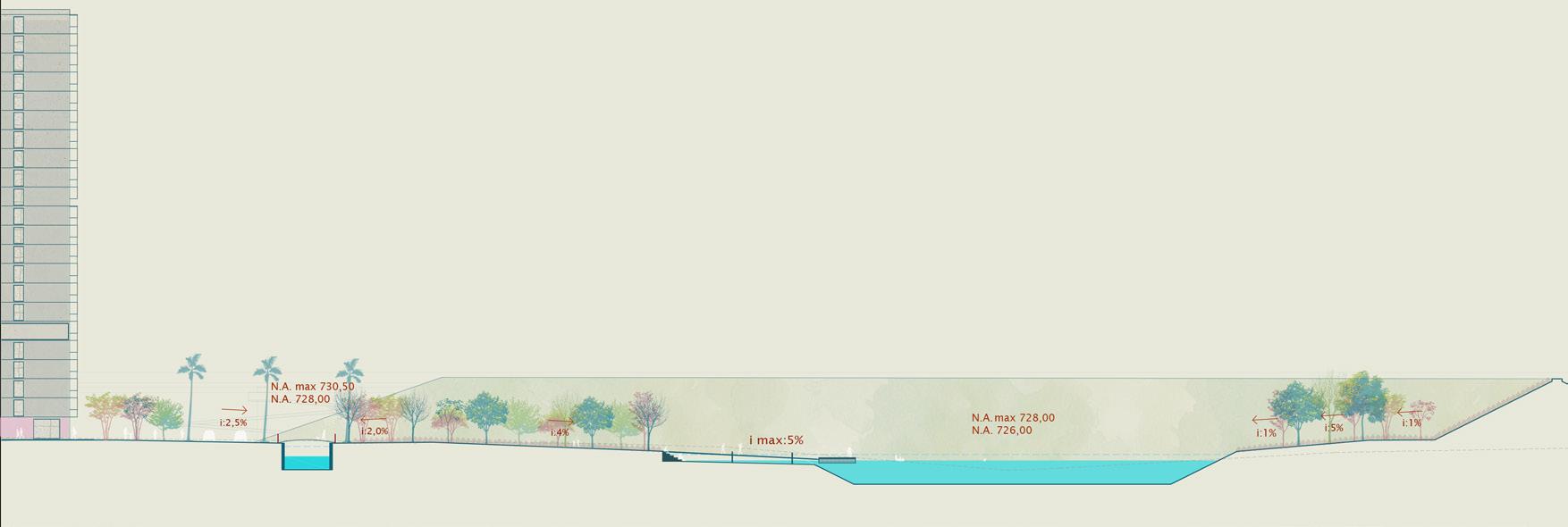
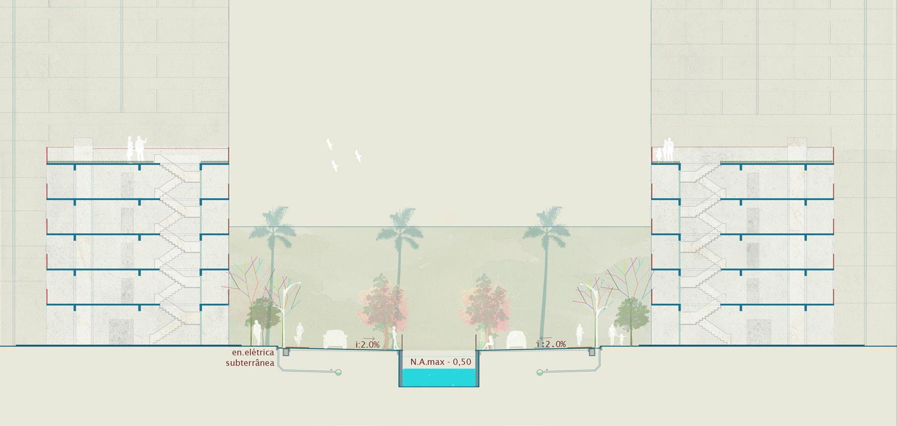
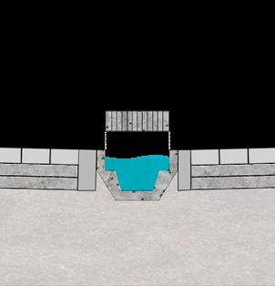
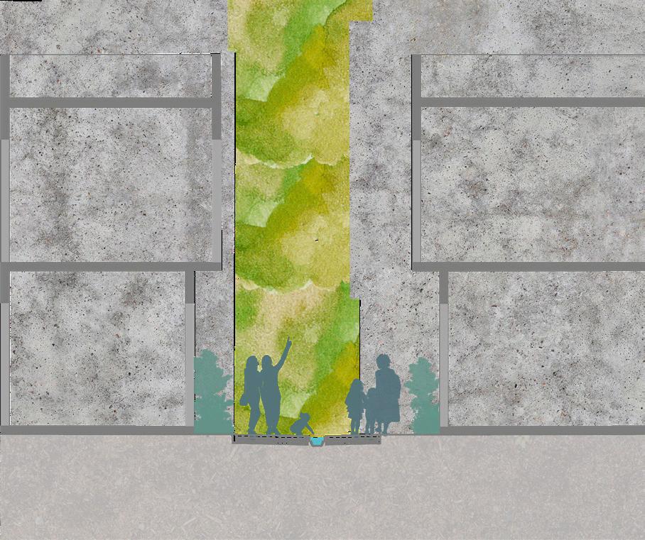
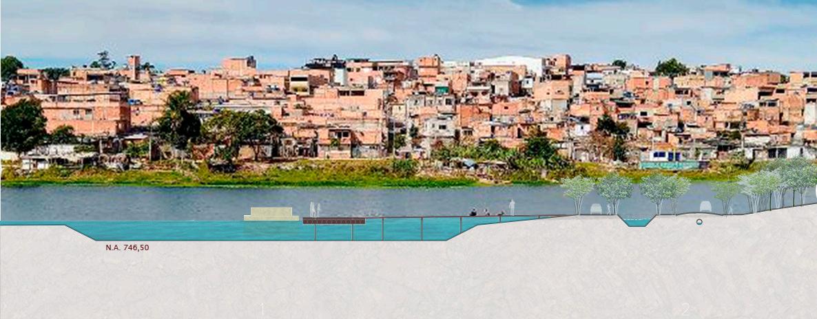
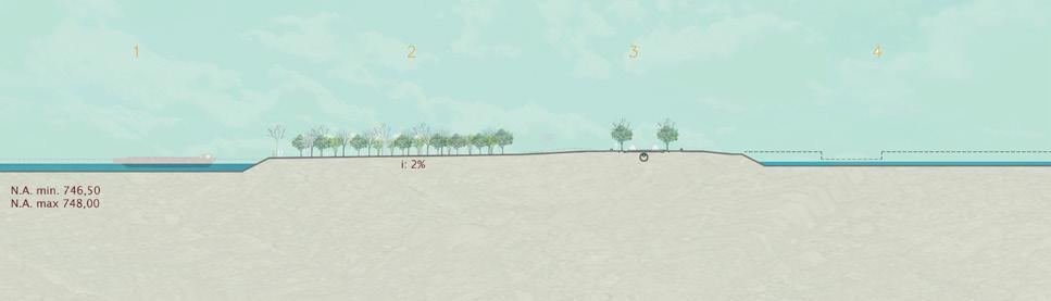
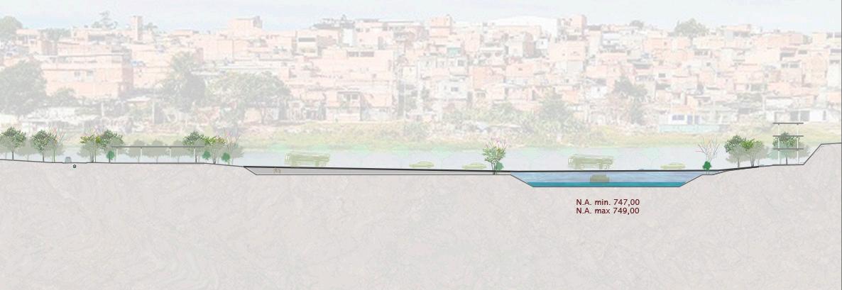
Image Description: Cross-section of the neighborhood. 1- the highway Av. President Durtra 2/4- Acoustic and visual barrier landfill, constructed from the project cut volume. 3- Lake of the Neighborhood. 3 the highway Ayrton Senna. 5- Tietê River poles
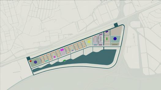
PROJECT KEY-DECISIONS
INFRASTRUCTURE CONCEPTS SECTIONS
CROSS- SECTION I Navigable canal for recreational use With a 12m navigation lock, for a 2m drop
CROSS- SECTION I The park neighborhood from landfill to landfill Navigable canal for recreational use
PROJECT KEY-DECISIONS
INFRASTRUCTURE CONCEPTS SECTIONS
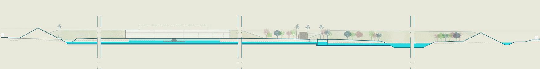
CROSS- SECTION I Navigable canal for recreational use
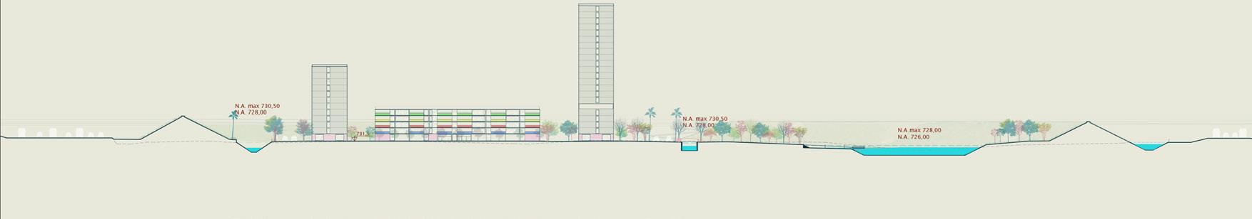
The park lake and the neighborhood life
CROSS- SECTION I The park neighborhood from landfill to landfill
The park lake and the neighboorhood life m
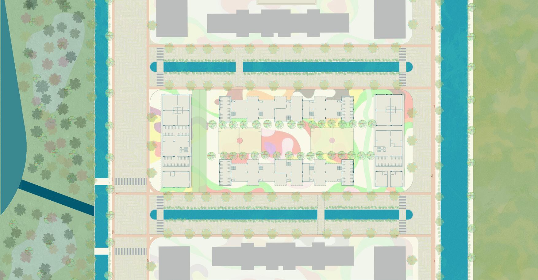
THE TIPIC SQUARE PLAN
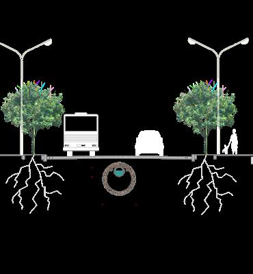
THE TIPIC STREET
CROSS - SECTION
PROJECT KEY-DECISIONS
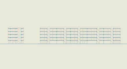
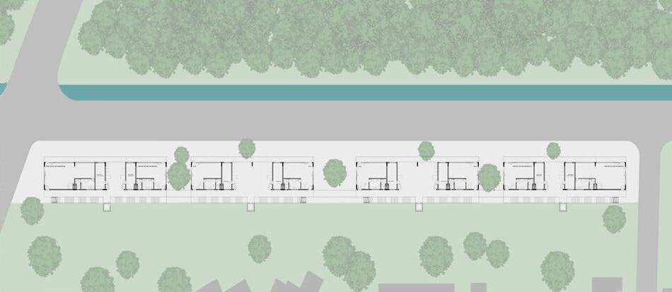
BUILDINGS CONCEPTS - HABITATIONS
Plan for the city-forest border: Barra do Sahy
Street-canal-habitation
FAUUSP/2023
Group Project
Vila do Sahy, São Sebastião,São Paulo,Brazil Free Studios, FAUUSP
Subject: AUP0162 - Architecture: Project 4/4
Semester/Year: 1/2023
Date: 03/07/2023
Co-author: Laura Zingari
Advisor: Prof. Dr.Milton Braga I miltonbraga@usp.br
This project is sudy about the limits of the integration between the urban growth and the conserved nature.
It is also a project about trials of complementarity between the architecture and the urbanism. We propose a design solution, which in addition to dealing with this problem on a city scale, also addresses the housing issue, detailing the type of occupation.
The perimeter canal of this project represents, along with a technical and a infrastructural justification, an ideological justification. It marks the fronts between the city and the forest, by water, in a planned, coherent and necessary implantation in their insertion. Represents a new design discourse for thet popular habition typology that exist in the country, and as well city configuration, where the ‘water path’ is a reference part in its design, not a issue, as it is use to be
THE PROCESS
THE MASTER PLAN OF BARRA DO SAHY
The infrastructure project needed to be modern and metropolitan, aligning with the area’s dynamic demands, while also being resilient and river-friendly. This approach was driven by the characteristics of a floodplain, which has been urbanized in an environmentally reckless manner in a city with a history of severe flooding and droughts, lacking river-integrated urban planning in its public architecture.
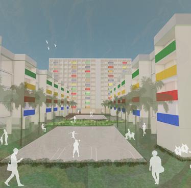
The canals and lakes formed a network of green and blue urban infrastructures, designed to enhance flood control and environmental integration. Public facilities were planned to accommodate the density and scale of the project. Similarly, the housing project was developed for a neighborhood with a density of 200 inhabitants per hectare, with one-third allocated for social housing, addressing both urban and social needs.
HABITATION TYPOLOGIES
PERIMETERAL CANAL
NEW ALLOTMENTS
URBAN QUALITY AREAS
REFORESTATION
NEW ACCESS AXIS
URBAN TRANSFORMATIONS:THE GAZUZA
FAVELA, SÃO PAULO
FAUUSP/2022
Favela do Gazuza, São Paulo, São Paulo, Brazil
Free Studios, FAUUSP
Subject: AUP0282 - Urban Design and City Spaces- Project Semester/Year: 1/2022
Date: 29/06/2022
Co-author: Rafael Macedo, Isadora Sanches, Juliana Martins, Leticia Meneses
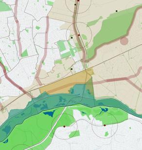
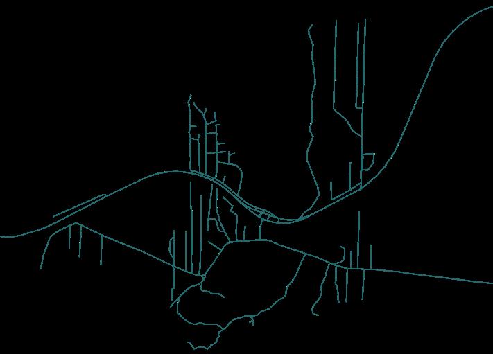
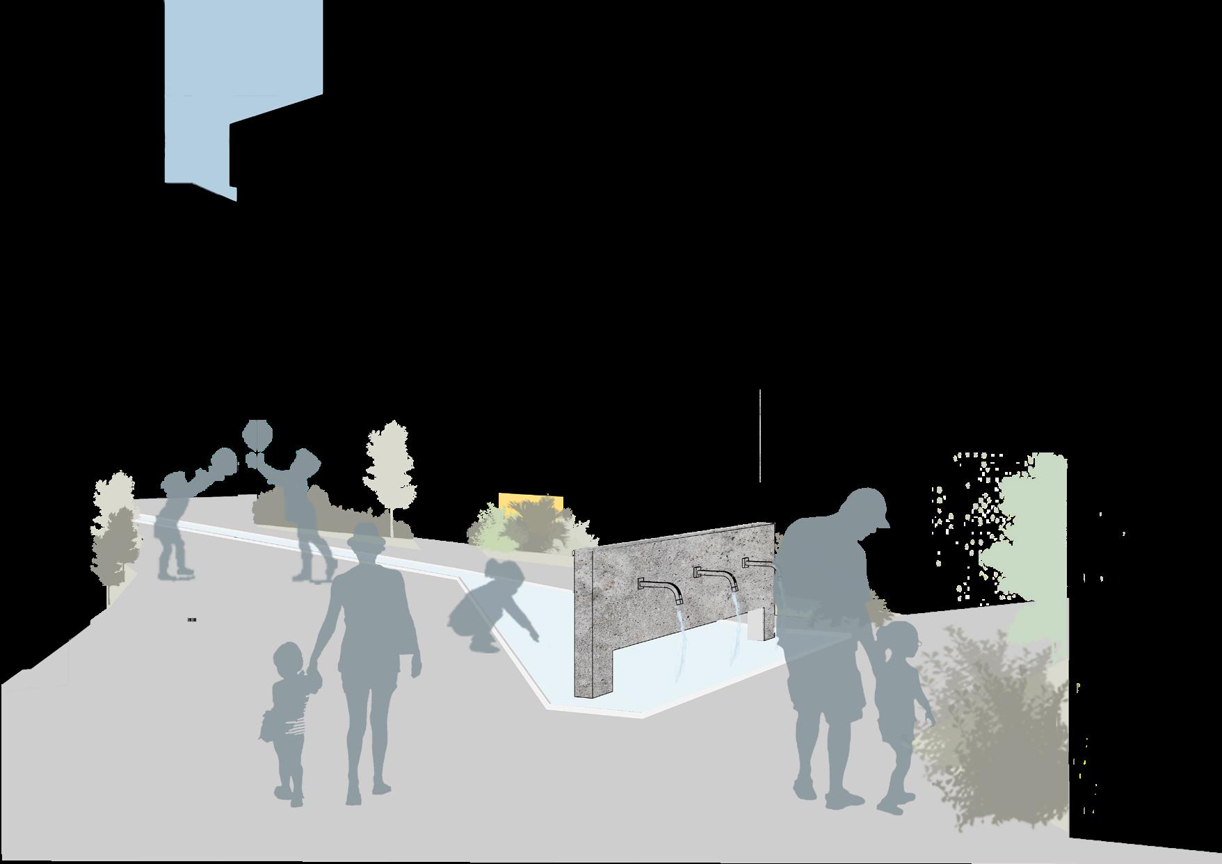
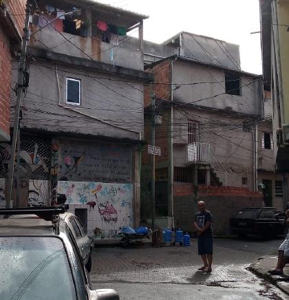
This project was designed in order to promote urban improvements for the Gazuza favela, in São Paulo, with the chalenging of minimal changes, but with strong and clear concept, on an already hiper urbanized area. The area, lacking infrastructure and planning, and densily populated, after deep group avaluation, contained multiples river source in its paths. For these paths and streets, crowded and already with a consolidated urban occupation, we foresee urban infrastructure betterments and the reconnection of the local population with their native river area, a topic so suppressed in this metropolis.
SITE PLAN URBAN TRANSFORMATIONS
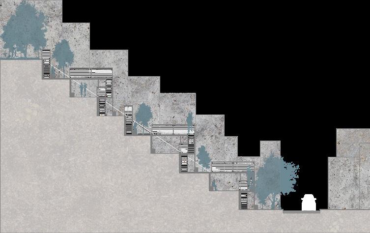
SLOPE PROJECT
REFLORESTATION AREA
RIVER SOURCE, “SPRING” RECOVERED
The intervention route began at this spring and extended to another in the neighborhood, located on a landslide-prone ravine. Some urban infrastructure interventions were also proposed in order to improve the quality of life of the inhabitants. Such as garden pathways, opening and redesigning streets and sidewalks, embankment and treatment for landslide areas, and a community kitchen garden.
GARDEN PATHWAYS
GAZUZA
URBAN TRANSFORMATIONS
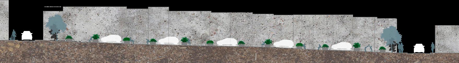
SPRING STREET - SECTION
The central gutter that runs from the main spring, in addition to controlling the runoff of rainwater, which causes flooding in the residents’ homes, and conducting this water to adequate levels, also acts as a reminder of the river that runs under the neighborhood’s most populated street, connecting its residents to it
AA CROSS- SECTION I The Central Gutter
GAZUZA URBAN TRANSFORMATIONS
SLOPE AND GARDEN PATHWAYS - SECTION
THE NEW SPRING STREET
‘RUA DA BICA’
URBAN-FLUVIAL INFRASTRUCTURE PROJECT:
PEDREIRA COMPARTIMENT OF BILLINGS
RESERVOIR, COCAIA
BRANCH.
LABPROJ/FLUVIAL METROPOLIS GROUP/ FAUUSP/2021
Solo Project
Hidroanel, Billings Reservoir, São Paulo, São Paulo, Brazil
LABPROJ/Fluvial Metropolis Group, FAUUSP
Scientific Project PUBUSP/2021
Semester/Year: 2/2020 - 2/2021
Date: 01/09/2021
Advisor: Prof. Dr.Alexandre Delijaicov I delijaicov@usp.br
Softwares: AutoCad/ GIS/ Illustrator/ Photoshop
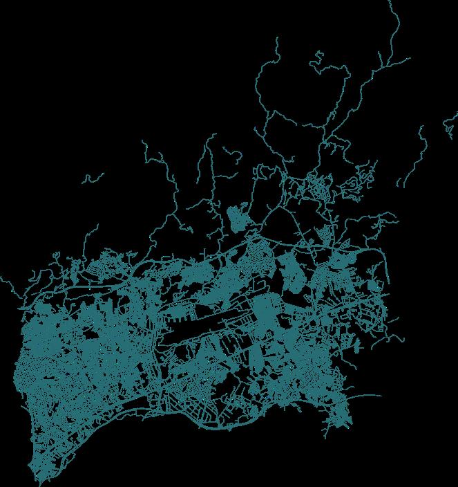
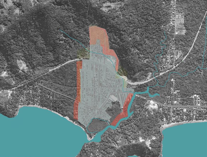
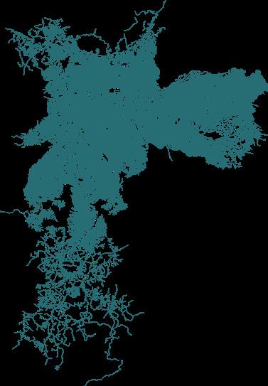
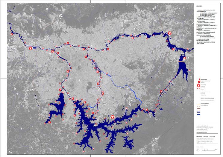
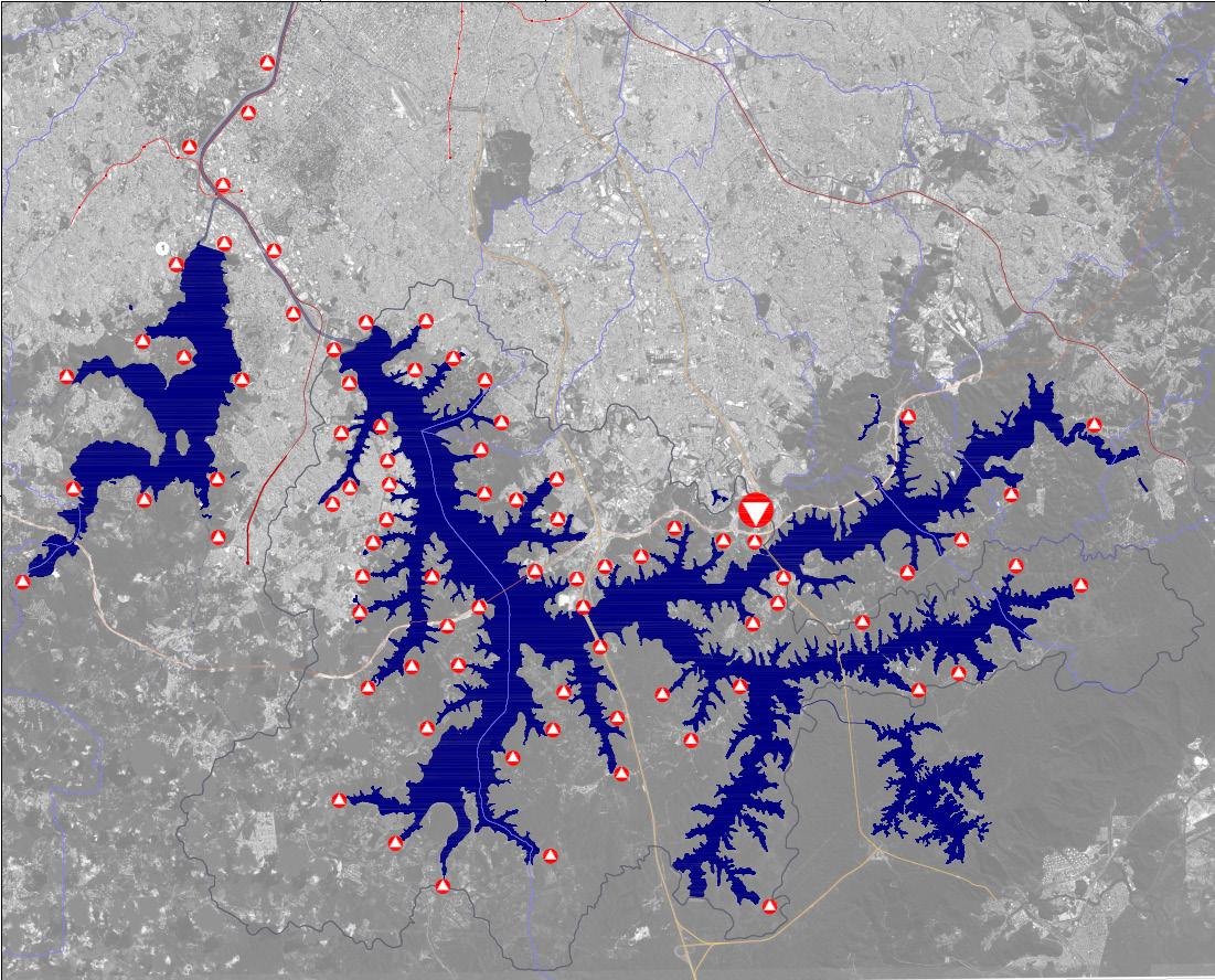
This project, developed within the Scientific Research work of the Fluvial Metropolis Group at the FAUUSP Project Laboratory, critically examines the São Paulo Metropolitan Hidroanel, proposing urban fluvial infrastructure for the Pedreira Compartment of the Billings Reservoir. It challenges the traditional urban model, which prioritized road networks over water systems, leading to environmental degradation, public health issues, and urban inefficiencies. The study introduces a metaproject that redefines urban planning by integrating rivers as structuring elements, focusing on the Cocaia branch of the Pedreira Compartment, a highly degraded area along Avenida Belmira Marin, where over 202,000 people commute daily. To restore the region and its water culture, the project develops a redevelopment strategy, incorporating navigable waterways, environmental recovery, and sustainable urban infrastructure, ensuring a resilient and functional urban model. Using a triad-based methodology—place (Where), program (What), and construction (How)—the research establishes a scientific and technical foundation for interventions. Ultimately, it advocates for a new urban paradigm, reinforcing the importance of fluvial infrastructures in sustainable urbanism, balancing navigation, environmental preservation, and metropolitan development.
‘Ports of the Metropolitan Hidroanel of São Paulo’ Board produced by me, from material prepared by Grupo Metrópole Fluvial, for the 12th São Paulo International Biennial of 2019.
A critical review of the Metropolitan Hidroanel of São Paulo, for the Pedreira Compartment of the Billings Reservoir drainage Basin, with a design focus on the Cocaia Branch.
‘Ports of the Metropolitan Hidroanel of São Paulo: Pedreira Compartiment of Billings Reservoir’ Board produced by me, from material prepared by Grupo Metrópole Fluvial, for the 12th São Paulo International Biennial of 2019.
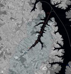
Pedreira Compartment of the Billings
Reservoir - Branch Cocaia
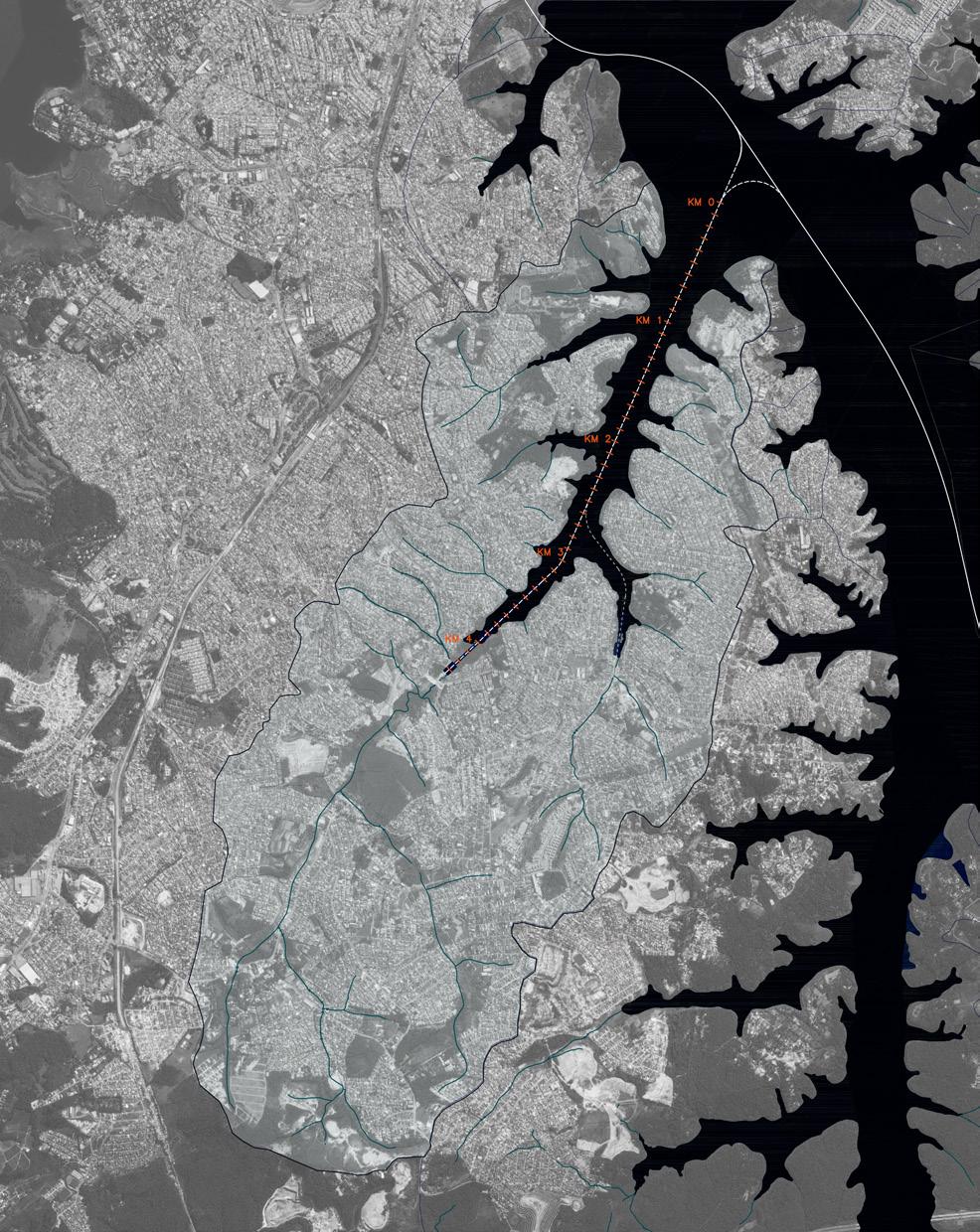
In the Cocaia branch of the Compartiment, the research developed the project of a waterway of 4.42km long, in order to connect this waterway to the others existing in the navigable axes of the Hidroanel.The entire watershed area was studied to ensure greater precision in decision-making for the project supporting the functionality of this waterway. Special attention was given to the calculations for sizing the sanitation collectors, whose implementation is essential for the proper operation of the waterways, considering that the area suffers from the direct discharge of waste into its tributarie. Two possibilities for embarkation and disembarkation, as well as water-land connections, were studied to explore the concepts of a fluvial city promoted by the Hidroanel waterways.
POSSIBILITY
For bording and landing
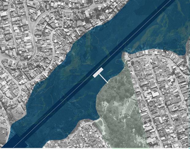
AA LONGITUDINAL- SECTION I Downstream and upstream of Belmira Marin Avenue BB CROSS - SECTION I Upstream of Belmira Marin Avenue
embarkation, and disembarkation.
Image Description: 1- Maneuvering basin,
2- Access road. 3-Av. Belmira Marin. 4- Mouth lake of the Cocaia River.
Image Description: 1- Elísia Gonçalves Barcelos Street. 2- Paulo Francisco Pucca SchooI. 3- football pitch. 4- Built Mouth lake of Cocaia.