PORTFOLIO OF PROJECTS
CIVIL ENGINEER
MSC – POLITECNICO
DI TORINO
CIVIL ENGINEER
MSC – POLITECNICO
DI TORINO


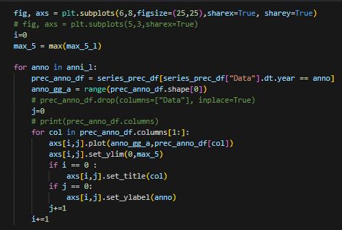
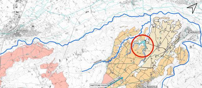
Cherasco and Narzole (CN), Italy
Area -> 3250 Ha
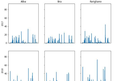
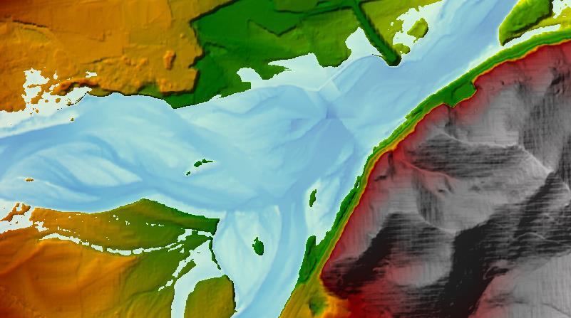
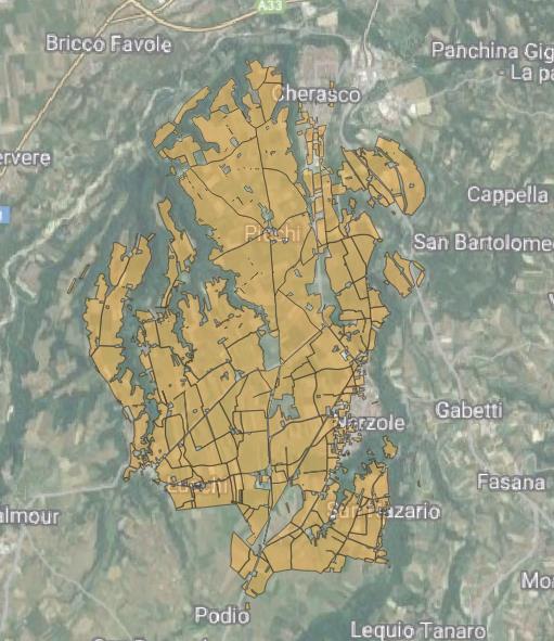 Sarmassa general layout

Lack of at least 500 L/s for irrigation in July and August
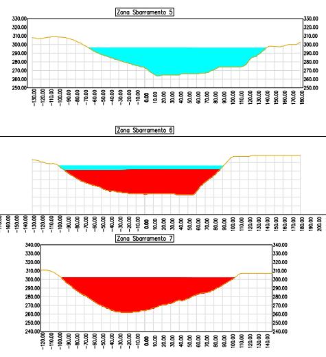
EARTHFILL DAM

Reservoir Volume -> aprox. 2.5 Mm3
Water for aprox. 1/3 of the consortium
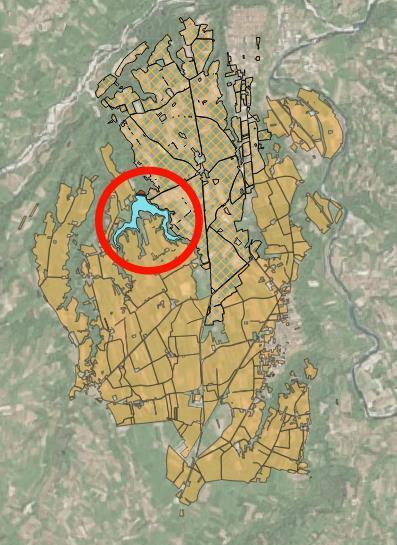
Sarmassa general layout, lake and involved area
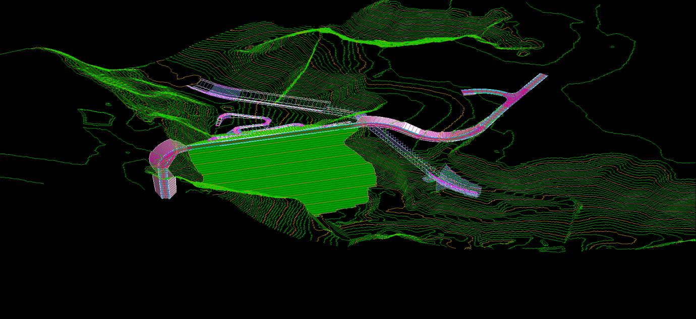
Earthfill Dam
Road restorantion
Dam access road
Spillway
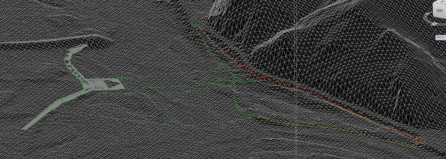
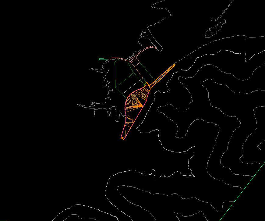
CIVIL 3D
SUBASSEMBLY COMPOSER
Dam Reservoir
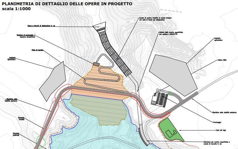
Project drawings
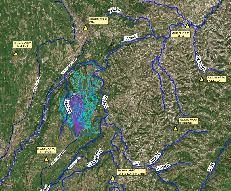
Borgo San Dalmazzo, Boves and Cuneo(CN)
PROBLEM
Water intake difficulties upstream of the consortium
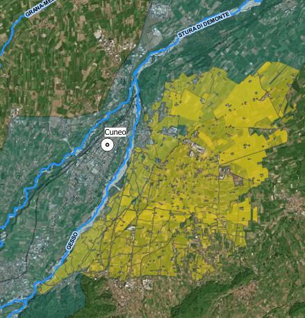
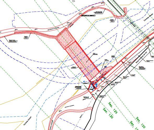
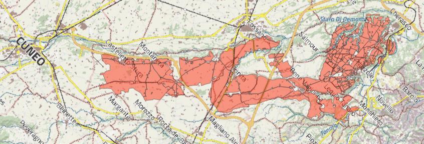
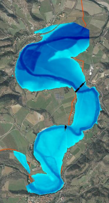
Naviglio-Vermenagna general layout
Weir just downstream
Gesso and Vermenagna rivers
Flood simulation
Existing condition
Design Condition
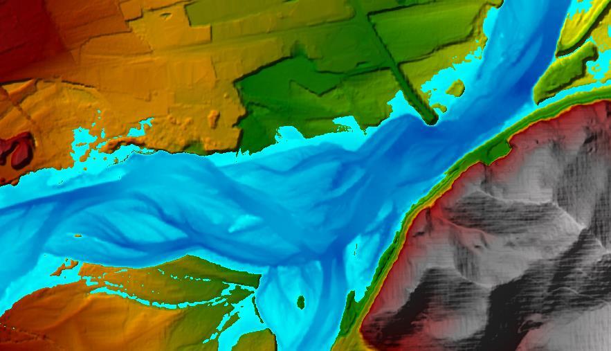
HEC-RAS
From Cuneo to Cherasco (CN), Italy
Served area –> 14000 Ha
Length. -> 23 km
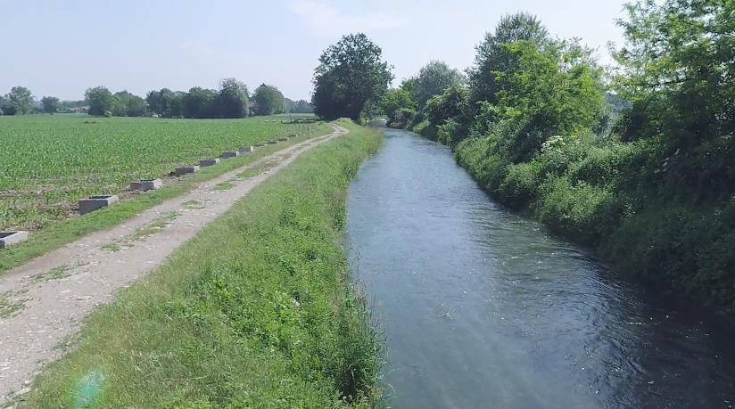
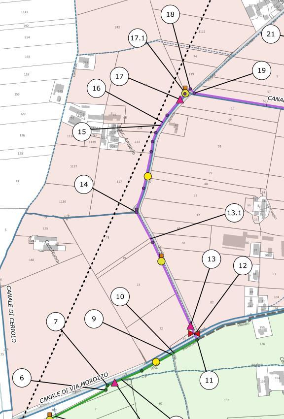
 Canal
Photo Consortium General layout
Canal
Photo Consortium General layout
Earth canals and branches
Surface irrigation
High water dispersion
PARTIAL IRRIGATION
NETWORK REPLACEMENT
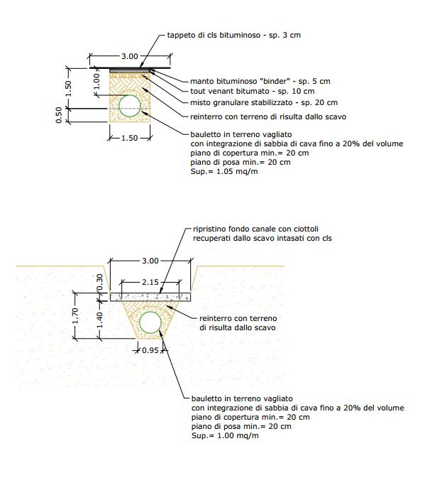
From Canals to Conduits
CONSCTRUCTION OR REPLACEMENT
CONSTRUCTION
Hydropower plants
Hydraulic equipment and machinery
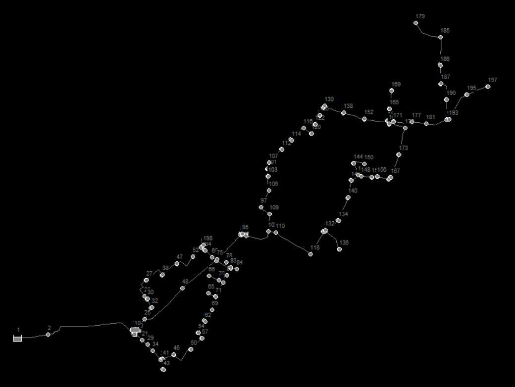
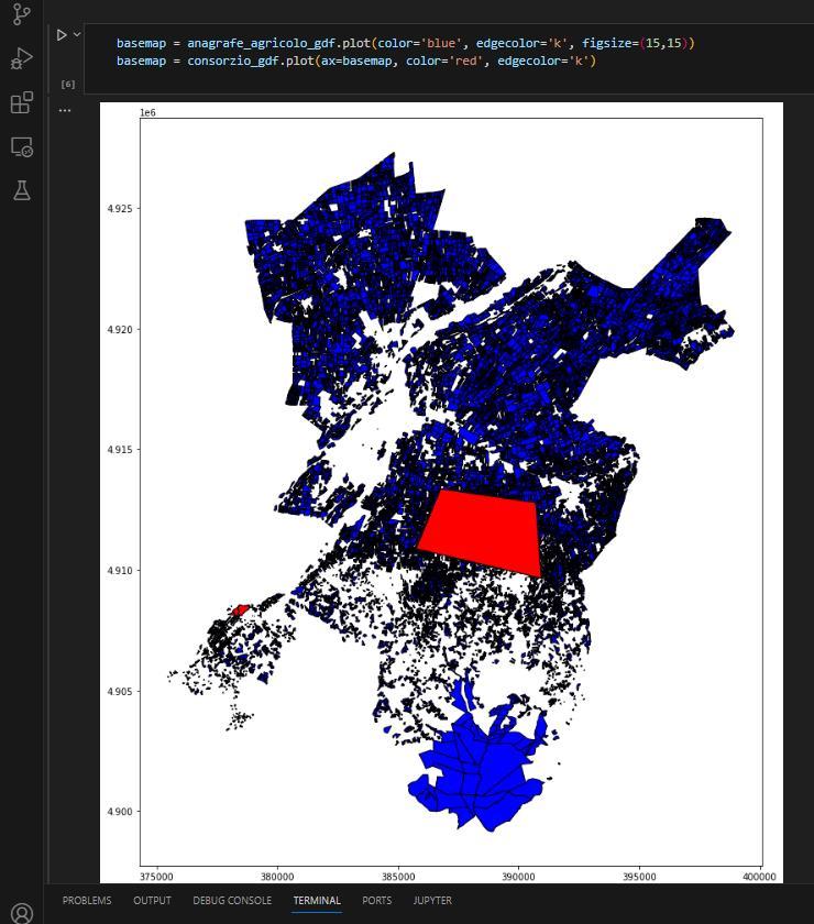
Irrigation Parcels and Canals
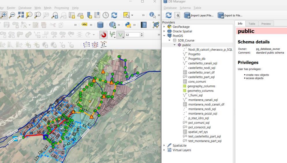
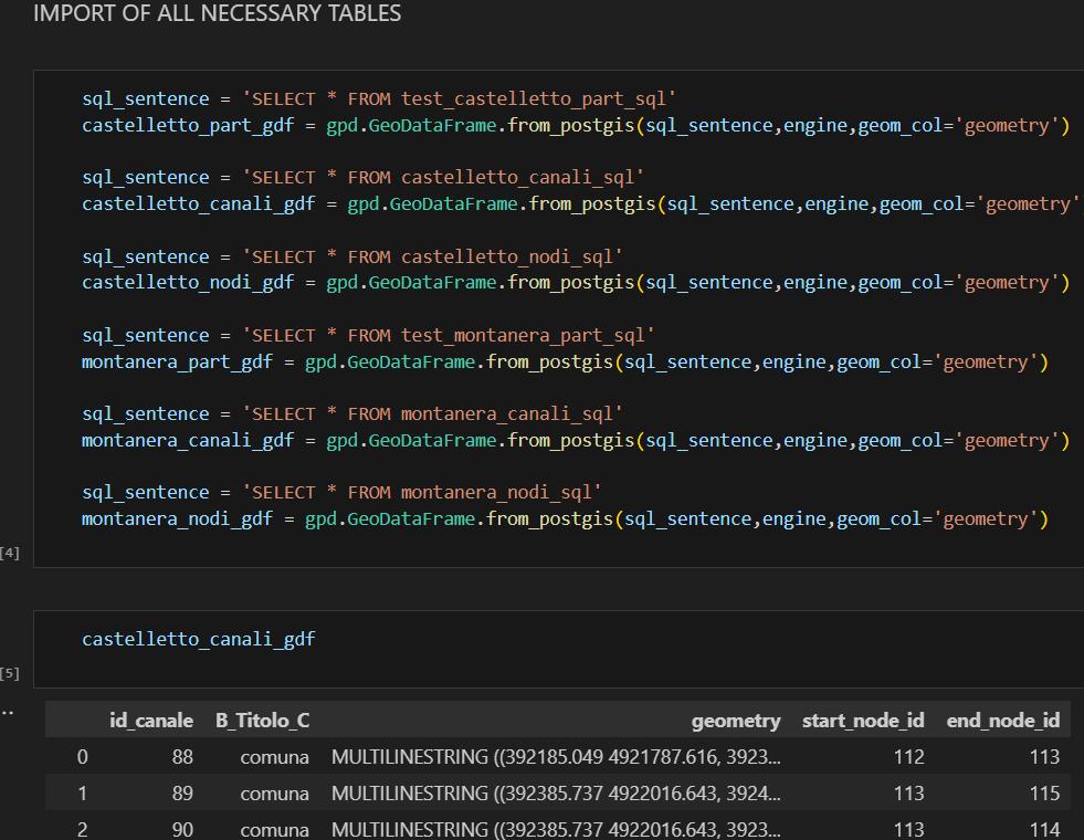
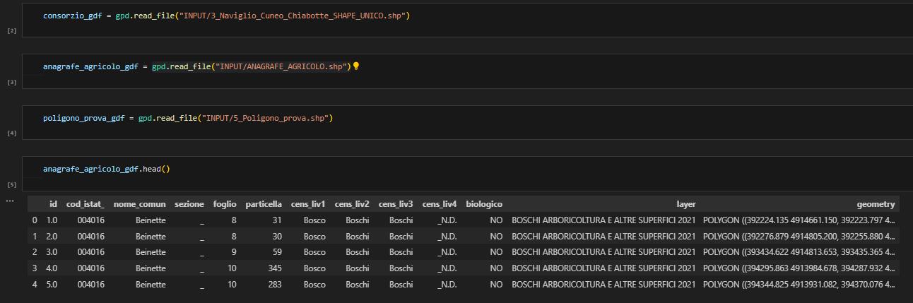
QGIS
PostgreSQL – PostGIS Python

Pumping station

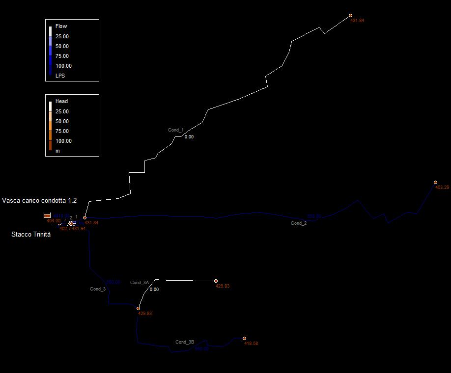
 EPANET Python wntr
Water availability and its impact on irrigation and hydropower
QGIS
QGIS-Python API
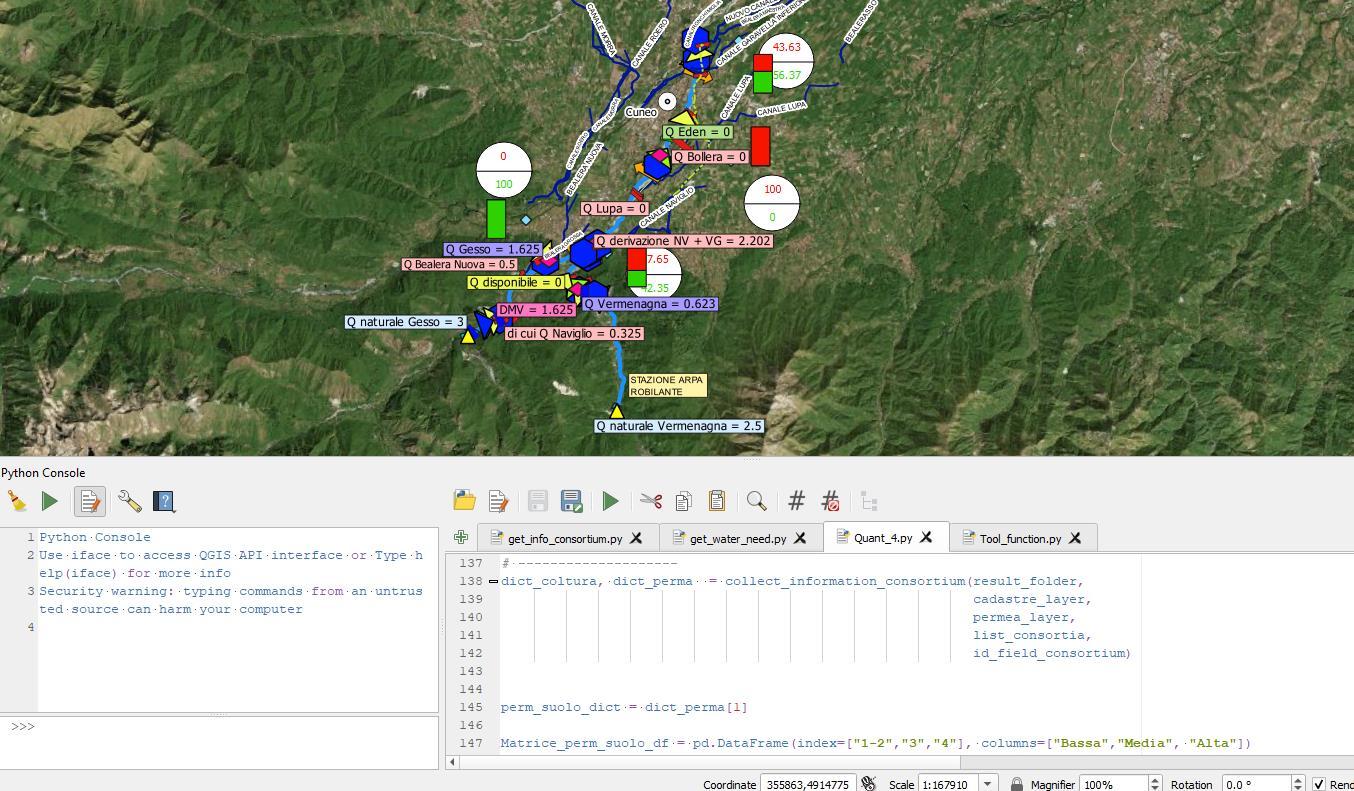
QGIS Map canvas and Python script using QGIS-Python API
OF QUANT4 EXCEL SHEET USED FOR IRRIGATION
WATER DEMAND (Studio PD Srl)
Python (Geopandas, Pandas e Numpy) Excel
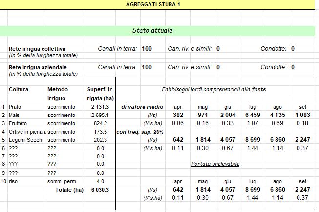
(Studio PD Srl)
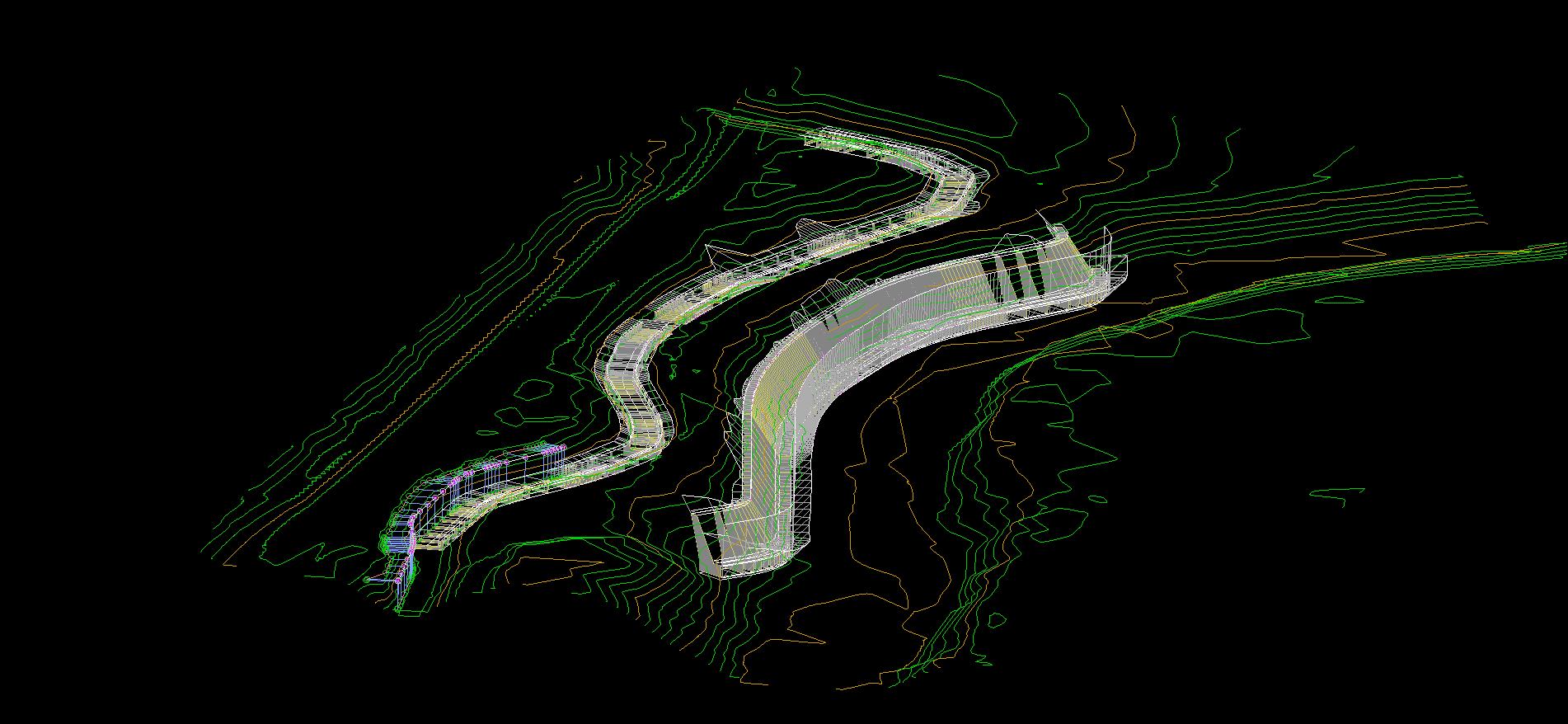
Carlo Alberto Canal lining and Rock armour on Bormida River
Cassine, Gamalero ed Alessandria (AL)
Modellazione Civil 3D
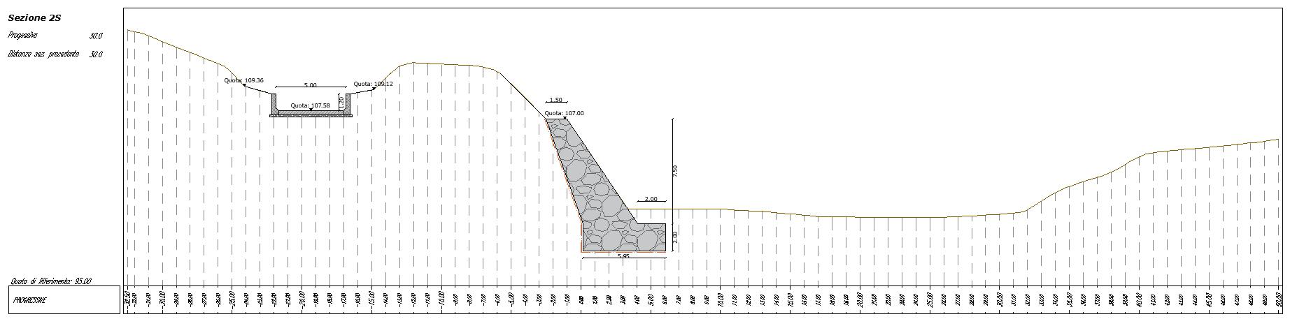
Weir on Bormida river
HEC-RAS analysis
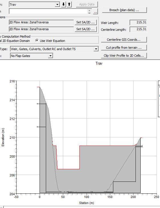
Flood analysis and weir modelling in HEC-RAS