Biodiversity Conservation Centre, Guwahati Mangrove Research Centre, Pondicherry Housing, Vijayawada Internship works
BIODIVERSITY CONSERVATION CENTRE | Guwahati | SEM X
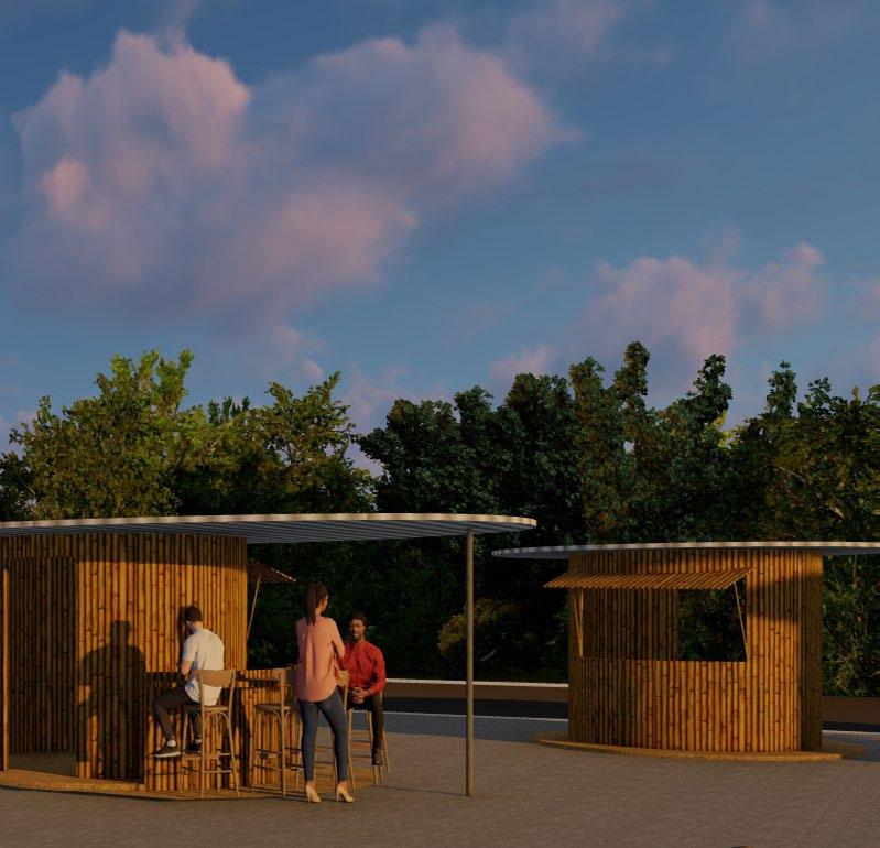
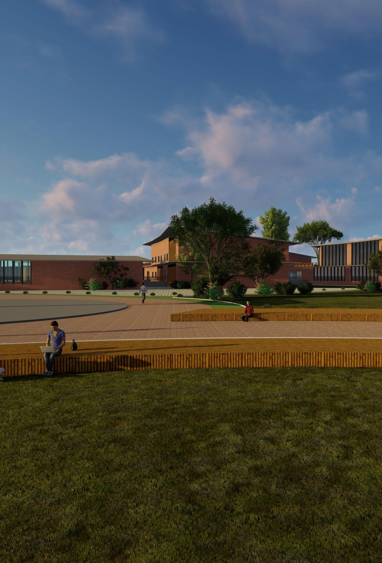
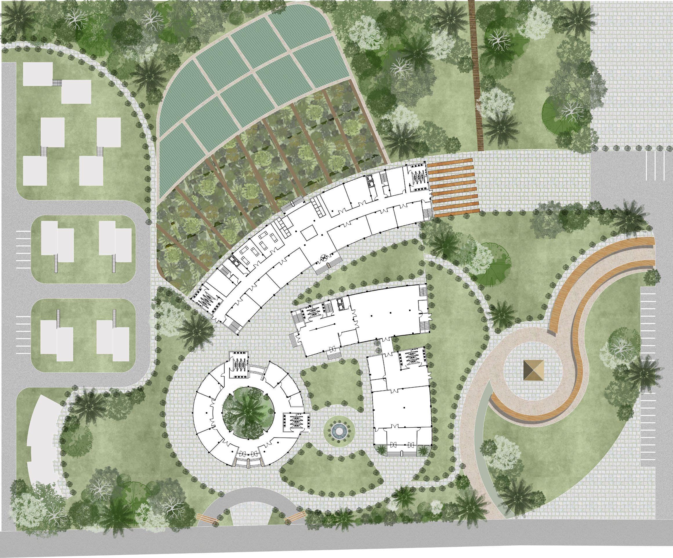
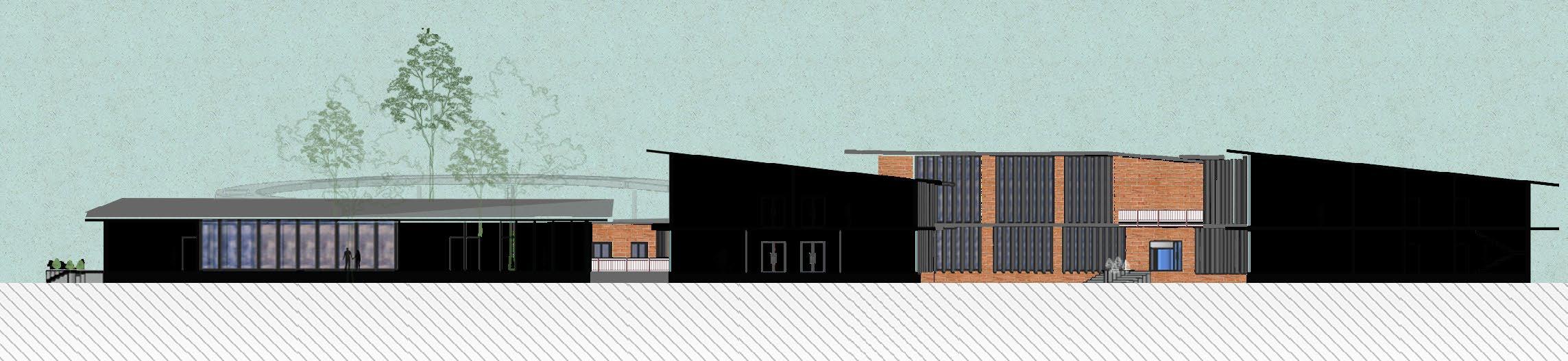
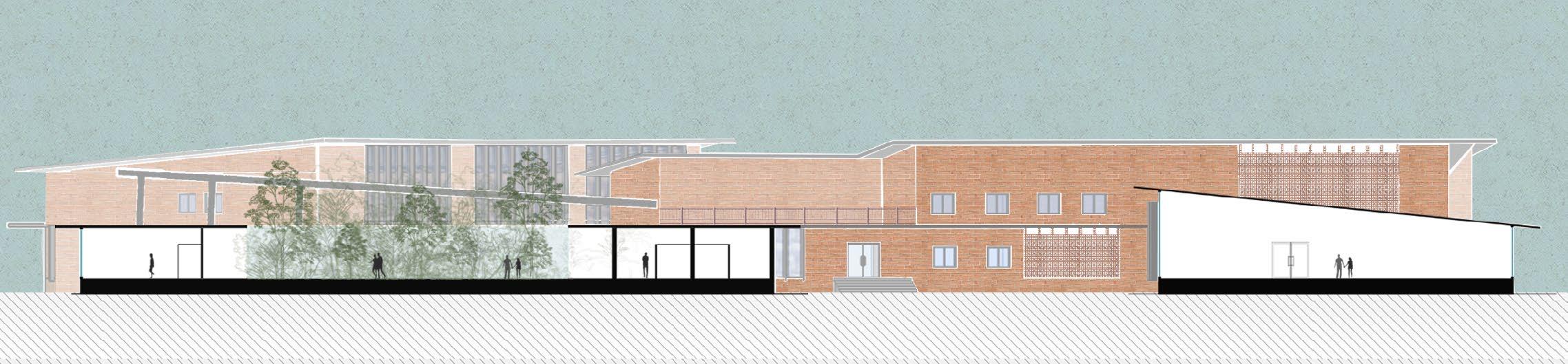
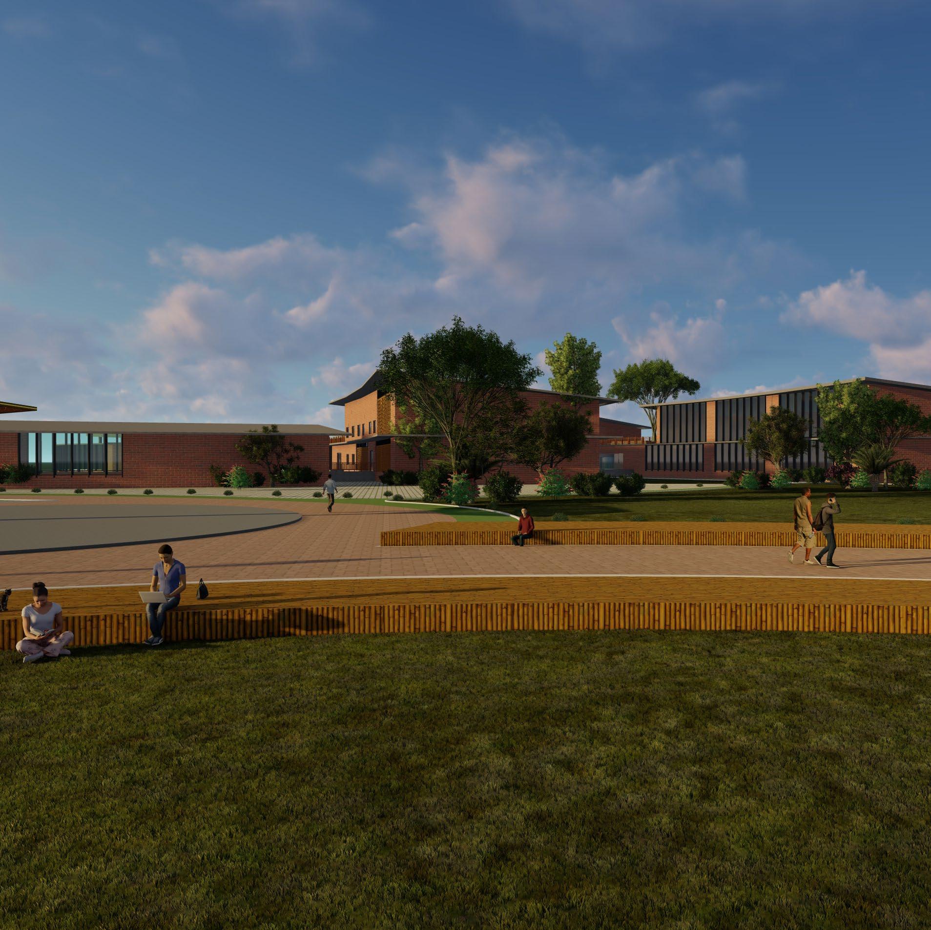
The Biodiversity Conservation Centre in Guwahati is designed as a sustainable hub for research, education, and community engagement, focusing on preserving the rich ecological heritage of Northeast India. Using a modular and adaptive architectural approach, the center accommodates research facilities, exhibition spaces, and community programs while allowing for future expansion. The material palette consists of locally sourced bamboo, compressed earth blocks, and recycled materials. Green roofs and vertical gardens enhance biodiversity, improve air quality, and reduce heat absorption. The center is designed to be more than just a research facility, it is a space where scientists, conservationists, and the local community can come together to learn, collaborate, and take meaningful action. Interactive exhibits, open-air learning zones, and research areas create opportunities for knowledge sharing and public participation, making conservation more accessible to everyone. Wildlife rehabilitation zones provide care for rescued animals, while native botanical gardens serve as living laboratories for ecological study and preservation. By blending modern technology with indigenous knowledge, the project fosters a deeper connection between people and nature, encouraging long-term environmental stewardship and inspiring future generations to protect the region’s biodiversity.
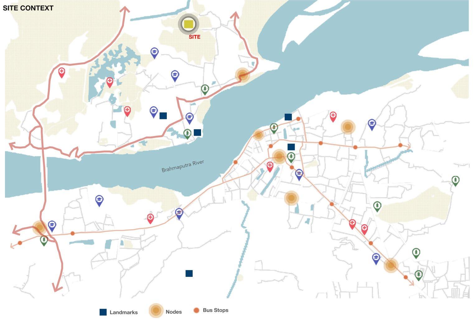
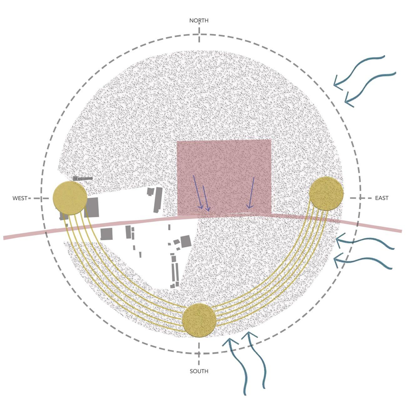
The site is located in Guwahati, Assam. Assam has the highest number of national parks and wildlife sanctuaries in the northeast region of India. Guwahati is a major transportation hub with an international airport, railway station, and well-connected road networks. This proximity allows for collaboration, research, and conservation efforts across multiple ecosystems. The city offers established infrastructure. The city can serve as a central location for responding to wildlife emergencies. Guwahati’s urban setting provides opportunities for educational outreach and awareness programs. It allows for engagement with schools and colleges. A lot of reputed and big academic and research institutions in Guwahati can facilitate collaboration between the conservation center.
TOTAL AREA = 10 ACRES (40,000 SQM)
GROUND COVERAGE (40%) = 16,000 SQM
MAX NO. OF FLOORS = 2
FAR = 0.8
TOTAL BUILT UP AREA = 32,000 SQM
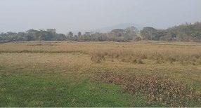
view of the site.
The wind is most often from the northeast and east for 8 months from Feb till October.
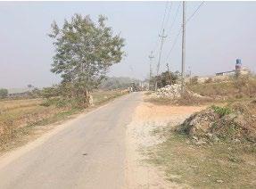
view of the abutting road.
The wind is most often from the south for 4 months from October till February.
existing road proposed road
In the newly developed areas the authority will have the power to refix the minimum road width considering the development in these areas.
SUMMER WINDS
WINTER WINDS
SITE
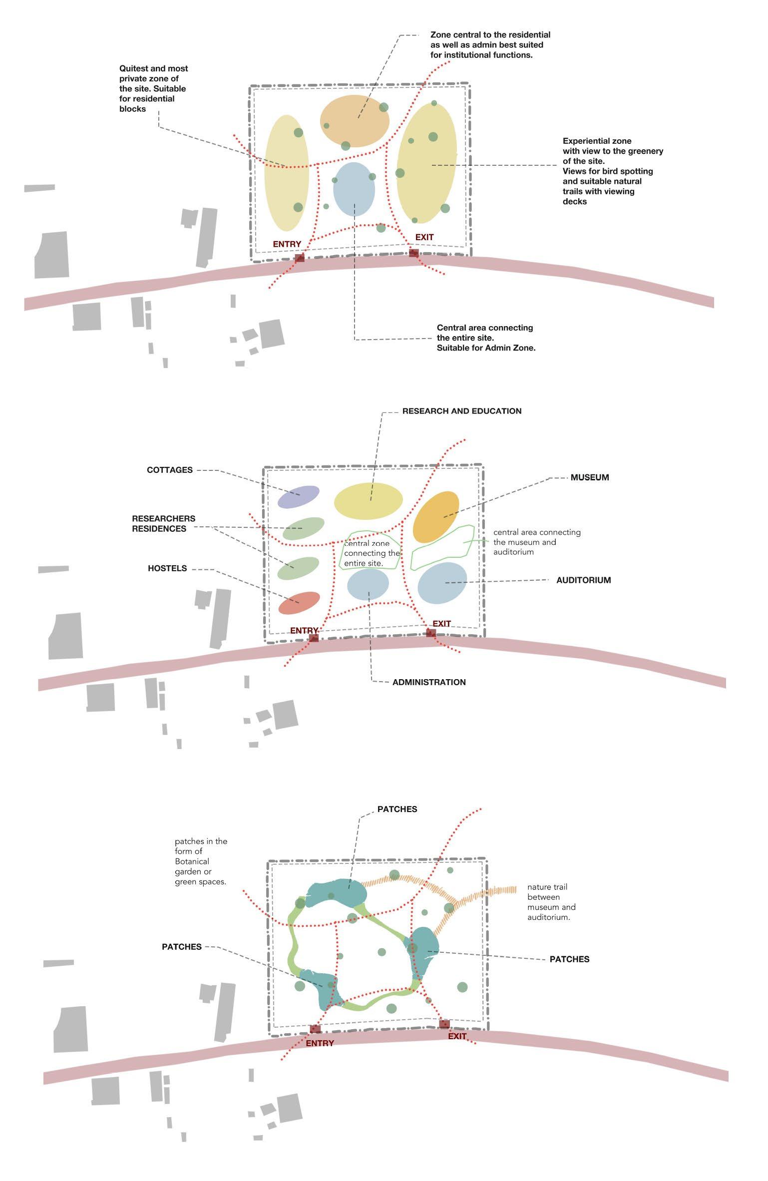
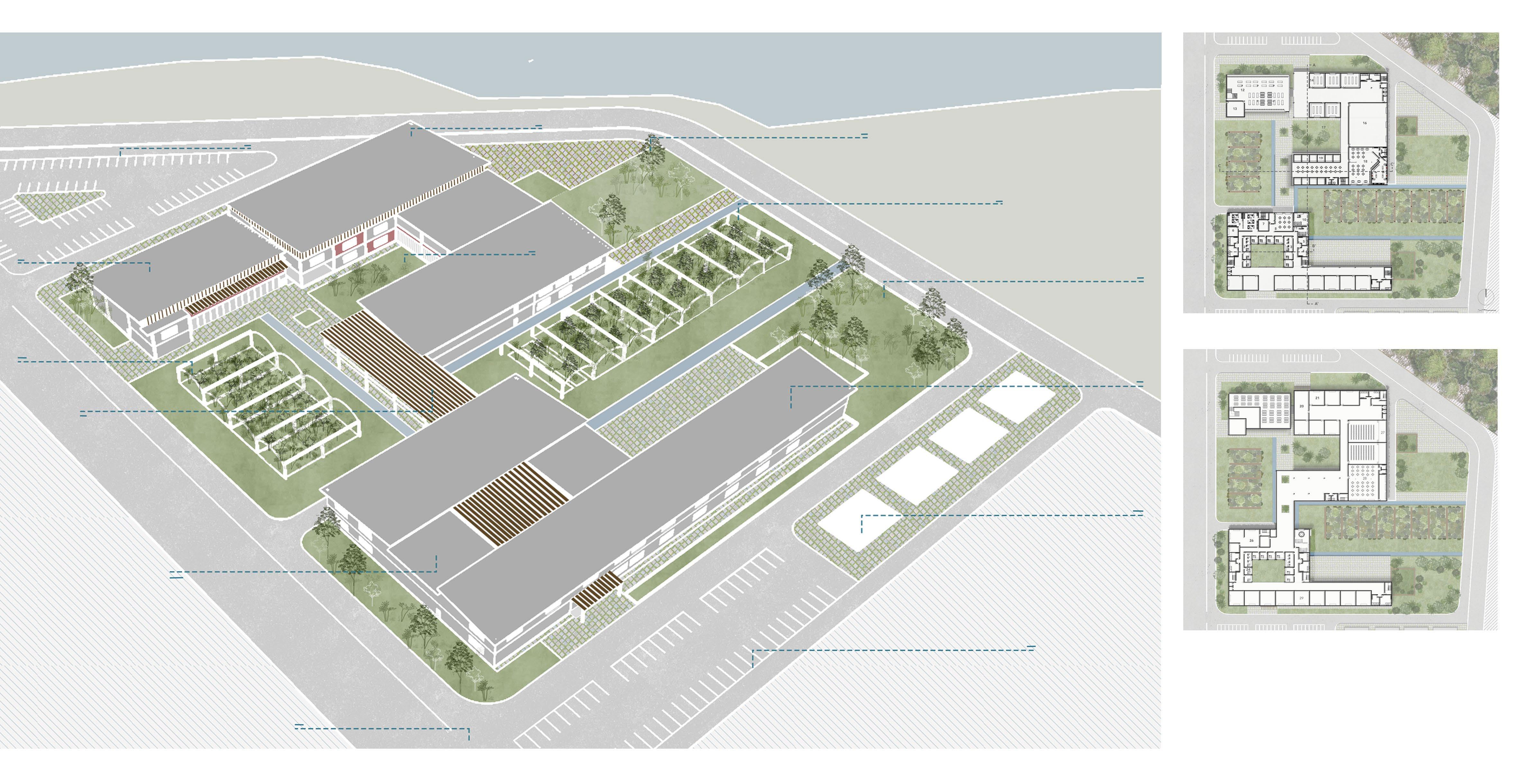
The site is analyzed to identify suitable zones for various functions. The quietest areas are allocated for residential blocks, while central spaces are designated for administrative functions. Experiential spaces with greenery and birdwatching areas enhance the site’s ecological value.
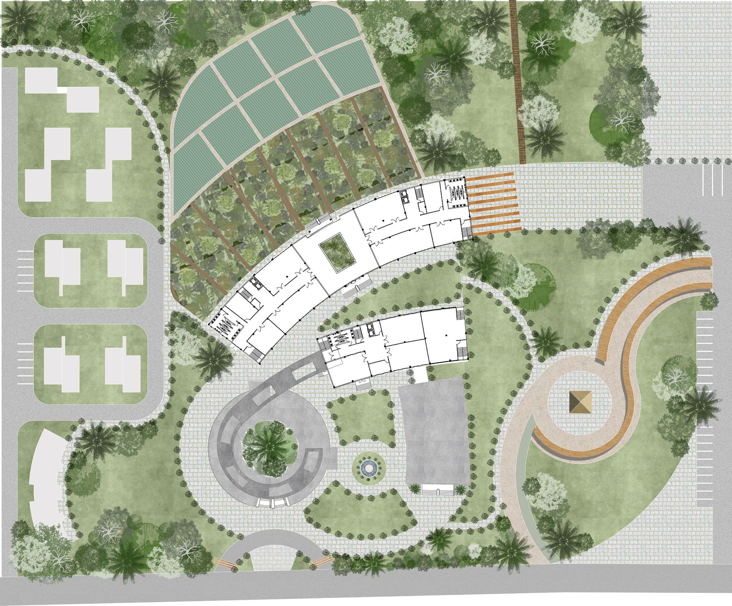
BUILT UP ZONING
Functional zoning divides the site into distinct areas: residential (cottages, hostels, and researcher residences), research and education, museum, and auditorium. The central space serves as a connector between key facilities, ensuring efficient circulation and accessibility.
OPEN SPACES ZONING
Green spaces are strategically placed to create a balanced environment. Patches of greenery enhance biodiversity, while a nature trail connects key zones like the museum and auditorium. These open spaces promote ecological sustainability and recreational opportunities.
Roof garden improves insulation, reduce heat absorption, enhance biodiversity, manage stormwater, and promote thermal comfort while utilizing underutilized roof space.
Bamboo railings offer sustainability, durability, and flexibility while providing natural aesthetics, enhancing ventilation, and reducing the carbon footprint of construction.
Green courtyards enhance passive cooling, improve air quality, support biodiversity, and aid in rainwater absorption, creating a sustainable microclimate and promoting user well-being.
Sloped roofs facilitate efficient rainwater drainage, enhance thermal insulation, reduce heat buildup, and improve durability while complementing regional climatic conditions.
Terracotta jaalis enable passive cooling, enhance ventilation, diffuse natural light, and provide privacy while adding a traditional yet sustainable architectural element.
Terracotta vertical fins provide passive shading, reduce heat gain, enhance ventilation, and improve thermal comfort while adding a sustainable and aesthetic façade element.
Ground Floor
First Floor
02
MANGROVE RESEARCH CENTRE | Pondicherry | SEM IX
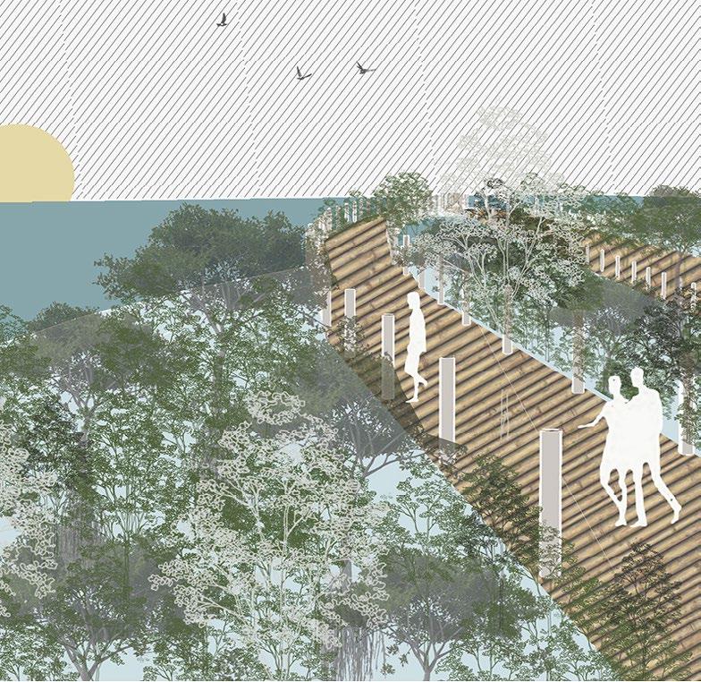
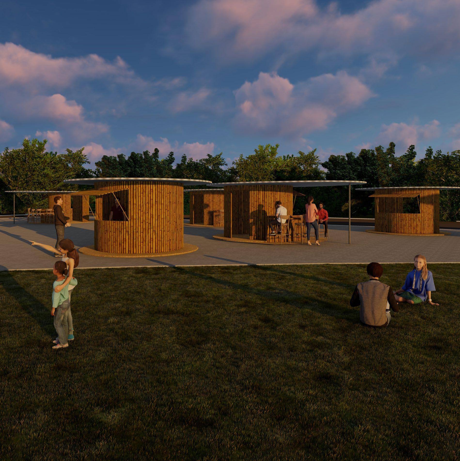
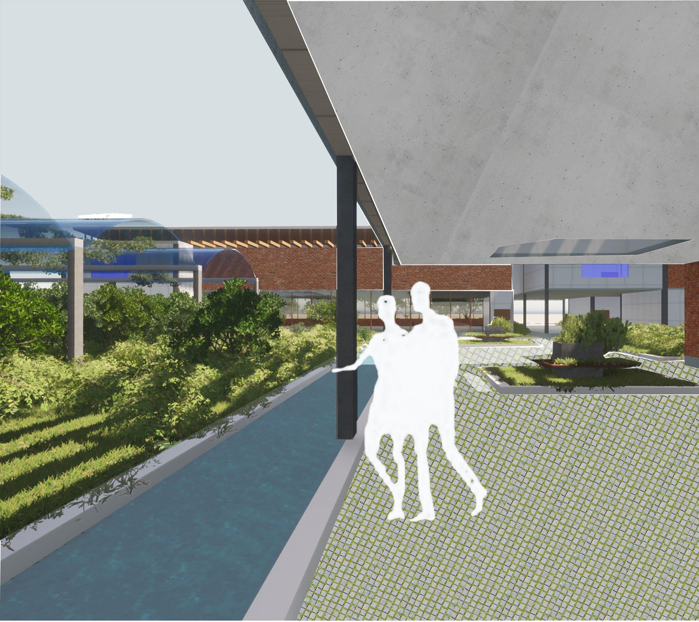
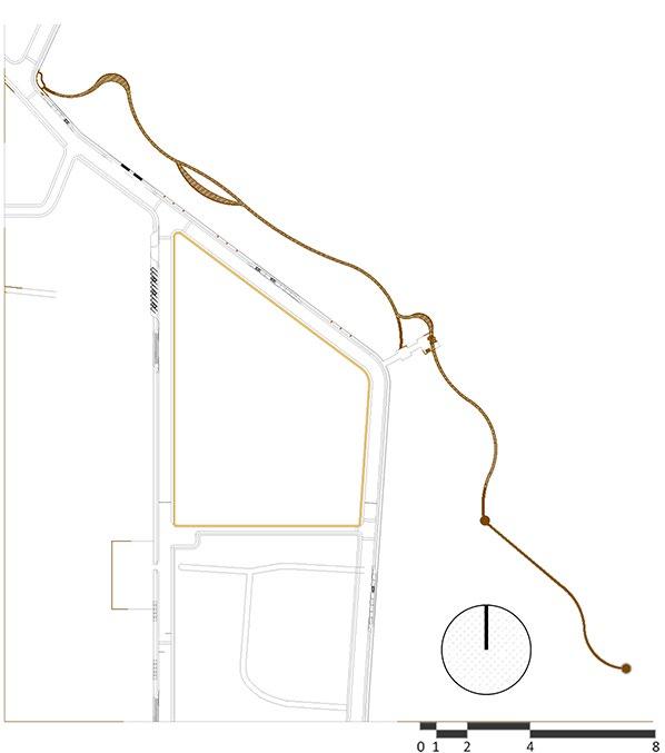
The Mangrove Research & Eco-Tourism Hub in Pondicherry is an urban design initiative aimed at integrating ecological conservation with public engagement. The project includes a Mangrove Research Centre, a public park, and a mangrove trail, all designed to promote sustainability while enhancing the relationship between the city and its natural environment. The research center serves as a dedicated space for scientists and conservationists to study the region’s unique mangrove ecosystem. The public park provides recreational spaces with native landscaping, interactive installations, and shaded seating areas, encouraging community interaction while maintaining ecological sensitivity. The mangrove trail, designed as an immersive experience, allows visitors to explore and understand the delicate wetland ecosystem through elevated boardwalks and educational signage. Additionally, strategic road interventions were proposed to improve pedestrian accessibility, reduce vehicular congestion, and enhance the city’s connection to its waterfront. By combining research, recreation, and responsible urban planning, this project fosters environmental awareness, strengthens community involvement, and promotes the long-term preservation of Pondicherry’s rich coastal ecosystem.
Proposed residential area according to land use map of 2036 Public park proposal
Mangrove research centre (green lab) proposal
Existing Mangrove Forest planted by the government
Proposed agricultural land according to landuse map of 2036
PROPOSED STRUCTURE PLAN
STRUCTURE PLAN Healthcare Provision Police Stations
Sub police stations must be provided within the area.
50 x 30 _ 2 flrs - for every 1000 people 2 beds must be provided and 1 hospital for every 10,000 people.
The contour map shows that the low lying areas are near the backwaters leading to the sea.
Landuse Map of Thengaithittu
Majorly the area has residential landuse and commercial, and small scale mixed use structures for the daily life of the locals.
Fire stations, hospitals and police stations must be within a 2 mile radius with each other and densely populated areas.
Figure ground Map of Thengaithittu
It shows half of Thengaithittu towards the sea is empty land. The built side also has green pockets between the structures.
space Map of Thengaithittu
Fishing harbour of Pondicherry
Achariya Siksha bala mandir
Existing Mangrove Forest planted by the government Existing vegetation
Thengaithittu Estuary
Thengaithittu Estuary
Fishing harbour of Pondicherry
Open access to the public library which is connected to the education and recreation block separated by vegetation.
Herbarium and green house for storage of green specimens and mangroves inside the site for research purposes.
Bridge connecting the research and education block overlooking the herbarium.
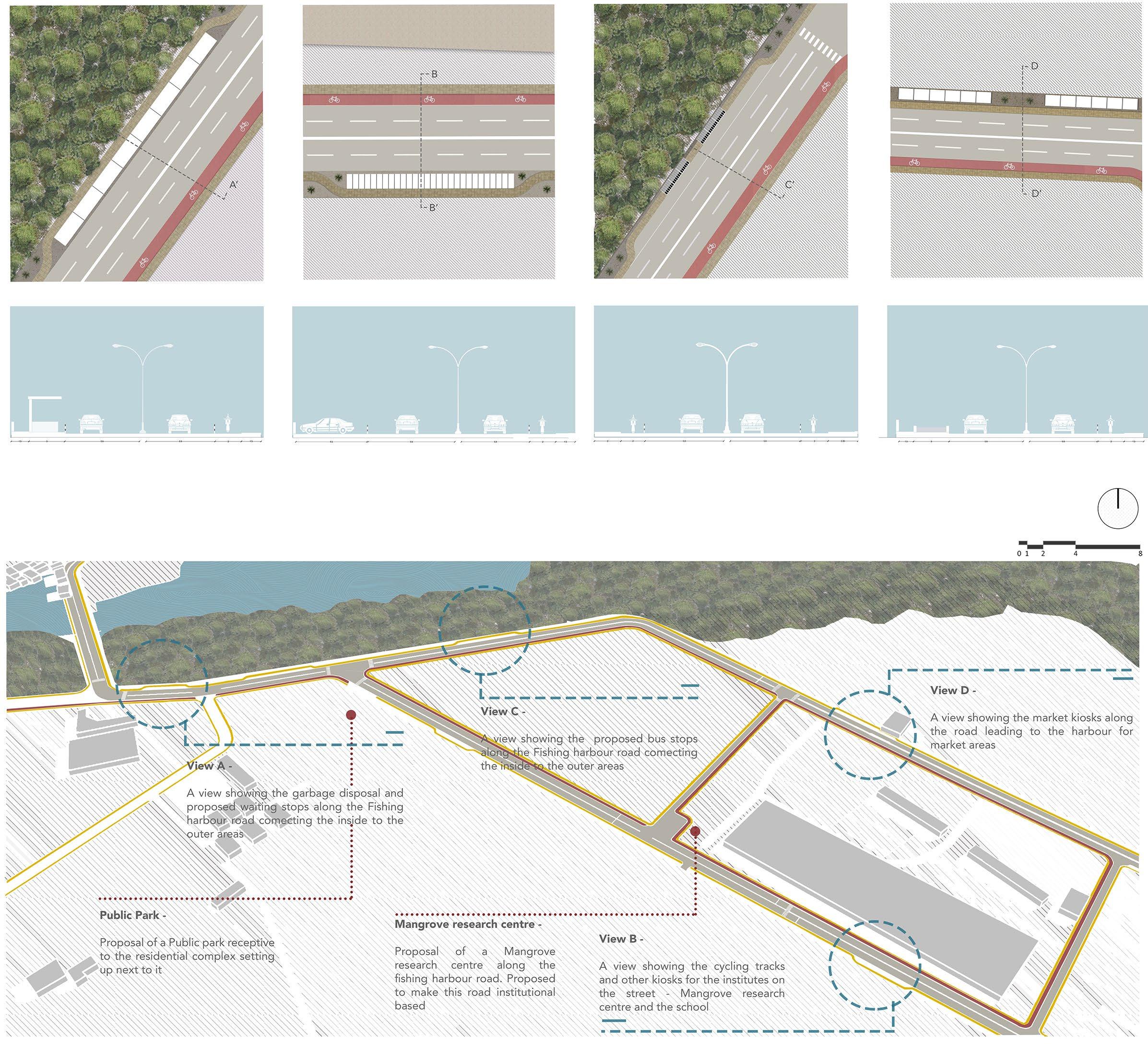
Plan and sectional view of Bus stops allotted to add in the bus route of Thengaithittu.
Plan and sectional view of showing allotted parking on the side of the road.
Plan and sectional view of showing divisions of 2m wide cycling tracks and 1.5m wide footpaths.
Plan and sectional view of showing pavement greenery and walkways.
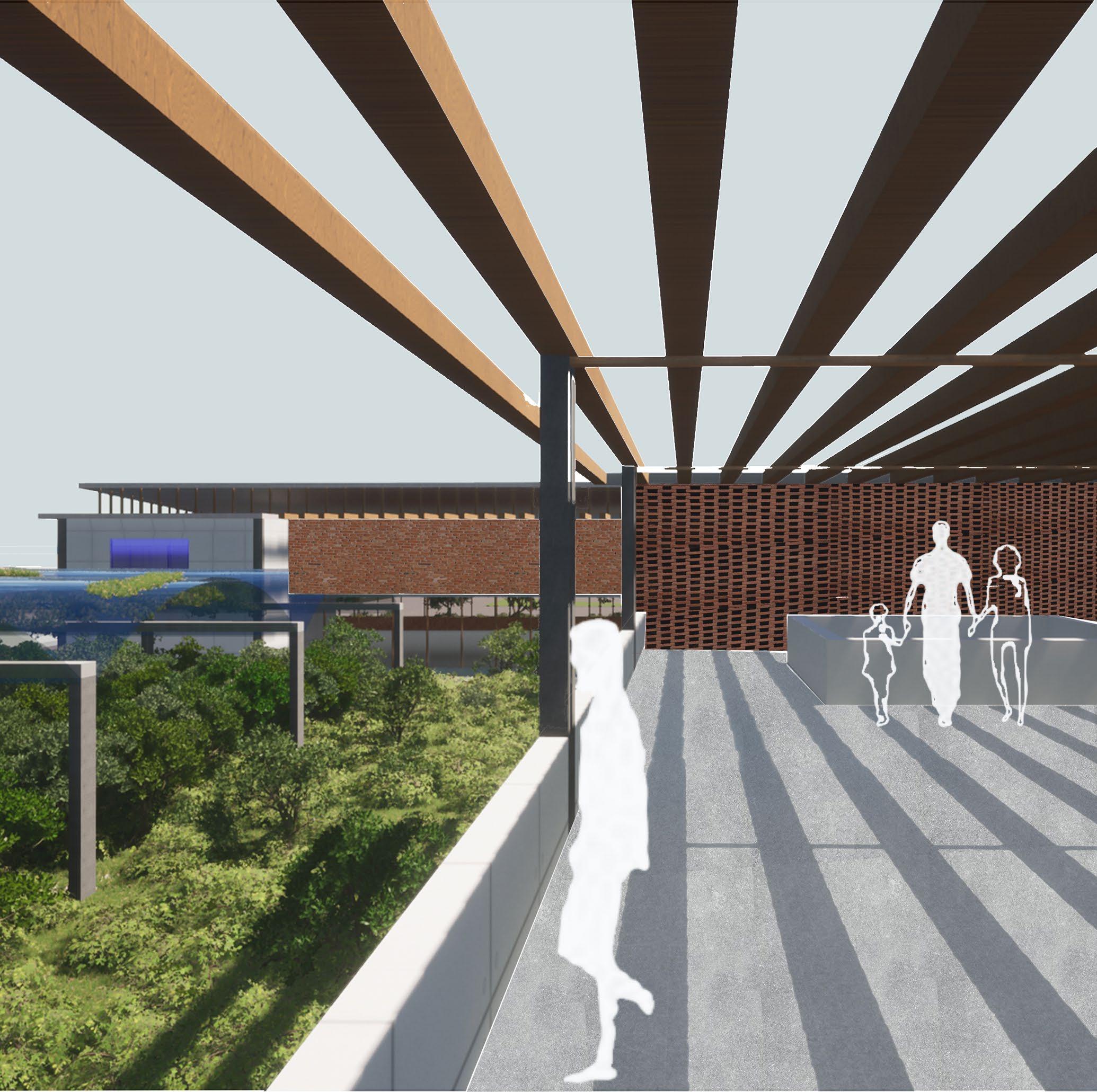
A view of the bridge showing the roof which gives natural sunlight from the pergola. Also acts as a viewing point to the herbarium and green house located next to the research labs with highlighted jali brick walls.
DETAIL B
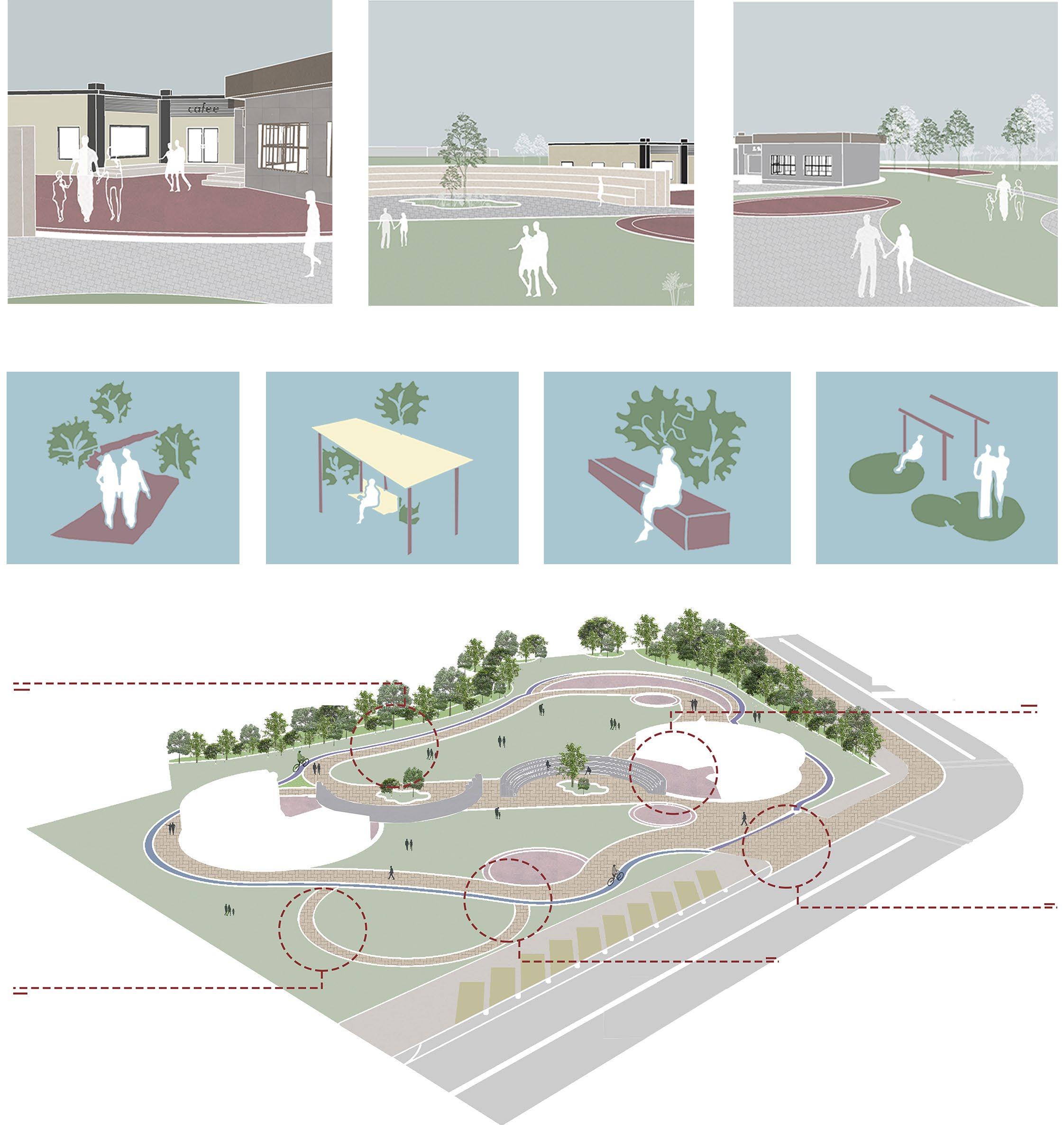
Depicting the two open air theatre located in the middle of the park connected wih the pathways.
DETAIL C -
Two types of pavement pathways, one major and two minor paths with pavers and grass connecting the open areas with the built areas.
DETAIL D
DETAIL A -
View depicting the small scale
for
with
View A - Showing the small scale market area for the local residents of Thengaithittu.
View B - Showing the main OAT which is a gathering space and promotes community engaged.
View C - Showing the walkways and pathways in the park connecting the market with the OAT.
Walkways Shared Seating Benches
Playground
A view from under the bridge showing the cutout which gives natural sunlight. Also acts as a viewing point to the herbarium and green house located next to the
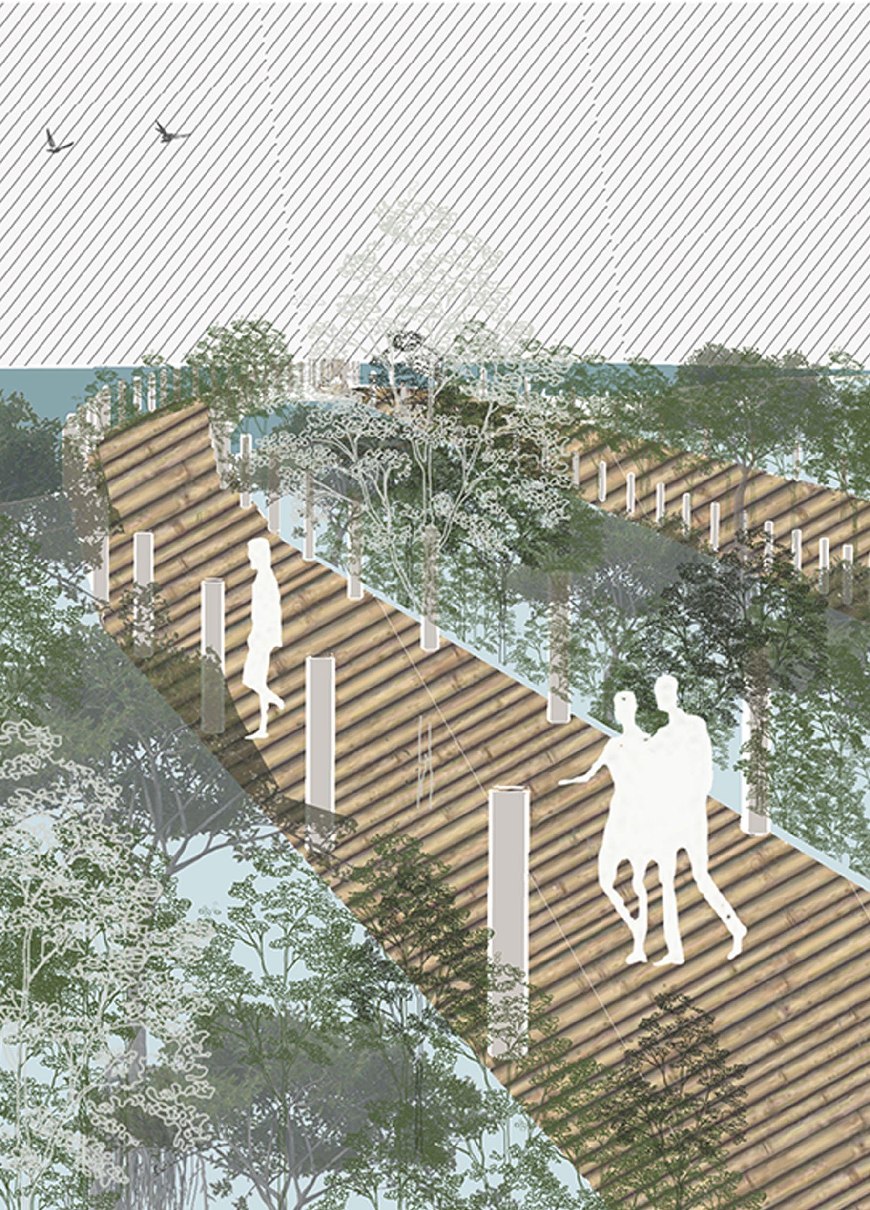
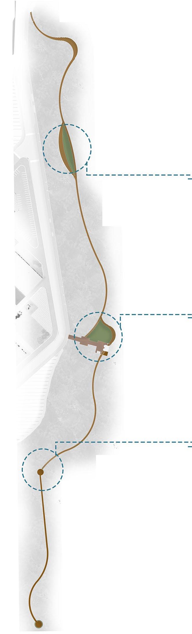
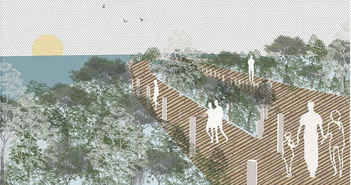
Mangrove Trail
DETAIL A
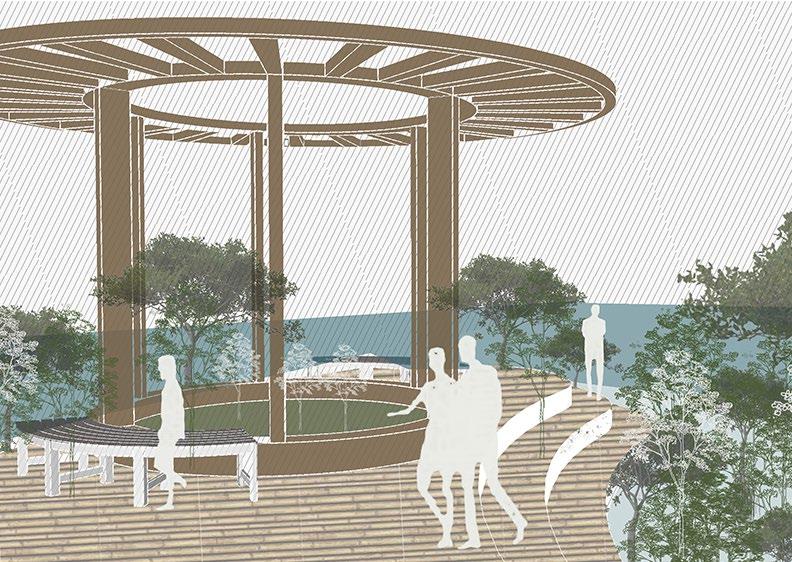
Mangrove trail along the path formed across the mangroves with the level differences. The starting point indicates a gazebo which overlooks the backwaters.
DETAIL B
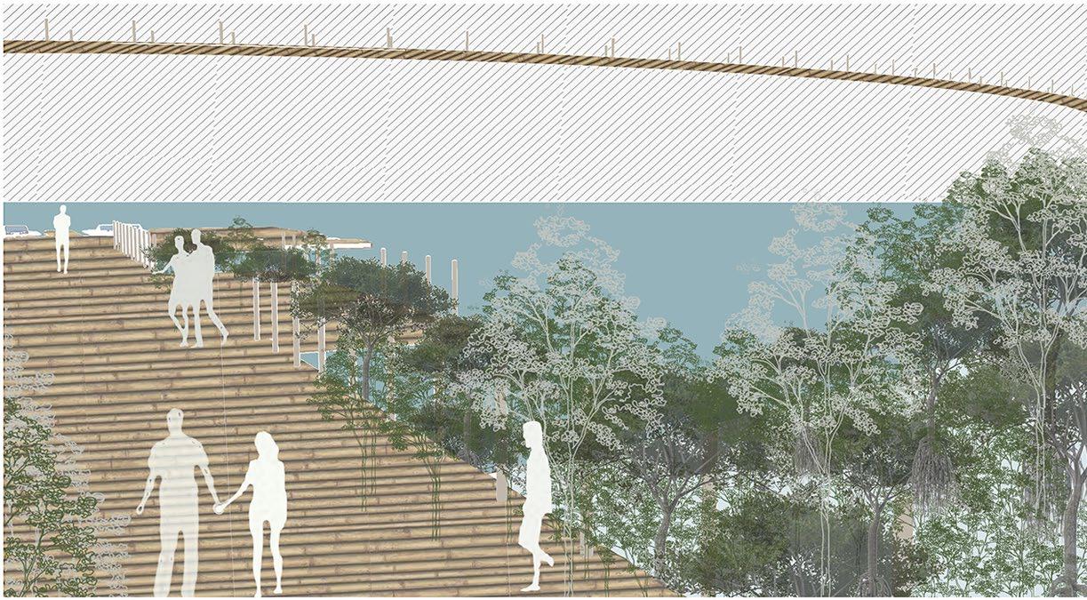
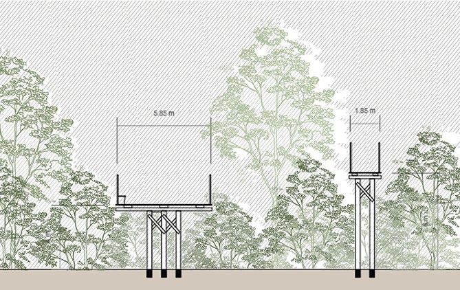
Elevated boardwalks are constructued to keep visitors above the sensitive mangrove roots and sediments, reducing direct impact on the ecosystem.
DETAIL C
Structures like kiosks, information centre, and observation platforms are designed with a minimal footprint to avoid disruption to the mangrove habitat.
View A - View of the mangrove trail overlooking the backwaters with bamboo parapets on either sides of the pavilion.
View B - Handrails are installed for safety especially in areas where the elevation changes.
View C - Benches and seating areas are strategically placed to allow visitors to rest and observe the mangrove ecosytem.
03
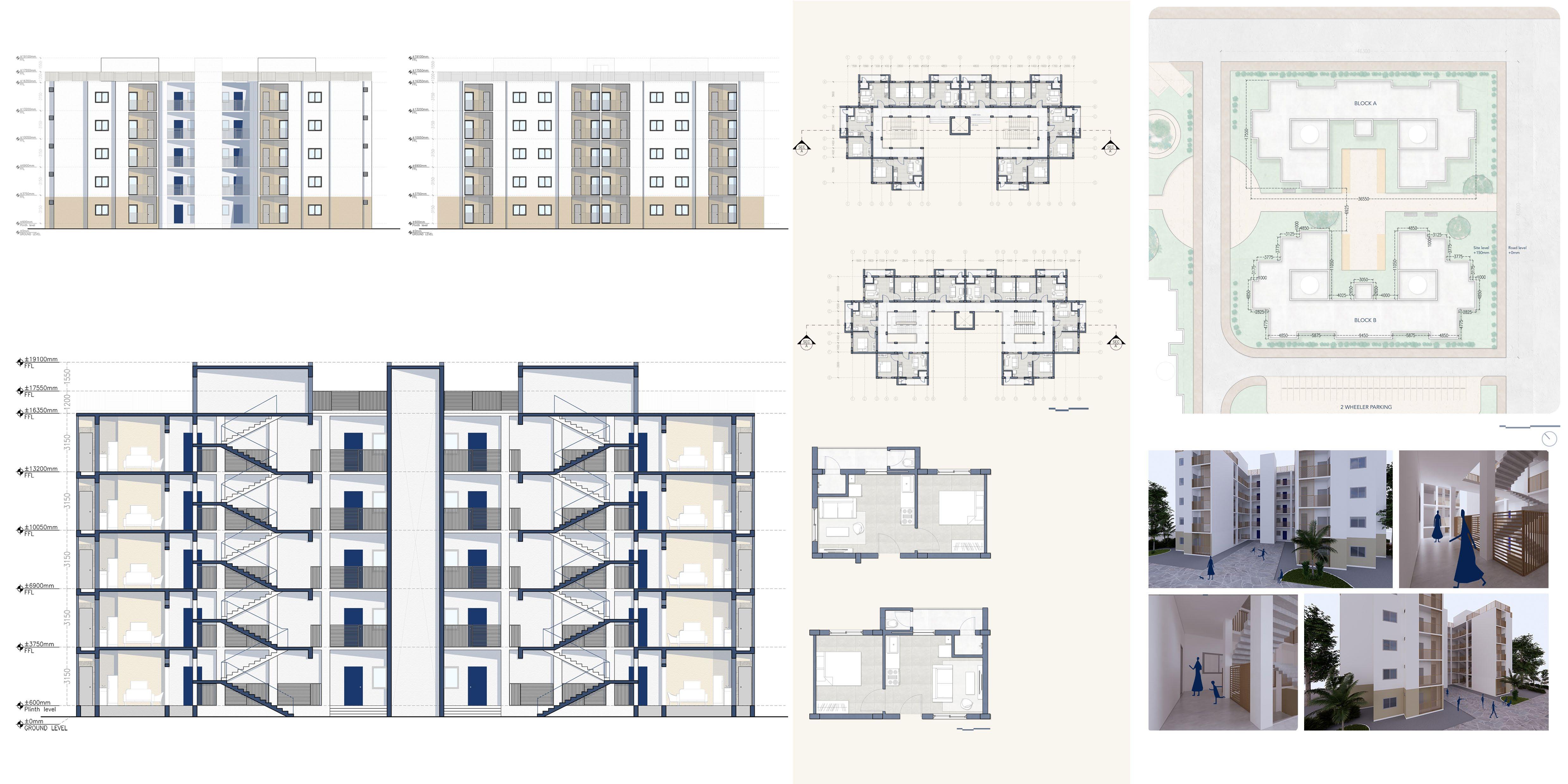
HOUSING | Vijayawada | SEM VIII
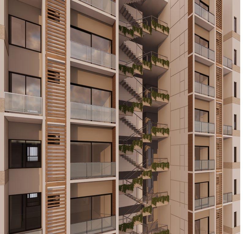
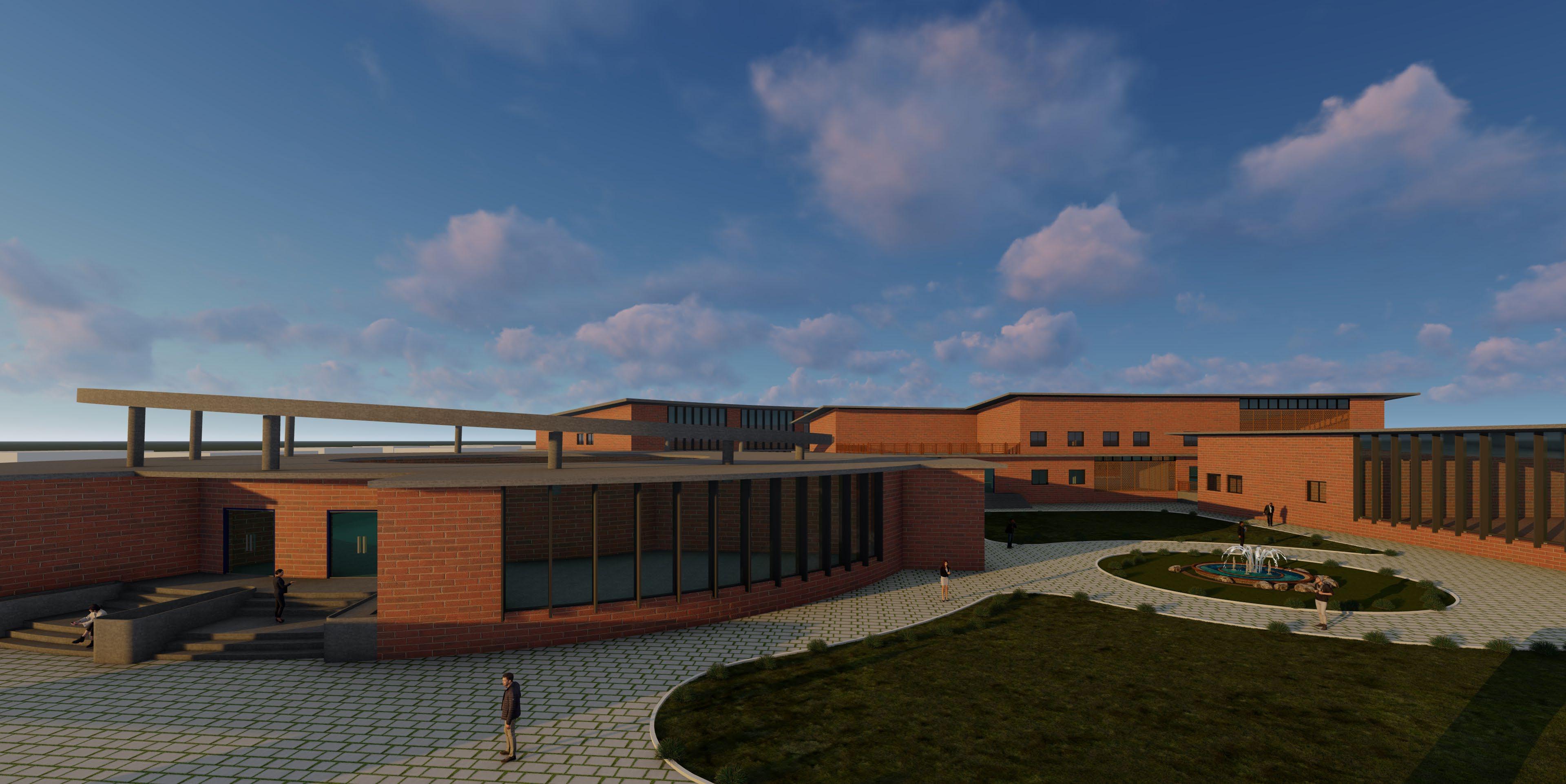
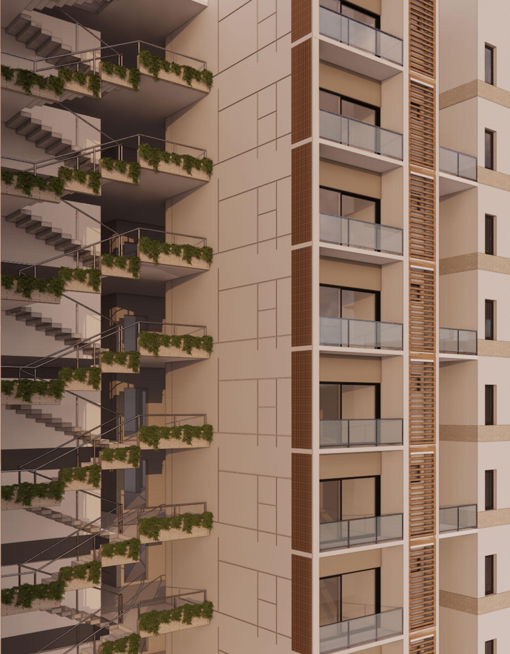
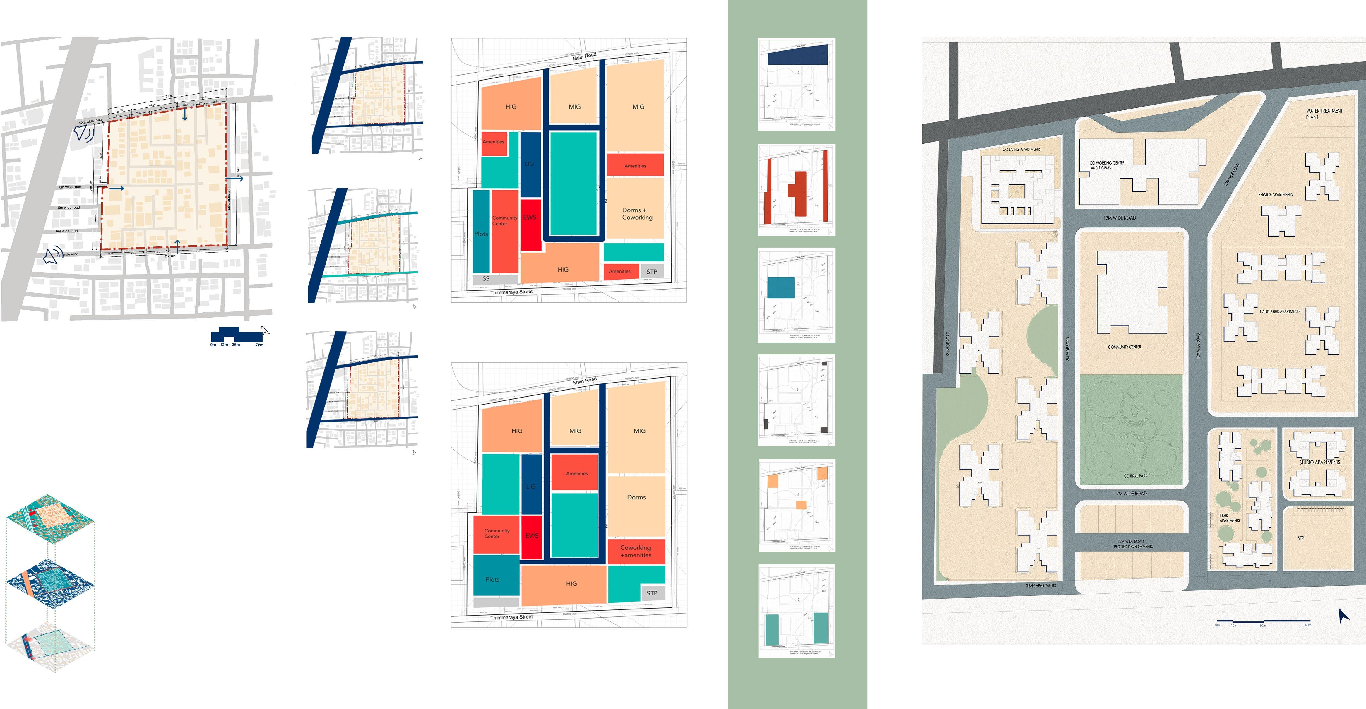
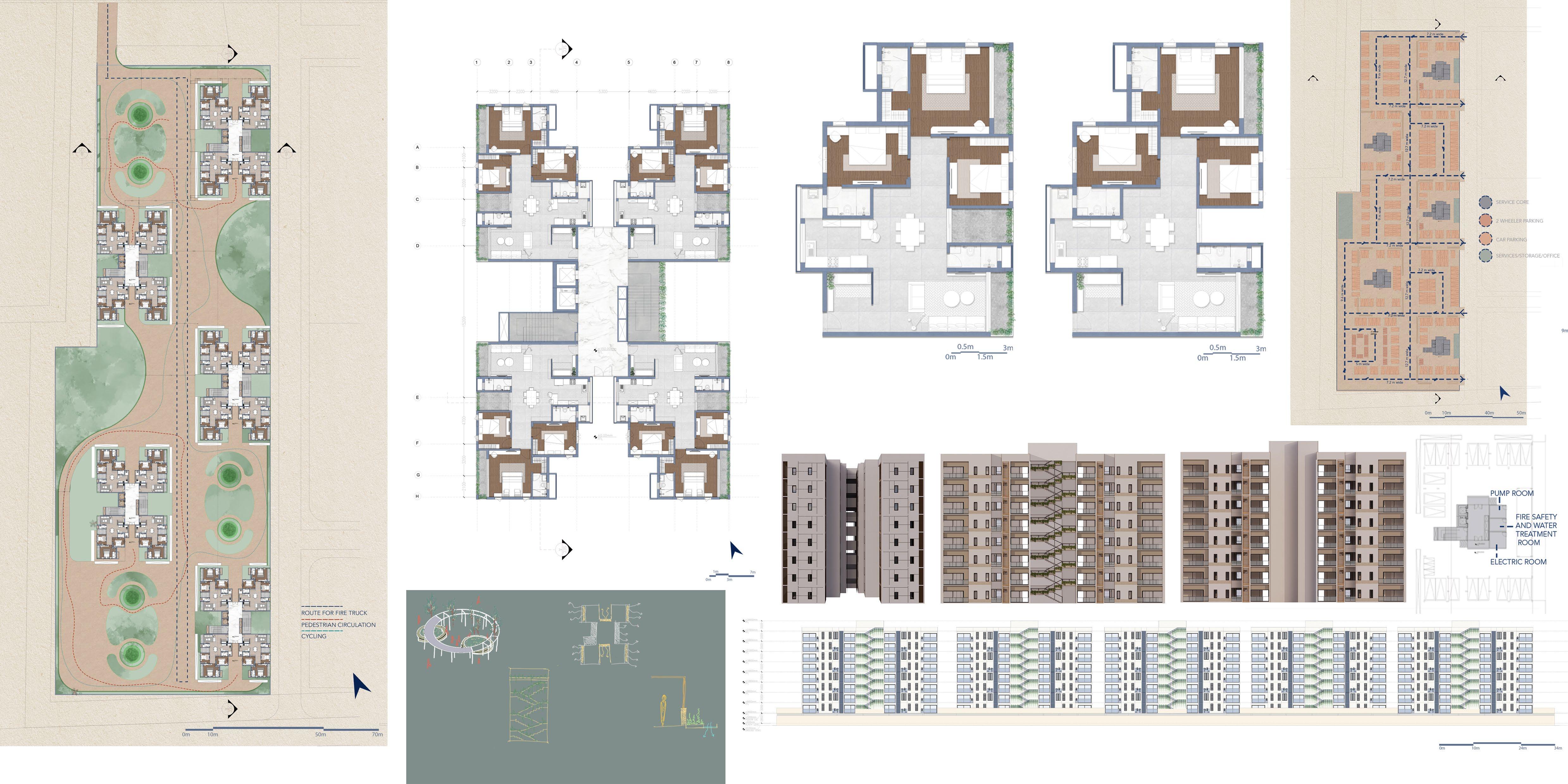
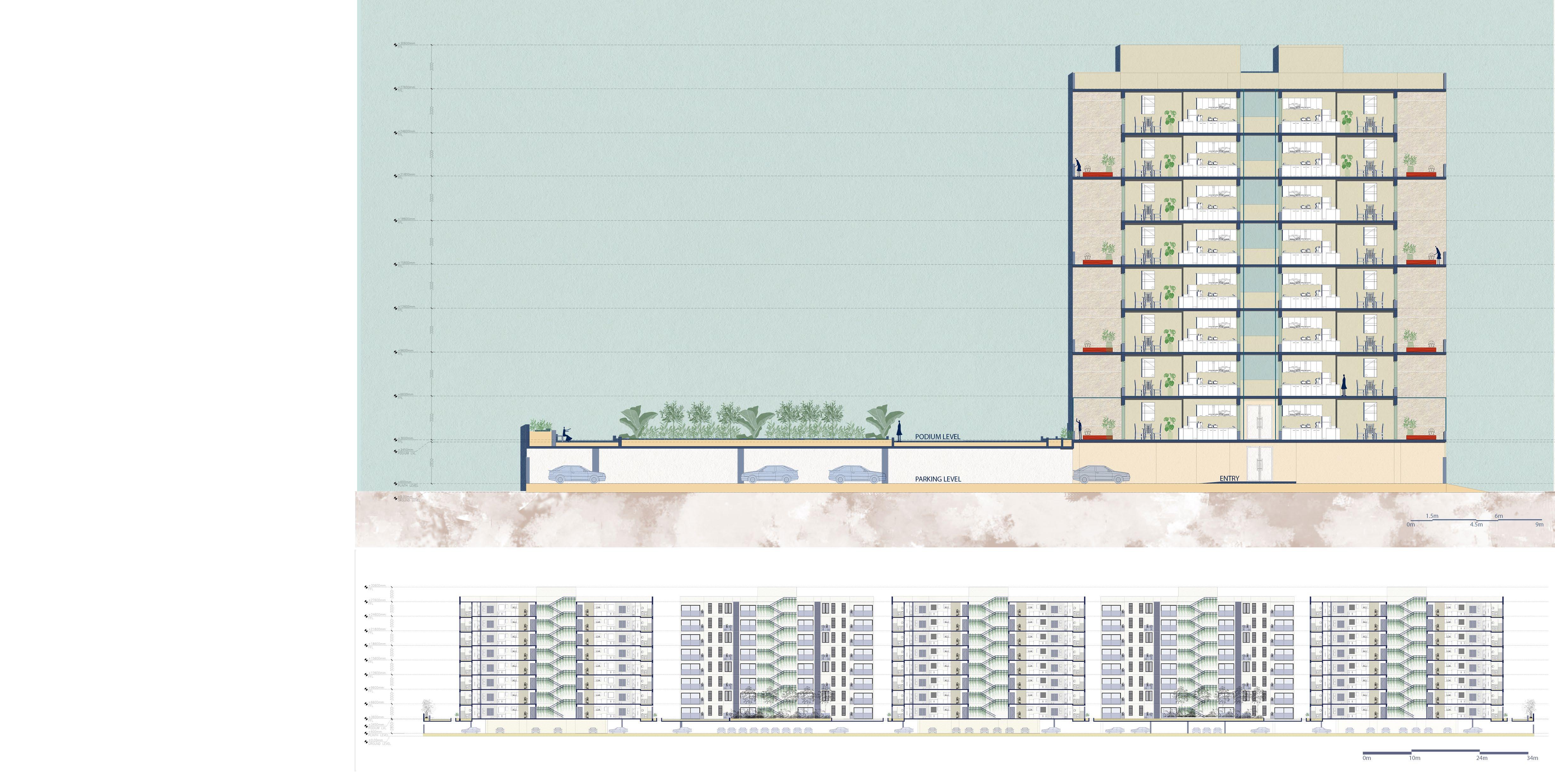
This project focuses on designing an inclusive housing community that integrates different income groups while fostering social interaction and sustainability. The master plan features a mix of affordable, mid-range, and premium housing units arranged on a podium, which houses parking and service areas underneath, creating a pedestrian-friendly environment above. A community center, accessible to all residents, serves as the social and cultural hub, offering shared amenities such as a library, multipurpose hall, and recreational spaces. The design also includes co-living apartments to accommodate young professionals and shared living arrangements, along with a co-working center that provides flexible workspaces, promoting a live-work balance within the community. The housing blocks are oriented for optimal natural light and ventilation, with staggered balconies and open corridors enhancing passive cooling. Communal gardens on the podium provide green spaces for relaxation, urban farming, and social engagement, promoting well-being and sustainability. Public and semi-public spaces are carefully planned to ensure inclusivity, while pedestrian pathways, cycling tracks, and seating areas encourage a vibrant neighborhood atmosphere.
9am - 12pm Traffic
12pm - 5pm Traffic
SITE DIMENSIONS
- The trapezium shaped site is located right behind prominent commmercial spaces including, shops and hotels.
- It is located in an afflulent neighbourhood.
- The site is bound by a main road of 12 m width and two auxillary roads one of which is 8 m in width and 6 m in width.
- The accesss for this site will be provided as primary entrance from main road, second entrance from the 8 m road, and another access at 6 m road.
- The people in this neighbourhood are involved in many different professions like lawyers, politicians, IT professionals, doctors etc.
- The site is surrounded by several low rise and mid rise buildings catering to several different uses, and one high rise hotel towards the main road.
9am - 12pm Traffic
The site has mostly residential land use areas. There are commercial areas located along the highway. Apart from these, there are a few commercial areas scattered around the site, these mostly consist of convenience stores and eateries.
SOLID-VOID SPACE RELATIONSIPS
The neighborhood is densely packed and each void is currently either a vacant land or has an overgrowth of wild plants.
ABUTTING ROAD AND CONGESTION POINTS
The service road leading to the entrance of the colony is a one way road that is currently being used as a two way zone by motorists, due to the commercial activity near the highway. This has caused added strain on the entries to the colony.
on the basis of Neo traditional neighbourhood planning concepts and cohousing principles.
Zoning via inferences.
LANDUSE MAP
Zoning
This unit has a balcony attached to the dining room. There are 4 of such units on each alternate floor.
ELEVATIONS
This unit has a window facing externally from the dining room. There are 4 of such units on each alternate floor.
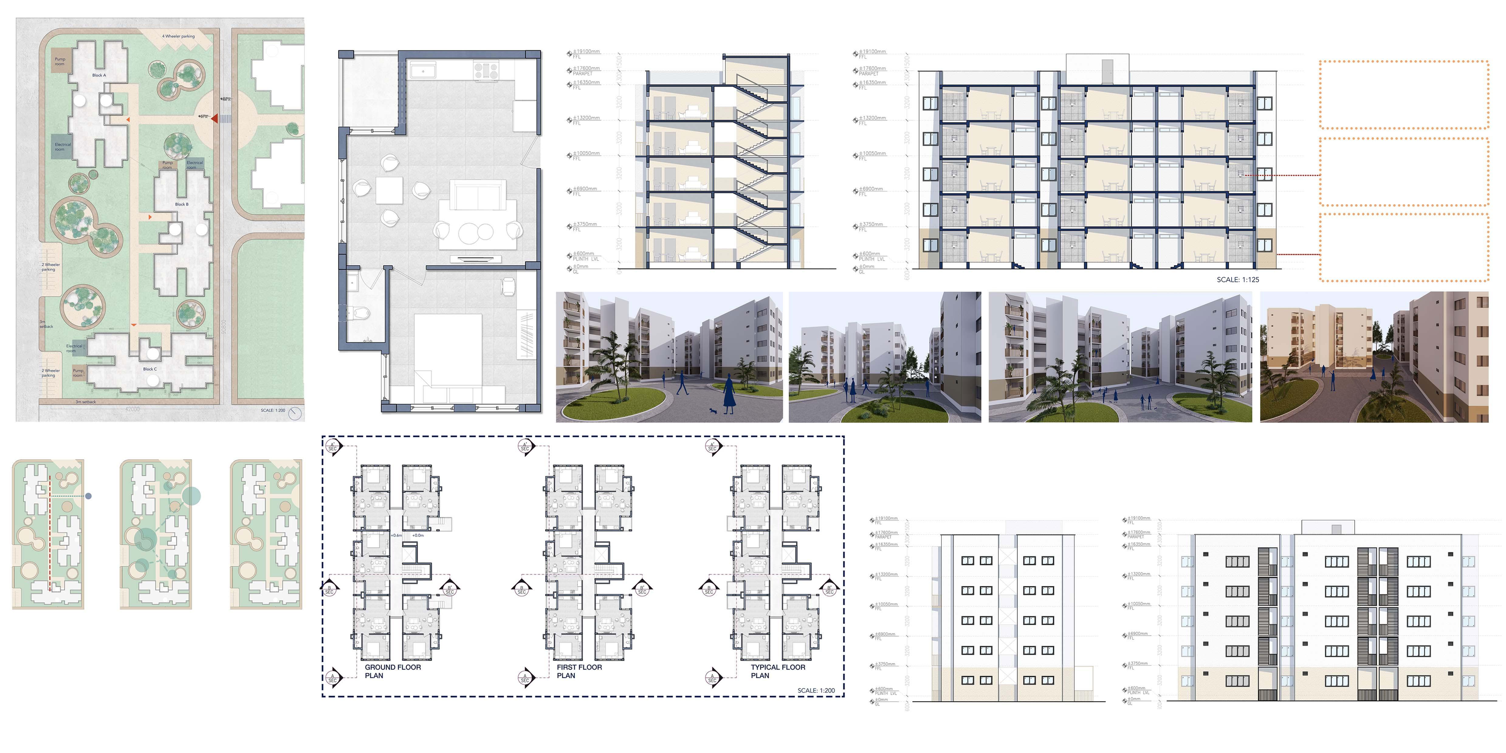
1BHK SCHEME A SITE PLAN
A central vertical axis runs through the site. Buildings are placed along this axis. A horizontal axis conects the site to the 1BHK SCHEME B blocks.
Community zones are located between buildings, enhancing community interaction.
Each block has 5 units in each floor. A total of 75 units have been achieved. Houses a total of 338 residents.
ELEVATION 1 ELEVATION 2
Bamboo railings provide privacy in the balconies and also provide a secondary function of hanging plants, and even laundry. UPVC doors and windows as a more affordable alternative as compared to aluminum frames. Community courtyards can be an excellent way to promote social interaction and create a sense of community within a residential development. A well-designed courtyard can also serve as a tranquil space for relaxation and rejuvenation.
Corridors form gathering spaces for community interaction. A sense of community in corridors is essential for creating a welcoming and supportive environment for residents in multi-unit buildings. Corridors are often the first point of contact for residents when they enter their building, and they can set the tone for their overall experience living there. Corridors can be used as social spaces for residents to interact and connect with one another.
SECTION AA’
TYPICAL FLOOR PLAN
SITE PLAN
This unit has a window facing externally from the living room.There are 2 of such units on each floor. The toilets have external entrances from the balcony so as to increase efficiency and ventilation.
UNIT 1B1T-B
This unit has a window facing the corridor from the living room.There are 6 of such units on each floor. Living spaces in the units are recessed and can be converted into a second bedroom for when visitors arrive.
UNIT 1B1T-A
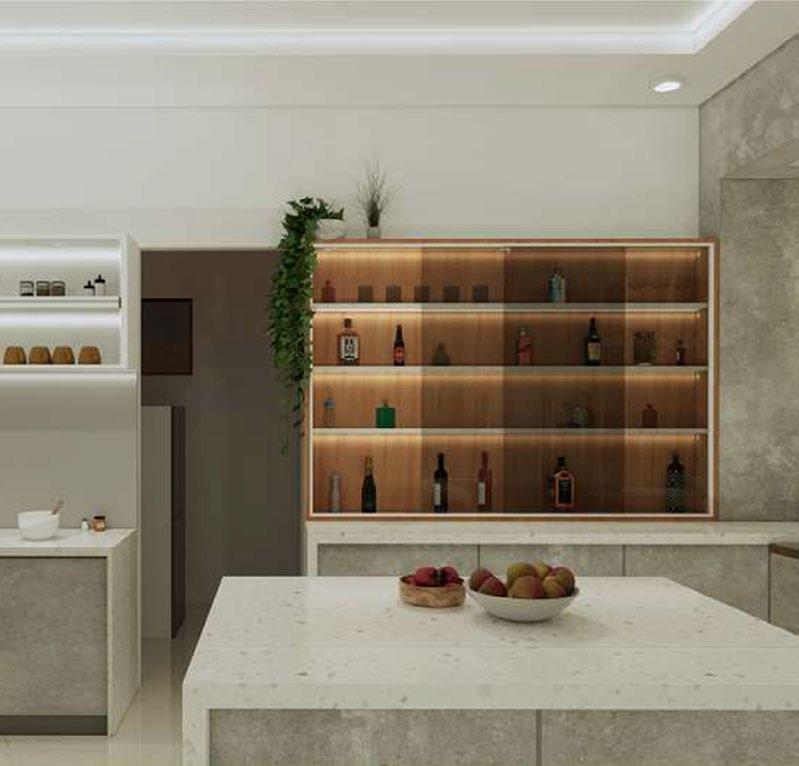
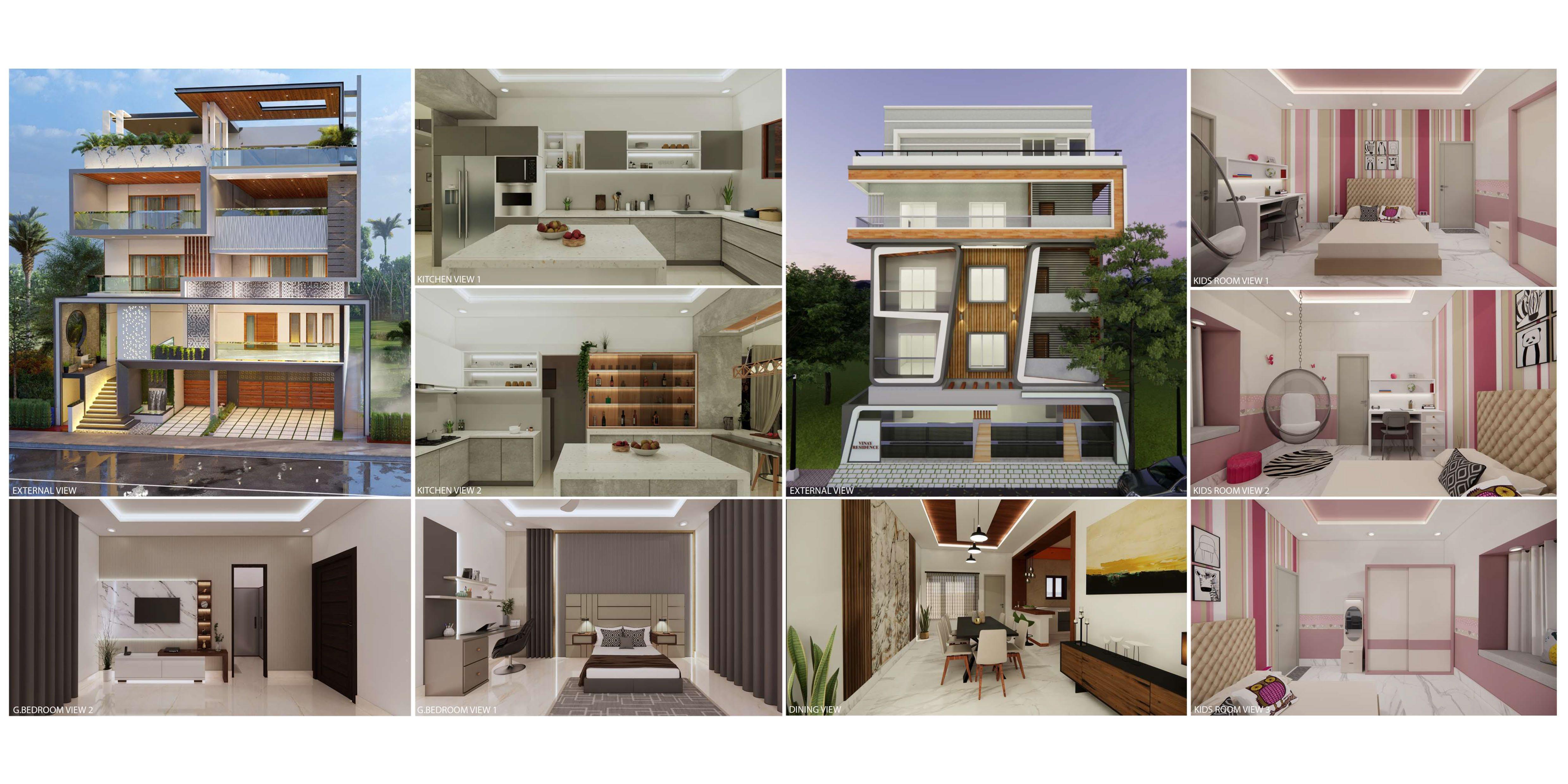
INCEPT ARCHITECTS | Bengaluru | INTERNSHIP
During my internship at Incept Architects, I gained practical experience in architectural design, technical detailing, and project execution. I worked on concept development, space planning, and layout optimization while enhancing my proficiency in AutoCAD, SketchUp, Photoshop, and Enscape for drafting, 3D modeling, and rendering. I contributed to the preparation of working drawings, site plans, elevations, and sections, ensuring precision and adherence to design standards. I actively participated in client meetings, team discussions, and collaborative design sessions, improving my communication and coordination skills. Site visits provided hands-on experience in execution, problem-solving, and contractor coordination.