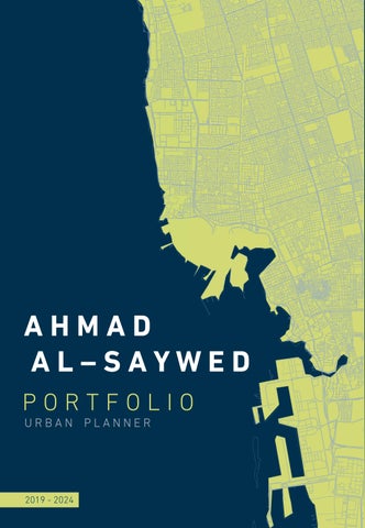
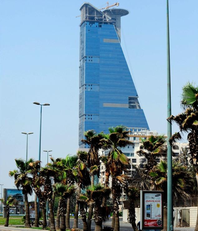
P O R T F O L I O
U R B A N P L A N N E R A H M A D A L – S A Y W E D
P O R T F O L I O
U R B A N P L A N N E R A H M A D A L – S A Y W E D
An ambitious urban planner, who is constantly seeking challenges and overcoming obstacles, with a passion for contributing to creation of vibrant communities with adequate quality of life, through the wide range of skills and capability that I possess
A good team player with analytical thinking and multi-tasking skills aiming to produce outstanding outputs A fast learner with communication skills and work ethic.
ahsawed1@Hotmail.com
+966 55 195 0003 03.04.2001 Jeddah

May/2024 BA of Urban Planning KAU University
- Bachelor’s degree in urban and regional planning with GPA of 4.54/5
Jul-Aug Mosa Al mosa
2023 Real Estate Valuation
- Work on real estate evaluation of the properties received from beneficiaries, by using Valuation methods
Jun-Aug Yasser Aloqbi 2022 Engineering Consultant
- Designing Residential plan on Al-Fanar Dist. in North Obhur
- Determine the urban space for "Melh Alshamal" village, In Jeddah Governorate
- Analysis and design "alluwlua" Plan, in Al-Leith Governorate
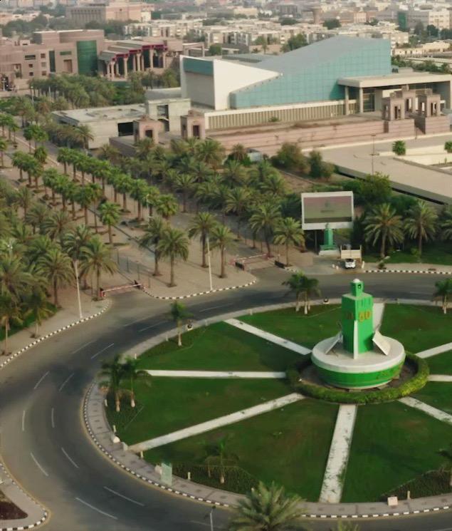
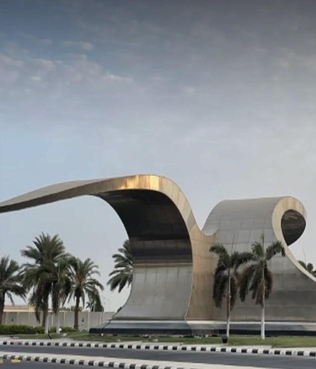
2024 Study road network and parking lots on King Abdulaziz University campus in Jeddah
2023 Study and develop a strategic plan for the city of Jeddah
2023 Creating and analyzing a spatial database in (GIS) for intermediate schools in Jeddah
2022 Designing a mixed-use district with a waterfront in Al-Andalus, Jeddah
2022 Designing of an urban corridor on King Abdulaziz Road, Jeddah
2021 Analysis the urban form of AlAziziyah neighborhood, Jeddah
Jan/2022 UDL Photoshop Masterclass
- Advance technique to create urban mappings, presented by Urban Design Lab
Jul/2021 Designing The Cycling City
- presented by Urban Mobility Academy funded by the European Union
Jun/2020 Self and Institutional Leadership
- presented by the Center of Preparation Future Leaders at King Abdulaziz University
Jun/2020 Stress management strategies
- presented by King Abdulaziz University
2021 Color Walk Jeddah Municipality
- Working with the executive team of the Color Walk project in Jeddah waterfront, in cooperation with Jeddah Municipality
- Soft Skills: Teamwork | Analytical Thinking | Multi-Tasking | Problem Solving | Fast learner | Communication
- Hard Skills: Research Methods | Develop Plans | Spatial Analysis | Land Use Planning | Presentation | working with 3D, 2D softwires (Offices, AutoCAD, SketchUp, Lumion, Adobes, ArcGIS PRO)
Sep/2024 Overall Band Score: 5.5 British Council
- Arabic: Native
- English: Upper Intermediate


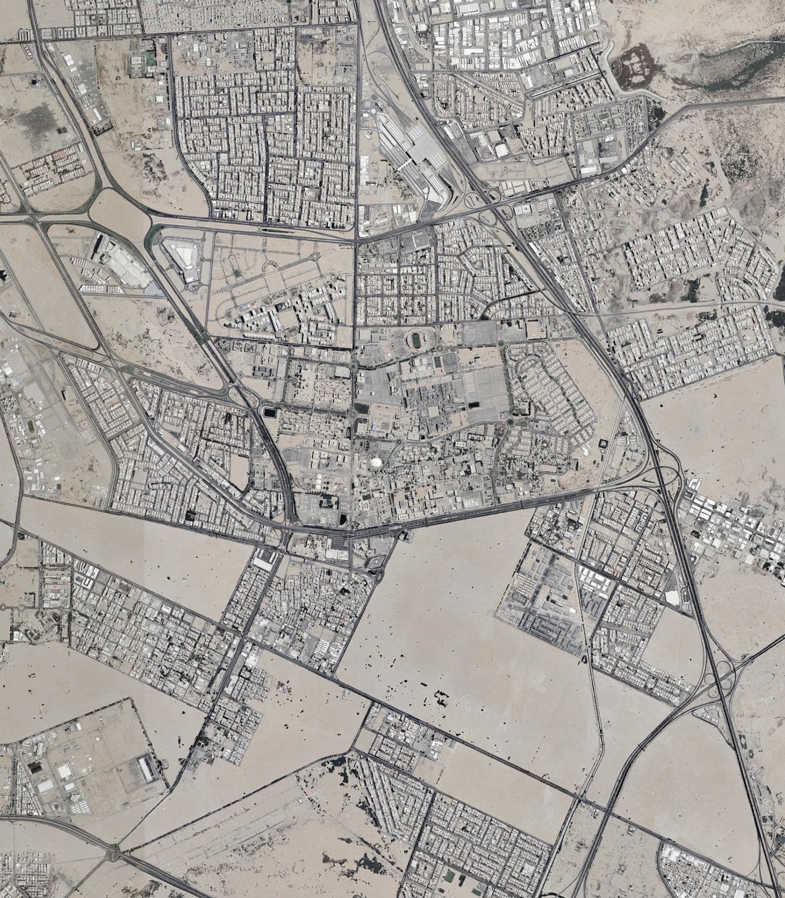
Due to the annual increase in the member of King Abdulaziz University, which reached 79 2% compared to 2013, and the increase in the use of private cars for transportation to and from the university, several problems have appeared in traffic movement inside the campus, at the beginning of each semester in addition to the morning and evening rush hours
The campus road network suffers from pressure exceeding the capacity, and the absence of optimal distribution of parking areas with the users on the campus, generating congestion in certain areas
The study will be specialized and detailed in (Study of the road network and car parking within the King Abdulaziz University campus in Jeddah) as it is a part of a joint and comprehensive study with my colleagues aiming to (enhance traffic flow and address traffic congestion within the university campus) The study includes presenting and developing solutions at the planning, operational and organizational levels in cooperation with some of the university’s responsible departments and authorities.
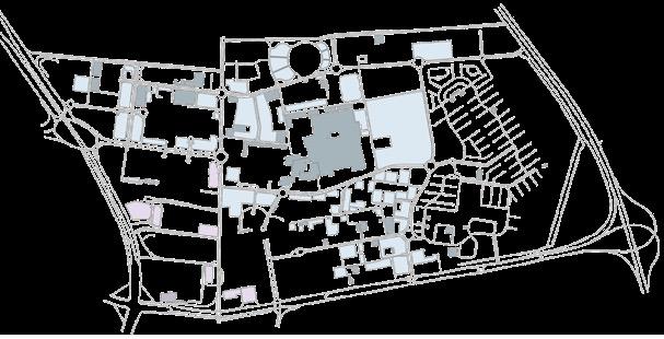
Prince Majid Road
Abdullah Reda Road
King
Abdullah Suleyman St
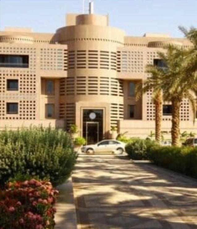
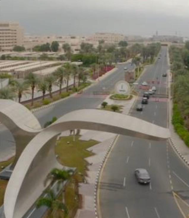
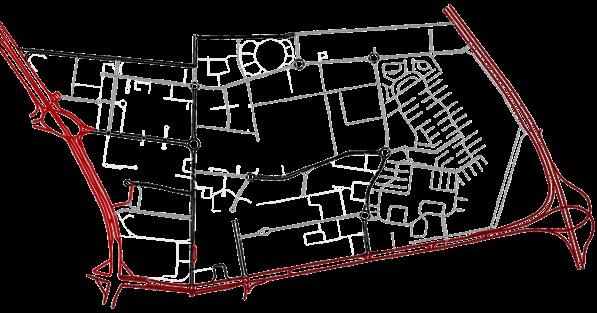
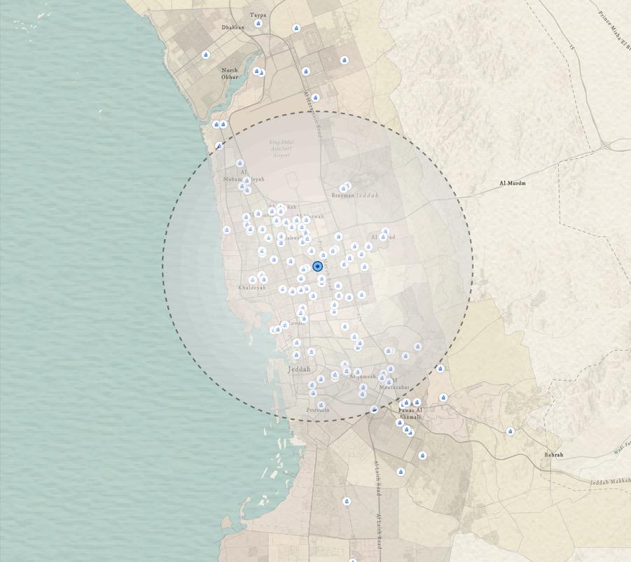
King Abdulaziz University is located southeast of Jeddah in the Sulaymaniyah district It is bordered to the north by Abdullah Reda road, to the south by Abdullah Suleiman street, to the east by Al-Haramain road, and to the west by Prince Majed road
The campus area is 5 7 million m2

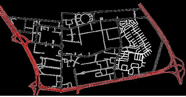
Road Hierarchy

The campus roads have three types of road grading starting from main, then Collector, and reaching local The road grading on the campus is considered acceptable as traffic moves from the surrounding into the campus
The largest percentage is for two-lane roads, at 55 7% A shift in the number of lanes is observed on some main roads within the campus, causing traffic congestion on them This is observed in Aladab, Medicine roundabout, and Hospital Street
The campus roads are divided into three speed categories, the largest percentage of roads with speeds of 30 km/h, at 50 6% As for the gradation of speeds for the roads, it is acceptable for the campus road network


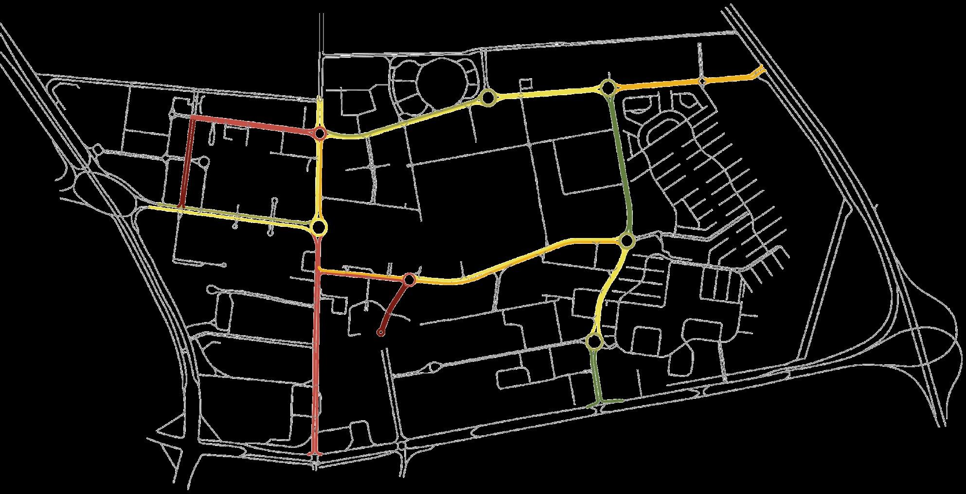
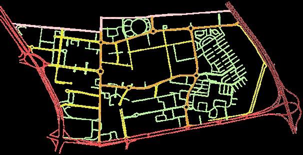
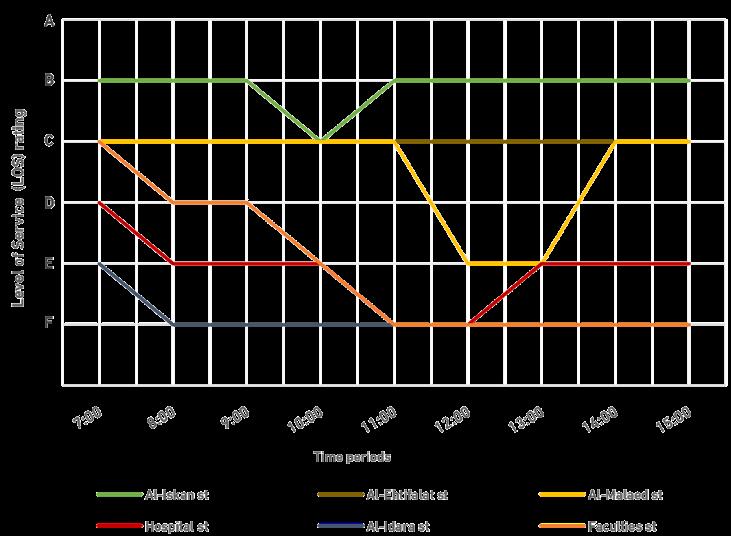
Road network level of service (LOS)
A
Level Of Service (LOS): It is a measure that describes the level of service on the road network through traffic flow, as its measure depends on the distance, time and speed of the trip. The measure also consists of six classifications, where classification (A) represents the best flow and (F) represents the worst.
Data indicates a low level of service (LOS) on Faculties, AlIdara and Hospital Street, indicating congestion and traffic jams.
The road network reaches its peak and traffic congestion during the period from (10:0012:00).
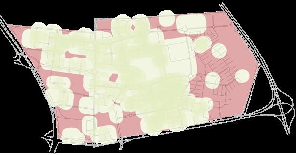
Public parking - Male
Public parking - Female Privet parking - Male Privet parking - Female
The total number of parking on campus is 24,814, largest percentage is for male section by 90 1%, while the female section largely lacks parking spaces Parking lots are spread out in the middle of the campus and are less in the southwestern parts on the female section
It is noted that the concentration of parking spaces is high in the central area of the campus, while they decrease towards the outskirts of the campus, and their absence is noted in the female section area
The southwest area “female section” of the campus shows that it’s unserved area, as well the east of the campus since it is the faculty housing area, as the residential units contain private parking lots
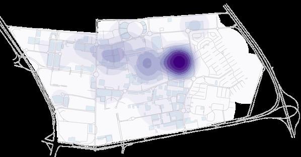
Average daily parking occupancy
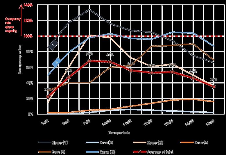
The occupancy rate of parking lots in major trip generator areas such as the University Hospital and the female section, during peak hours, reaches 160 % above their capacity.
The average occupancy rate of parking lots on the university campus during the period from (7:00-15:00) was (50 %). Spatial distribution
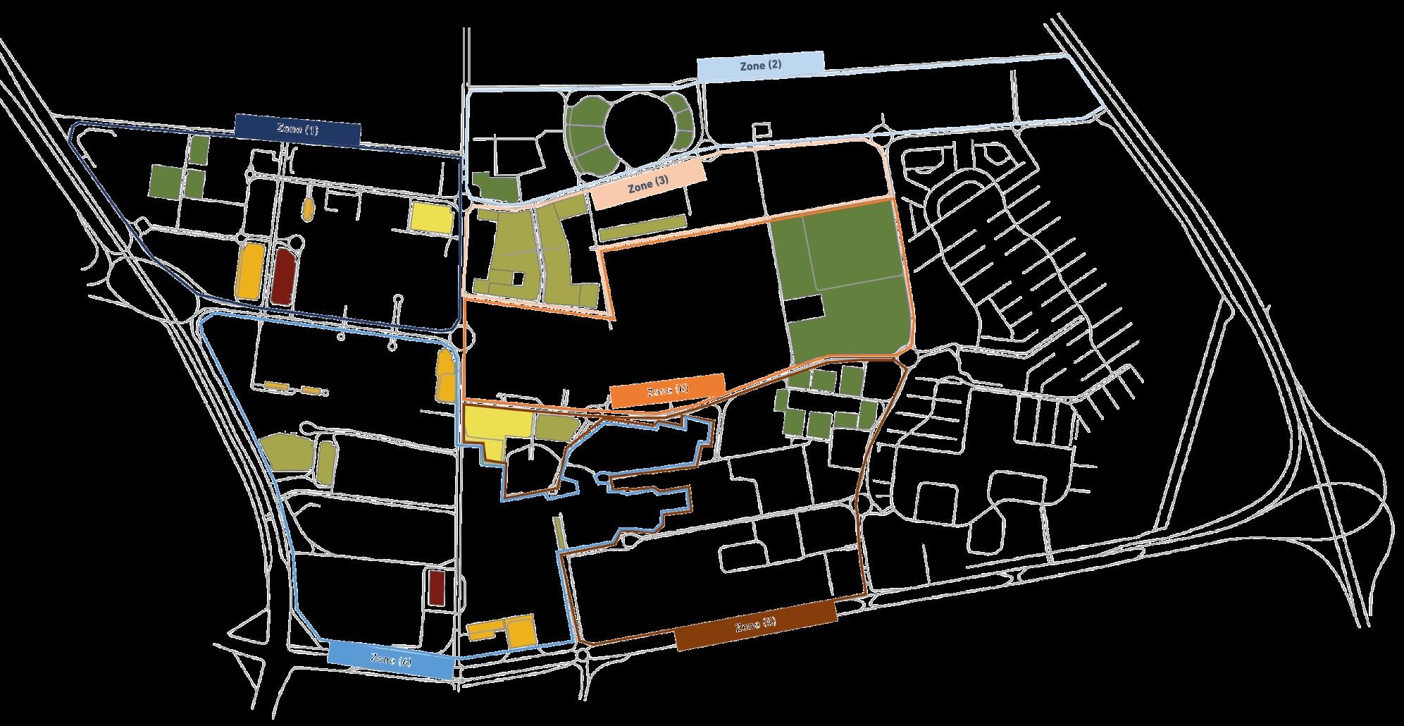
The data indicates that the occupancy rate of parking lots in zone (1), (3) and (6) increased, exceeding their capacity during peak hours.
The peak demand for parking lots is during the period from (8:00-11:00).
Three scenarios were designed to develop solutions that reduce the percentage of problems affecting traffic movement on the campus over different time periods from short to long, which were reached based on the analyses of the current situation of the study.


The first scenario aims to develop short-term solutions, and the proposals can be easily and quickly implemented to improve the current traffic situation at the level of the road network and parking lots
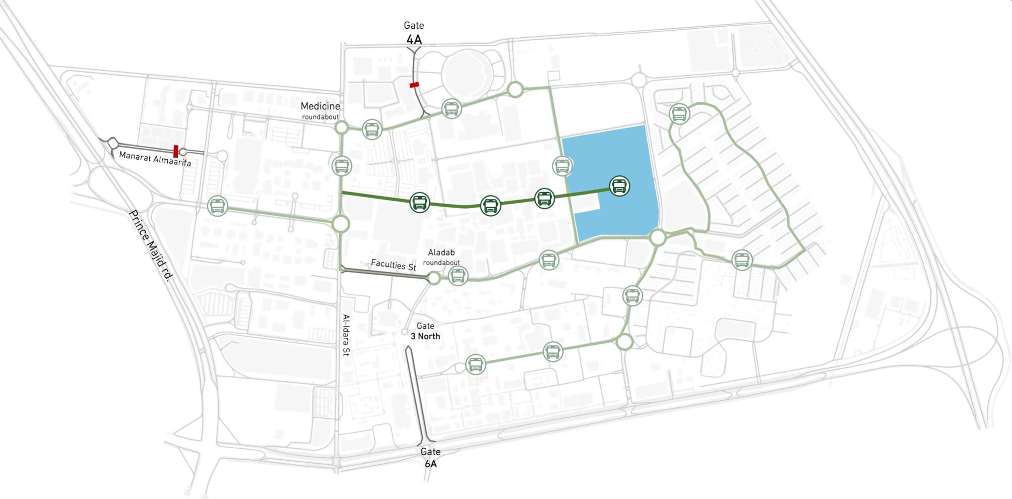
Activating entry and exit from Gate 4 A by removing barriers from the streets leading to it, and reopening Gate 6 A to serve the female section and reduce congestion on Faculties st. and Aladab roundabout
Linking the largest, low occupancy parking (Faculty of Science parking) by public transport lines, with movement generators and areas suffering from a shortage of parking spaces, using the park and ride concept

The second scenario aims to deal with and develop the solutions set out in the previous scenario with a greater rate of change to reduce the problems over a medium -term period
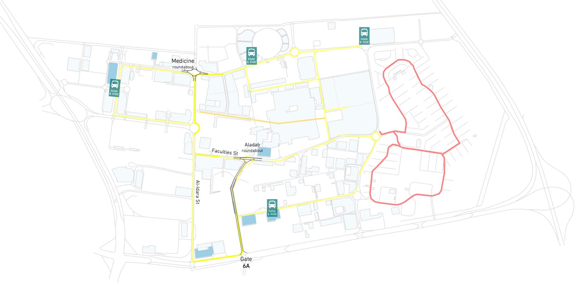
Redesigning the Medicine and Aladab roundabout to become a Tintersection, connecting the street leading from Gate 6 A to Aladab roundabout to reduce congestion on the surrounding streets
Adding 6 new parking spaces with 2,750 parking lot, allocating Park & Ride areas in the largest parking spaces and connecting them to public transport lanes

The third scenario aims to modify and develop the current master plan of the campus to solve the traffic problems affecting traffic movement over a long-term period
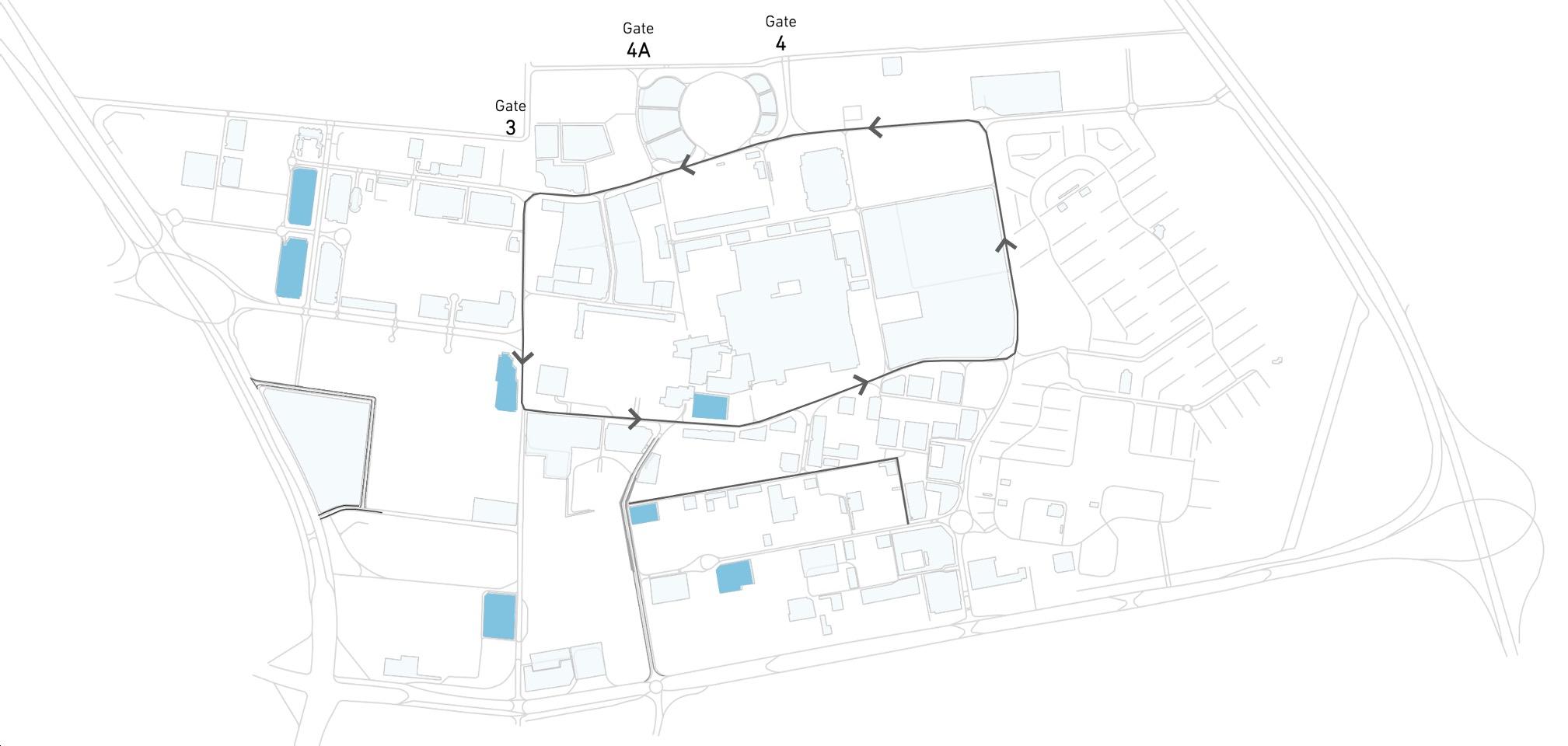
Converting the main roundabouts into T-intersections, redesigning the ring road surrounding the academic square into a one -way street, cancelling Gate 3 and diverting traffic to Gates 4 A and 4
Converting 7 sites into multi-storey buildings for parking lots, so this increase in the number of parking spaces to 35,564 , and that increase by 30 % over the current situation
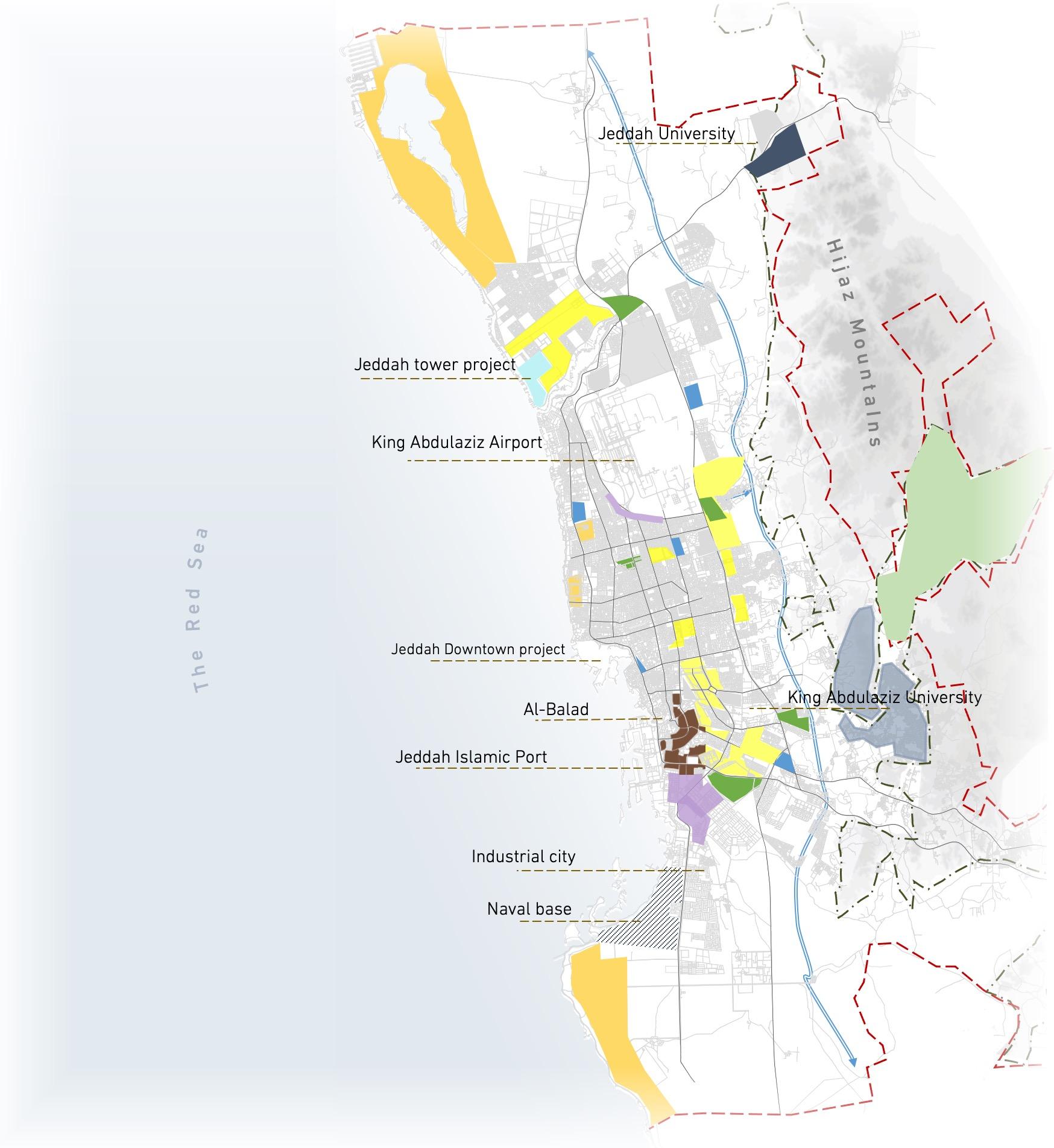
Study and develop a strategic plan for the city of Jeddah,
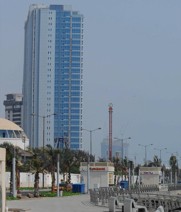


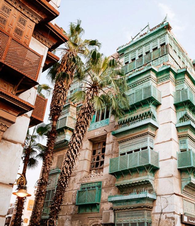
Jeddah is in the Makkah Al-Mukarramah region in the west of the Kingdom of Saudi Arabia The city has an important role due to its geographical location as the gateway to the Two Holy Mosques and a destination for Muslims from all over the world, and its lands extend along the Red Sea coast and contain the main port of the Kingdom.
Given this, Jeddah has an abundance of potential and components that are important to study and identify by analyzing the current and previous planning method and how they were exploited and dealt with, as this provides a clear perspective of the problems and potentials present in the city From this standpoint, work will be done to design alternatives to the master plan for a period of 10 years to extend from 2023 to 2033, to focus on finding ways to solve problems and employ capabilities for the city of Jeddah


The housing supply shortage is 200,000 units. Vacant and cleared land must be used to make up the shortfall
Shortage of hospital beds by 18,153 beds. Vacant land in the center should be used to make up the shortage
Total reliance on private cars for transportation, resulted in congestion on main roads during rush hours
Absence and
The weakness of per capita of open areas and the shortage of public parks by 870 hectares
Lack of public transportation network, which 97% of the population moving around using private cars
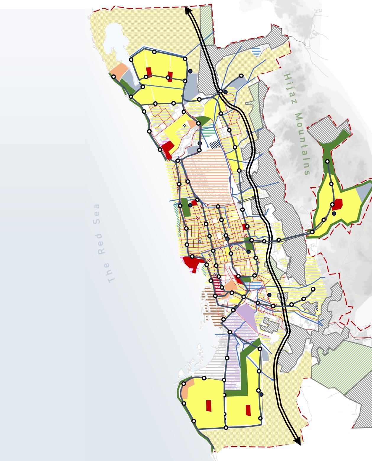
Focus on the suitability of the location in distributing urban centers to serve the population and the locations of projects that are consistent with the Kingdom vision according to their characteristics.
Emphasis on urban expansion and growth towards the north of the city, while ensuring the allocation of residential areas and the presence of public services towards future growth and expansion.
High-risk areas were considered environmentally protected, and construction was prohibited in them, in addition to the fair distribution of parks and open areas throughout the city to increase the per capita share of green spaces.
Emphasizing the existence of a connection and relationship in the spatial distribution between residential areas and each of the urban and health service centers and public transportation.
Focus on ease of access and connectivity between the city's outskirts logistically and through a public transportation network.

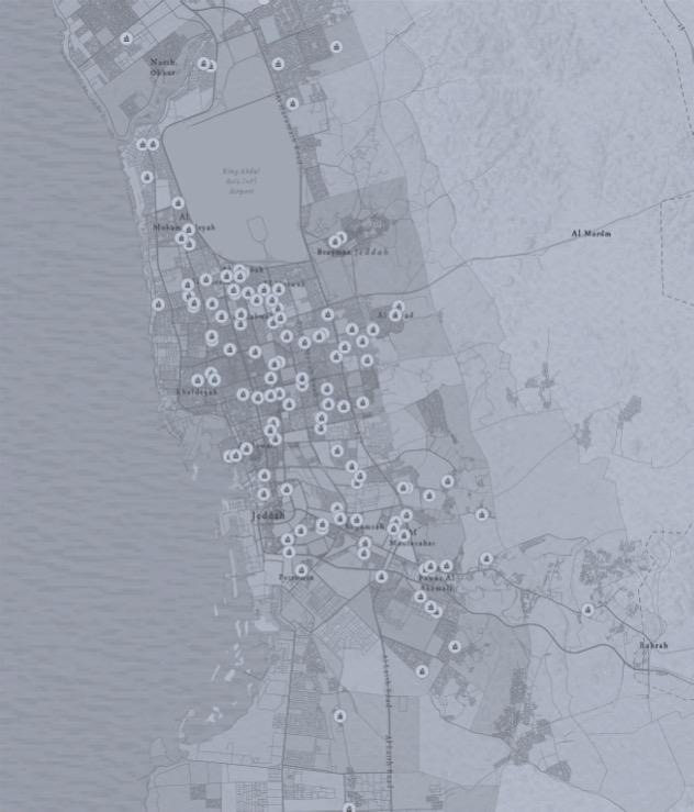

Providing the opportunity for general education for all segments of society in an appropriate environment is one of the goals of education in the Kingdom of Saudi Arabia and its Vision 2030. To achieve this goal, the government and the Ministry of Education focused on preuniversity education by establishing schools in a fair manner for boys and girls for the three stages of primary, intermediate and high schools
The project is focus on updating geodatabase for boy's intermediate schools in Jeddah city, that contains information about the current spatial distribution for both the public and private intermediate schools
Contributing to helping decision-makers and planners in their demographic and geographic spatial awareness of the distribution of boy's intermediate schools in Jeddah city, the areas where they are concentrated and the areas where they are lacking.


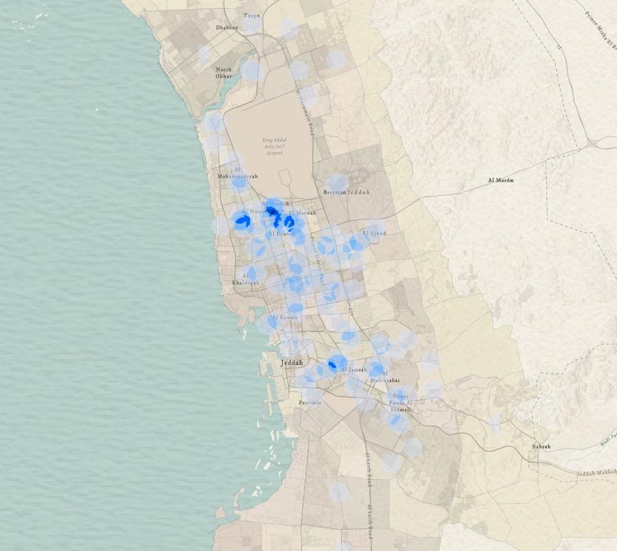

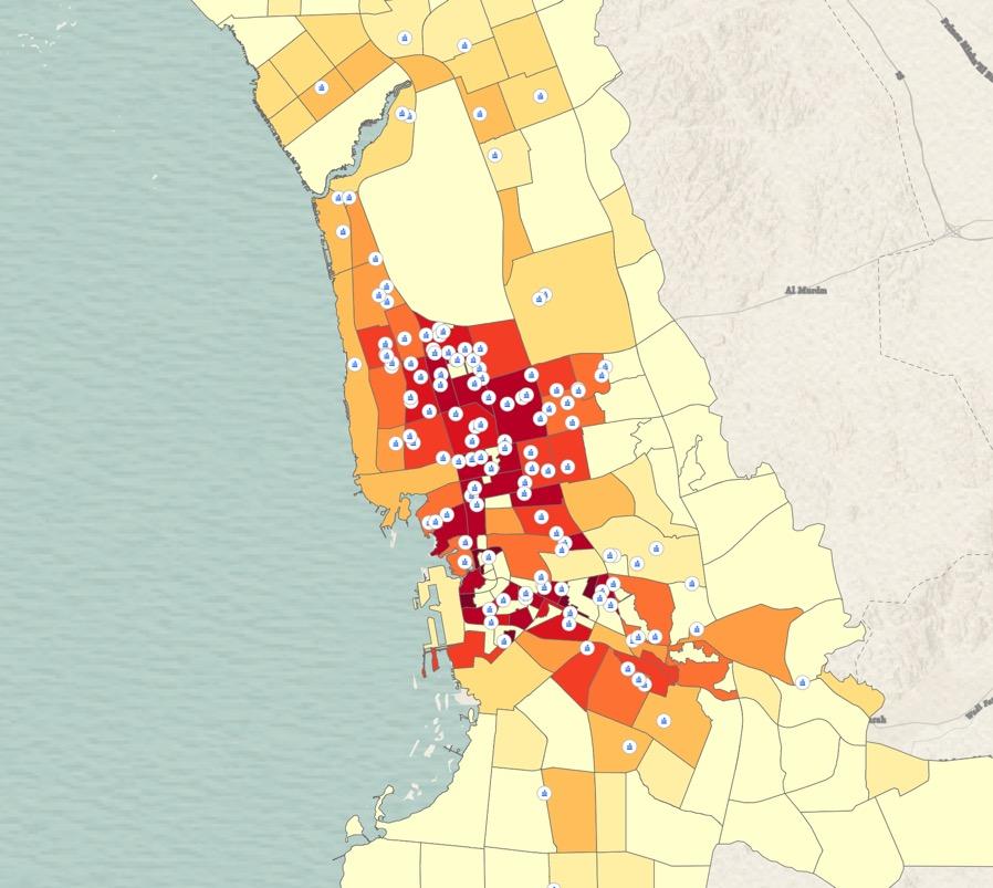


The study and analysis of the spatial distribution of boy's intermediate schools in Jeddah city resulted in their high concentration in the city center due to the high population density in its residential neighborhoods, considering their absence north and south of the city in neighborhoods with medium and lower density Accordingly, the study recommends providing boy's intermediate schools in the north and south of the city to compensate for the shortage, meet the population need, and achieve justice and equality among residents in access to services


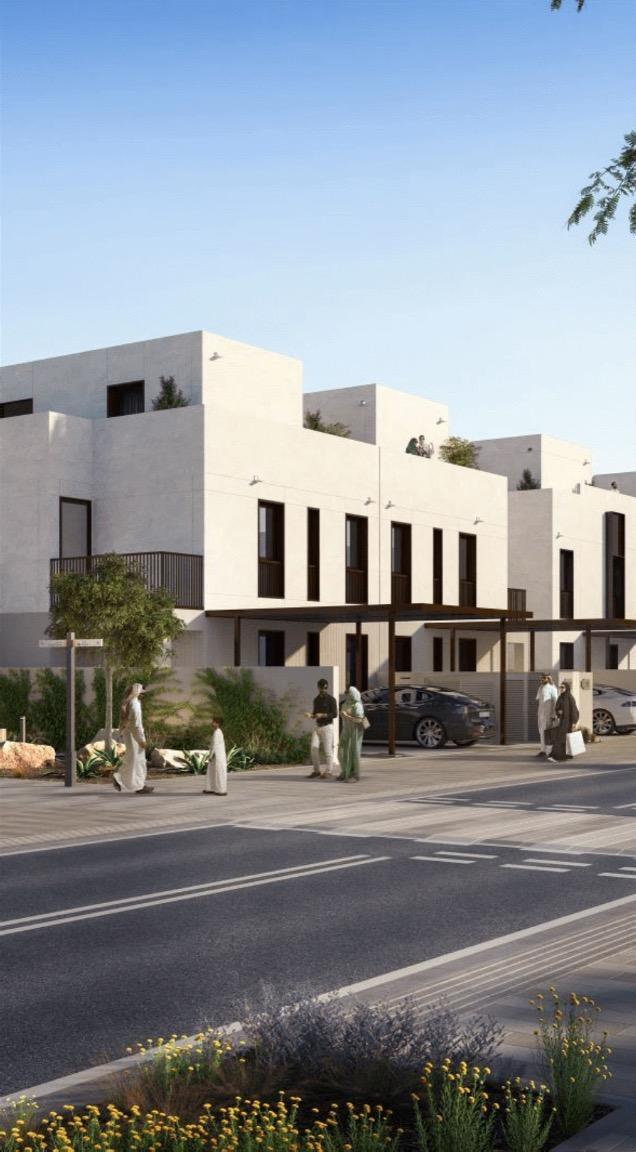
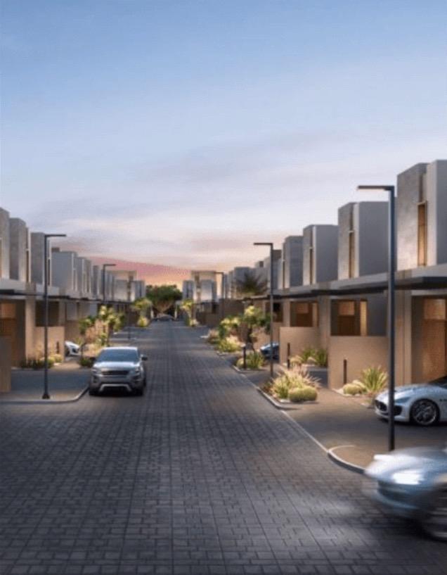
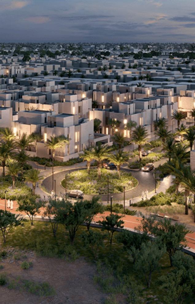
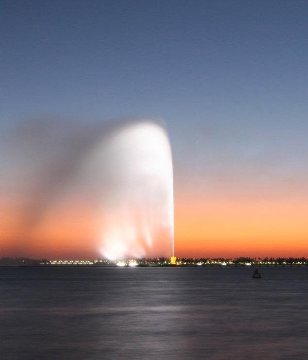
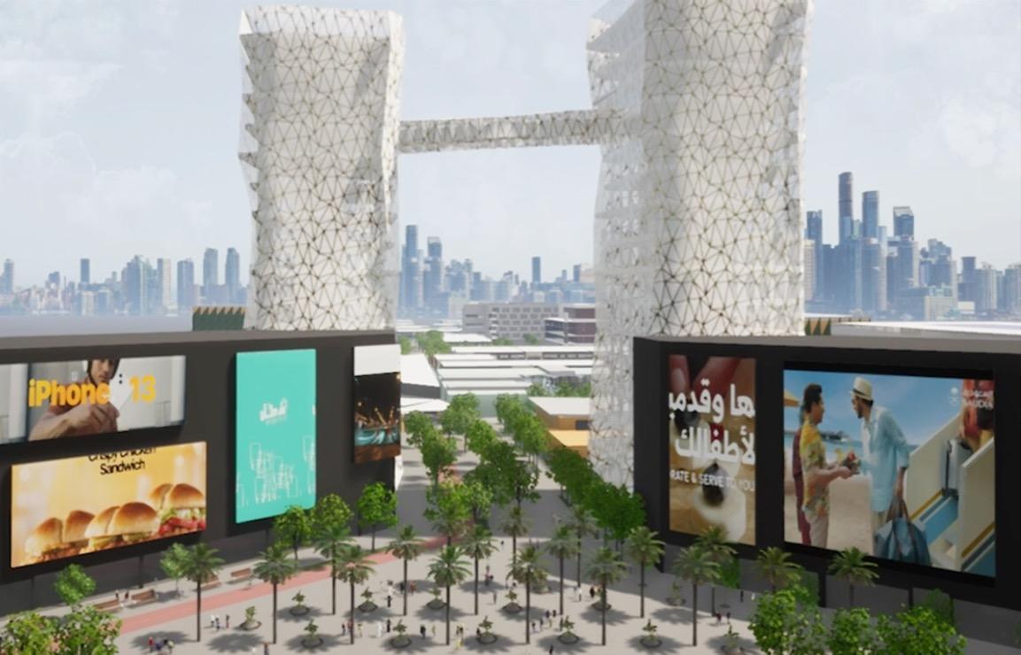
The project is located 10 km from the historical area, 8 4 km from the southern corniche, and the project extends along the Red Sea coast to the west for a length of 4 5 km The project site represents a unique opportunity with its view of the Red Sea coast, its proximity to the city center and its easy accessibility via the city's main roads. The project aims to prepare design ideas and alternatives for the project area, considering the presence of a green spine for pedestrians and an open recreational area on the seacoast, as well designing the waterfront area as a part of the master plan for the project
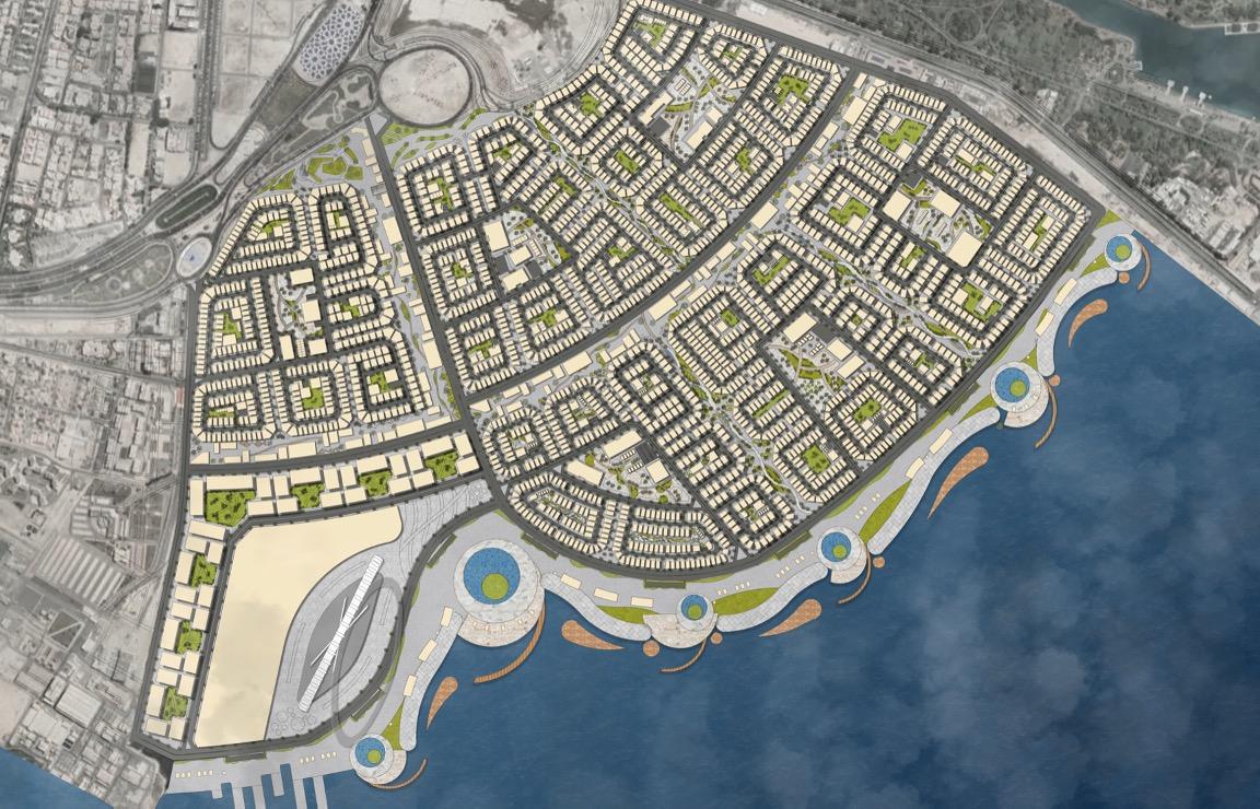
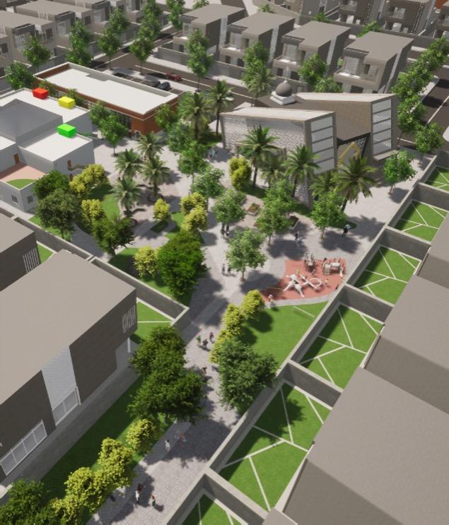
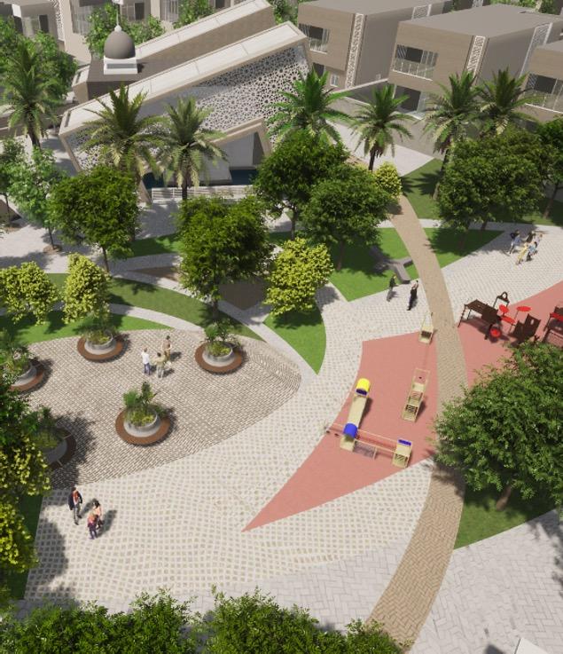
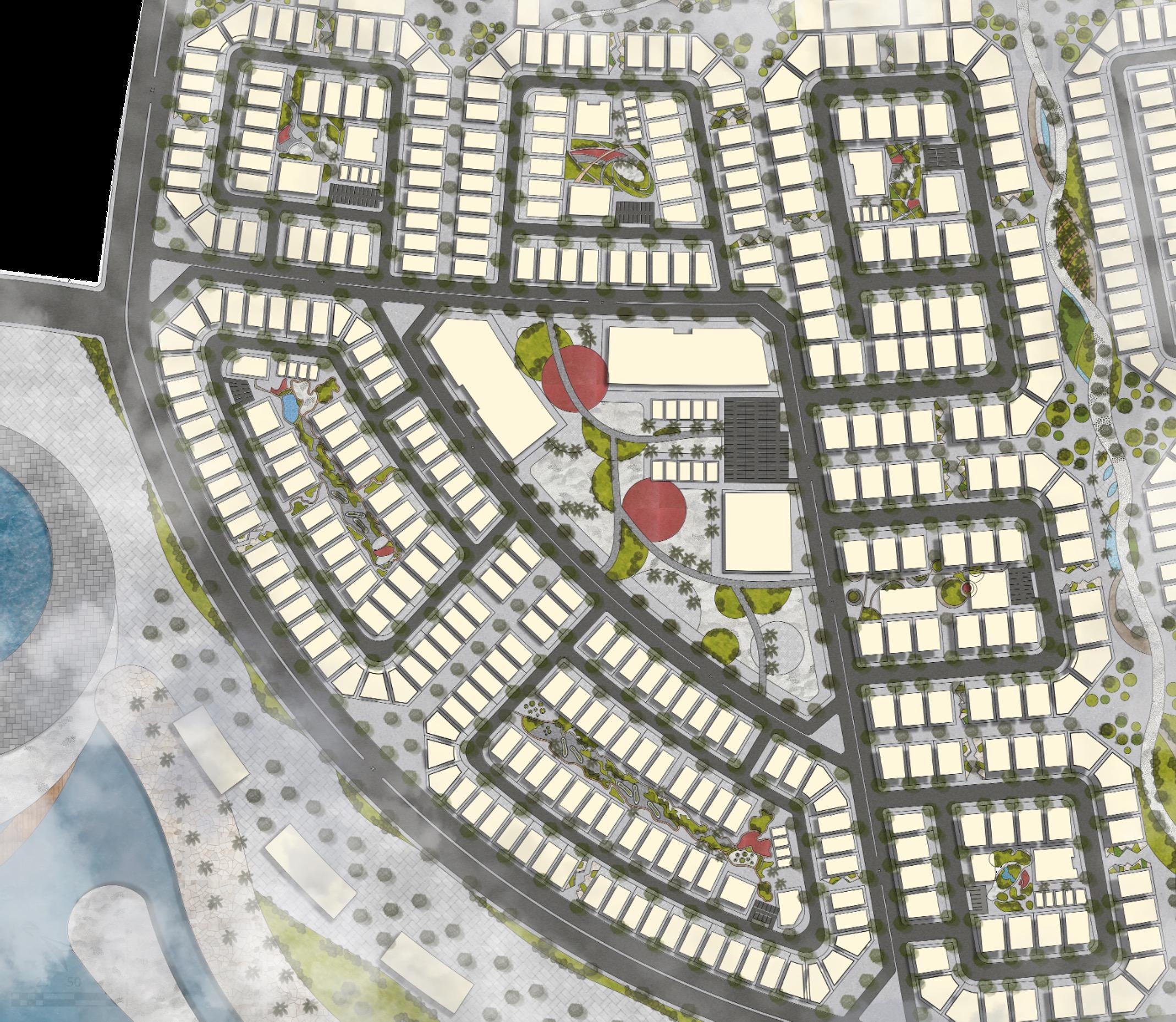
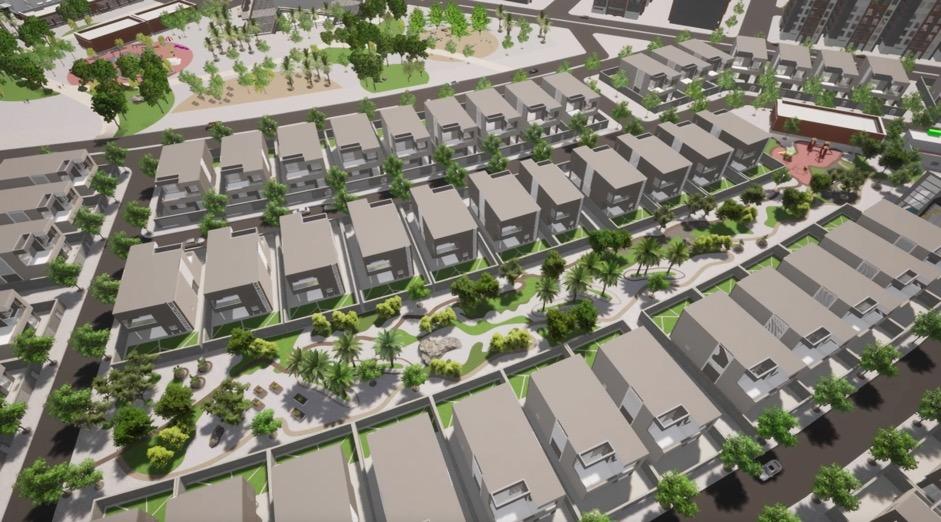

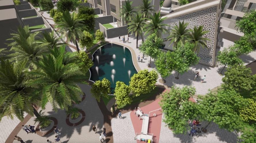
The design concept was based on the presence of 6 residential neighborhoods in the master plan, each neighborhood has its own center supported by basic services for the neighborhood residents and within a service area of 500 meters to be within a walking distance Then comes the green spine as an axis linking the 6 neighborhoods together, considering and giving priority to pedestrians in its design, and from it they can reach the waterfront area and the commercial and entertainment area
Cost and profit estimation for a neighborhood
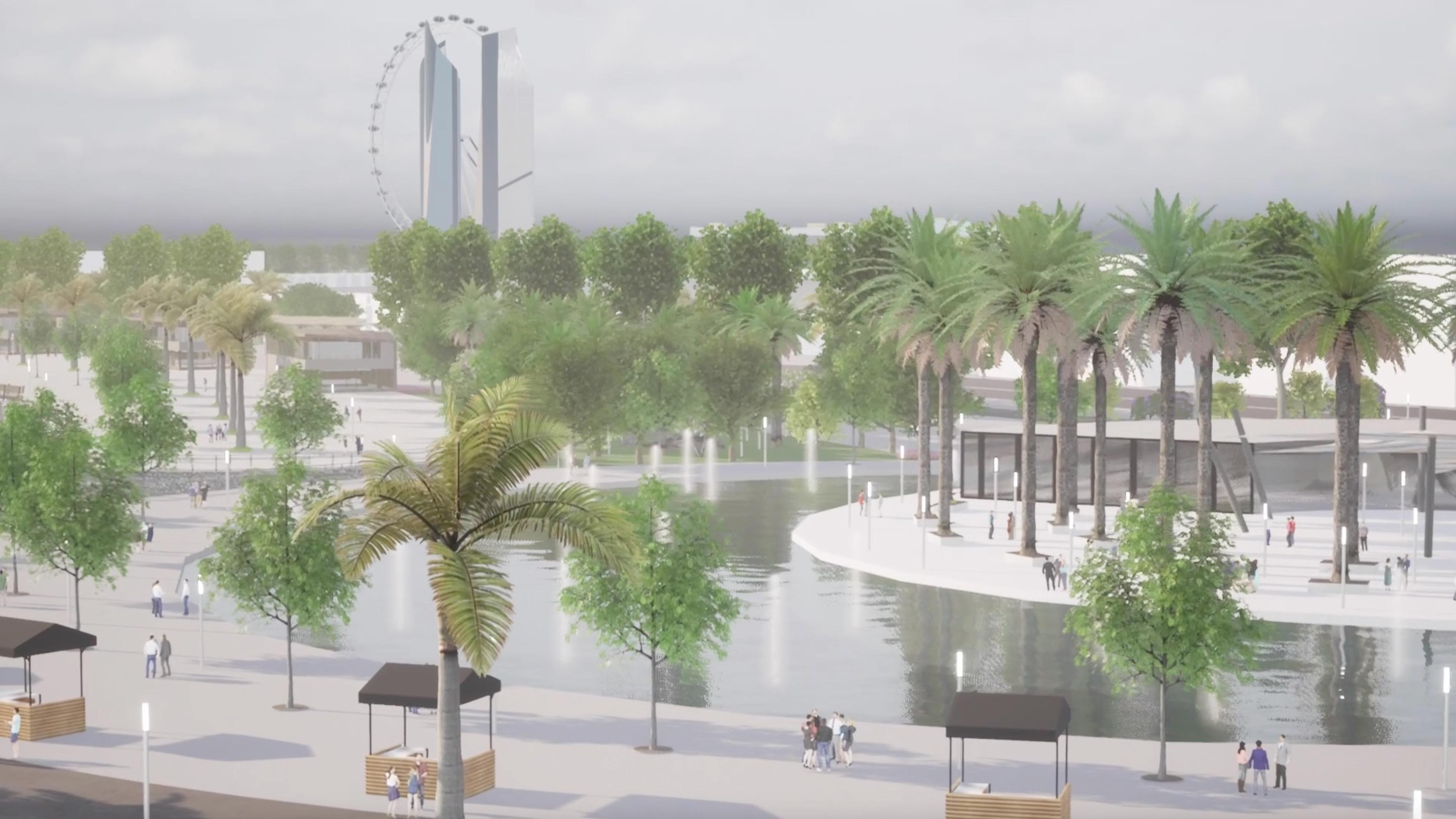
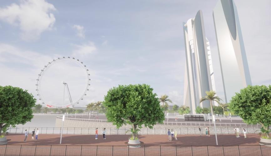
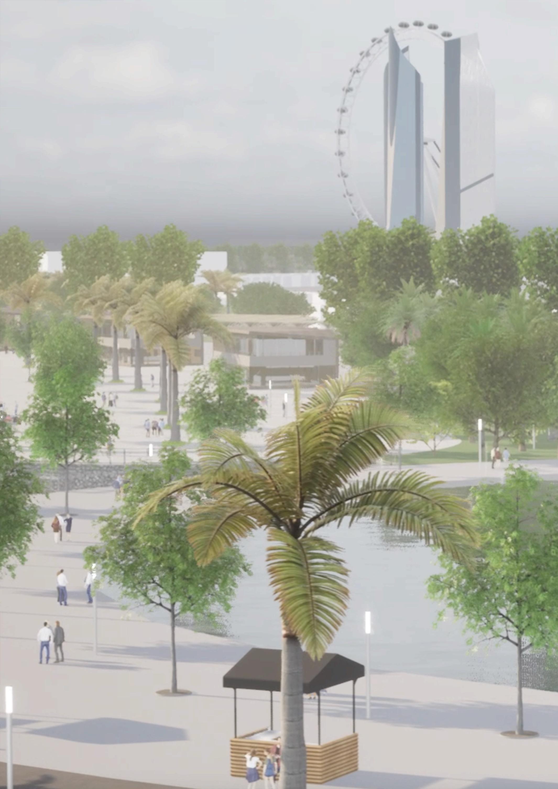
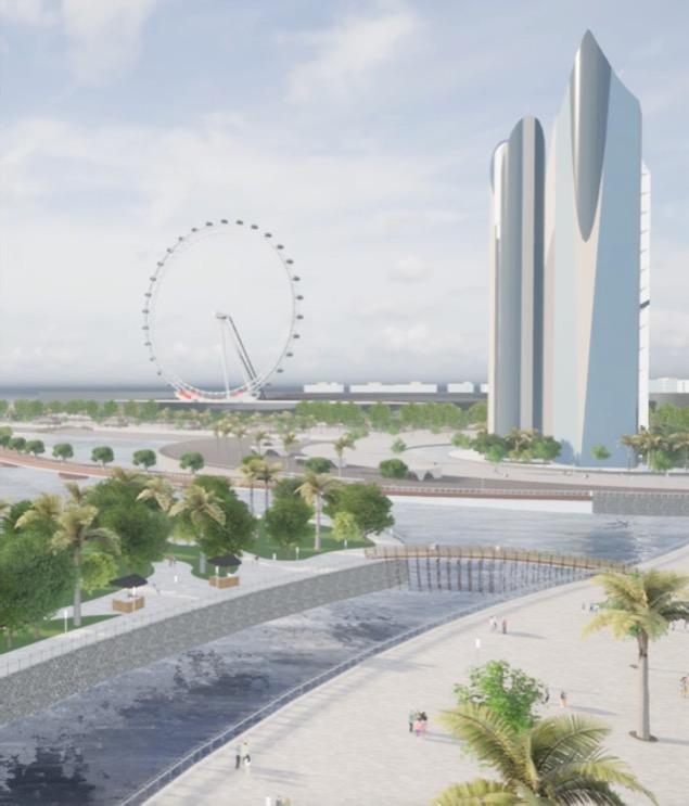
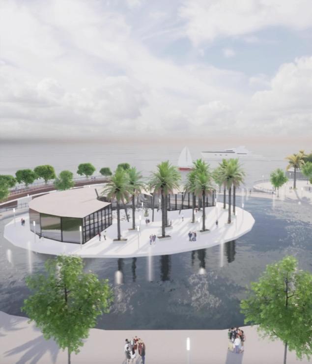
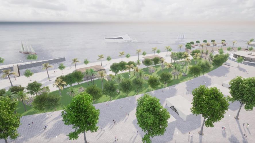
The 4.5 km long waterfront, overlooking the Red Sea coast of Jeddah, was designed to be a tourist and entertainment waterfront at the city level. The waterfront includes a large commercial area north of the waterfront, and the Eye Wheel overlooking the city and the sea, in addition to open beaches for swimming and green areas, In addition, the Northen area has been allocated for hotel accommodation to enhance the tourist aspect of the area
Waterfront uses statistics
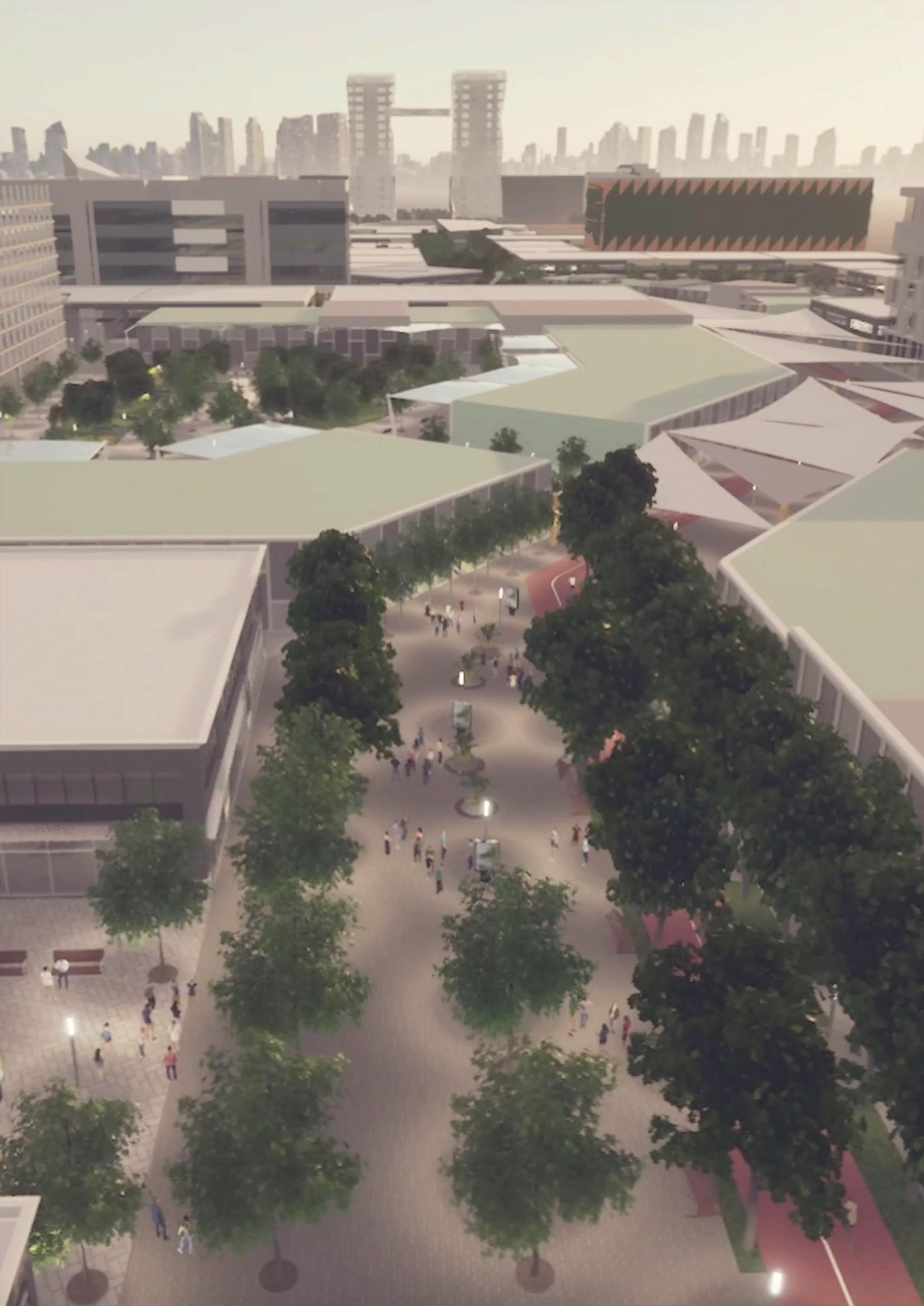
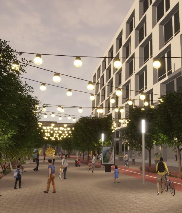


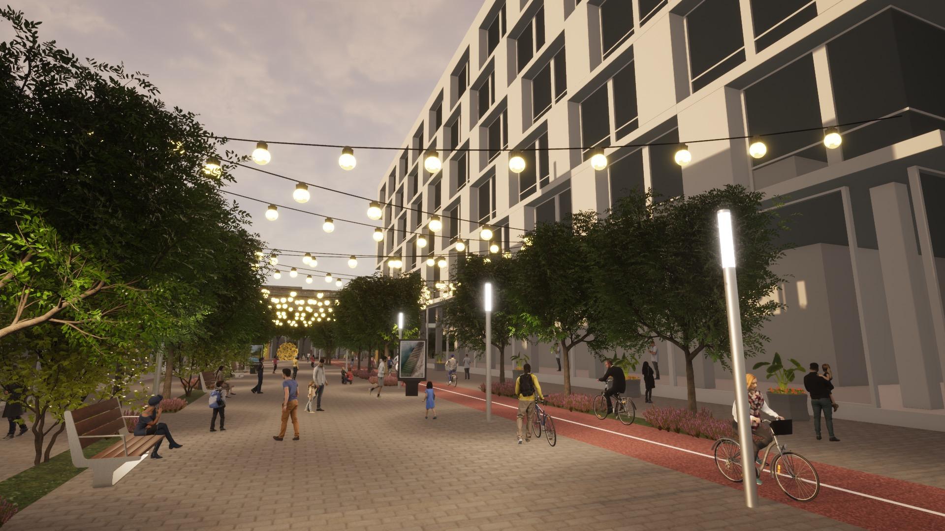
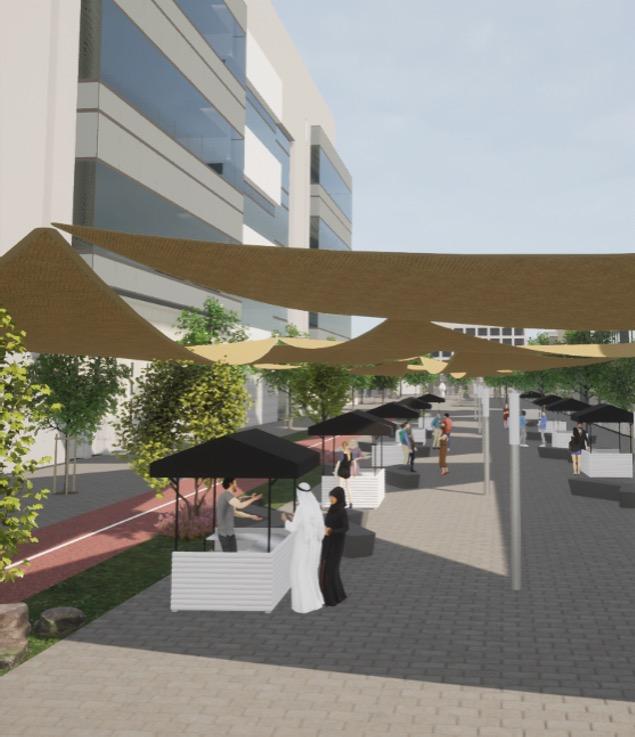
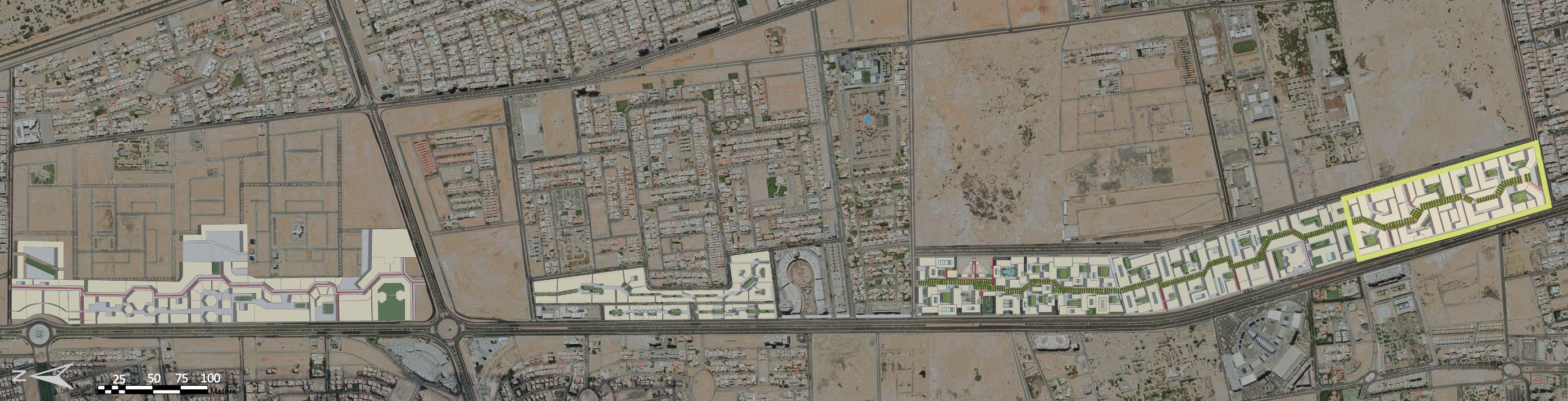
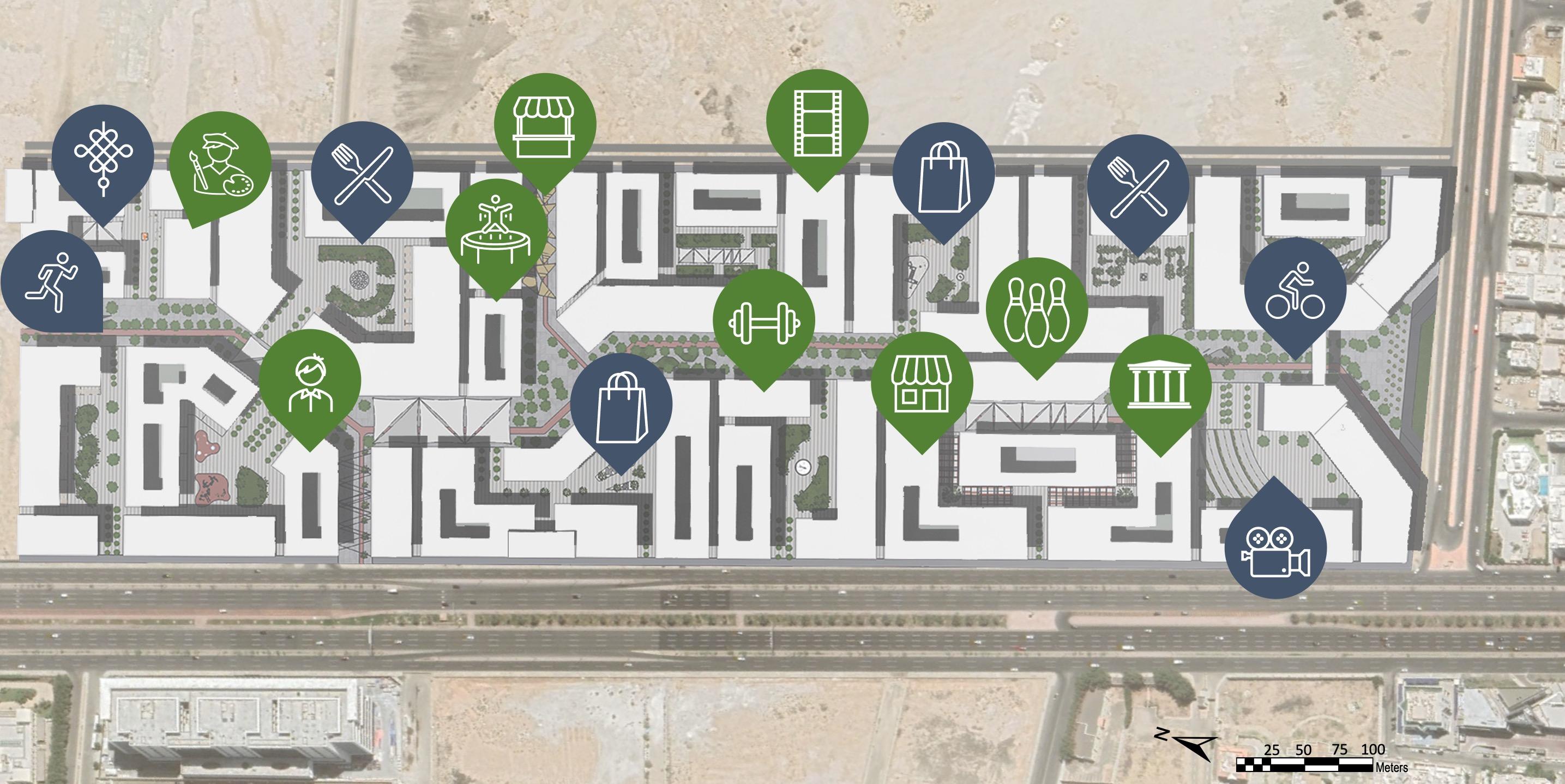
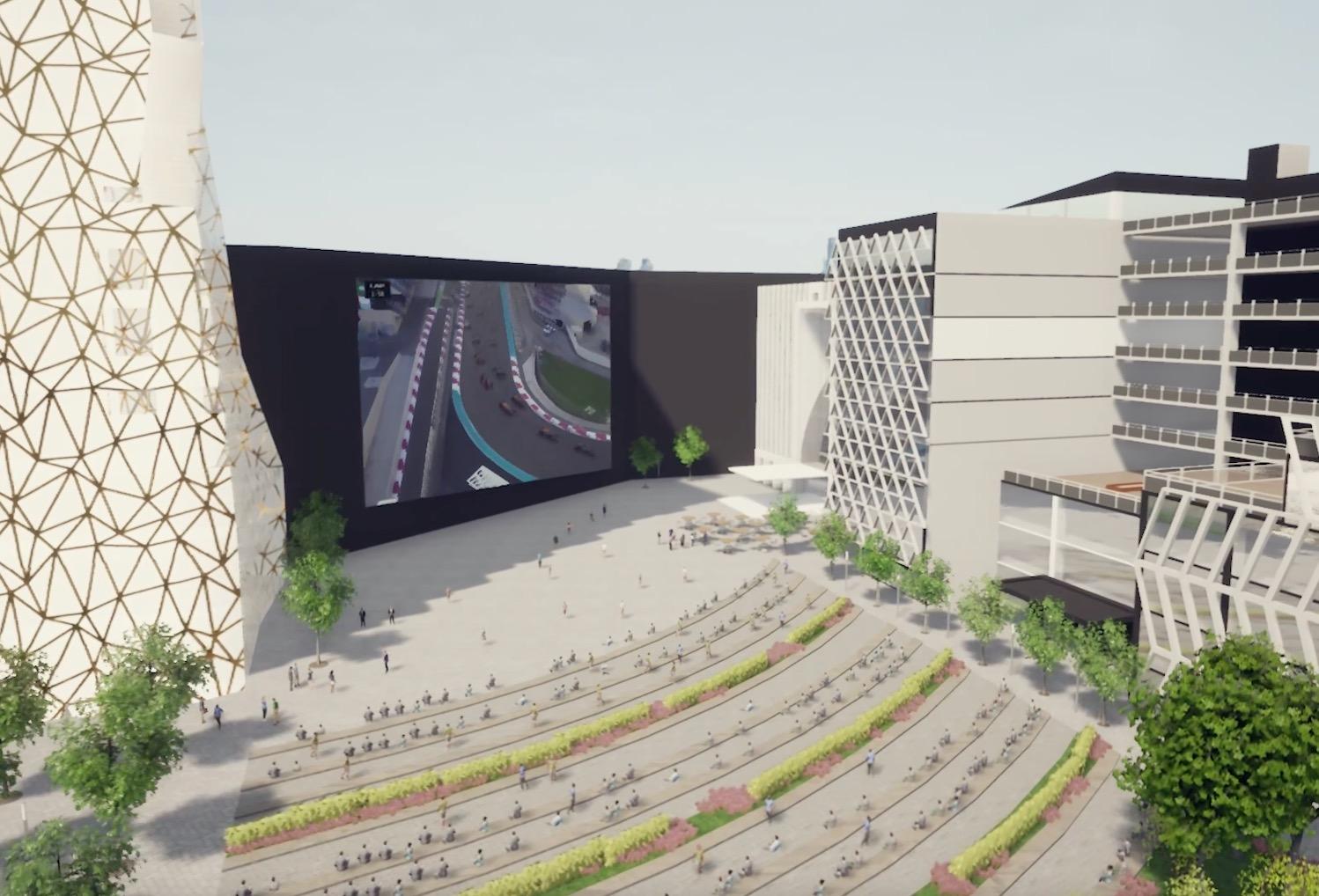
The project focuses on creating a 7-kilometre long and 40-metre wide pedestrian and bicycle path (Urban Corridor), in an environment full of entertainment activities and events, including a showground, investment areas, an integrated set of commercial and entertainment facilities, and administrative and hotel centers to be a tourist and economic destination in line with the Kingdom’s Vision 2030
Aiming to creating a recreational and tourist destination in a safe environment for pedestrians and encouraging the attraction of investments and economic activities, and increasing the per capita of open spaces in Jeddah
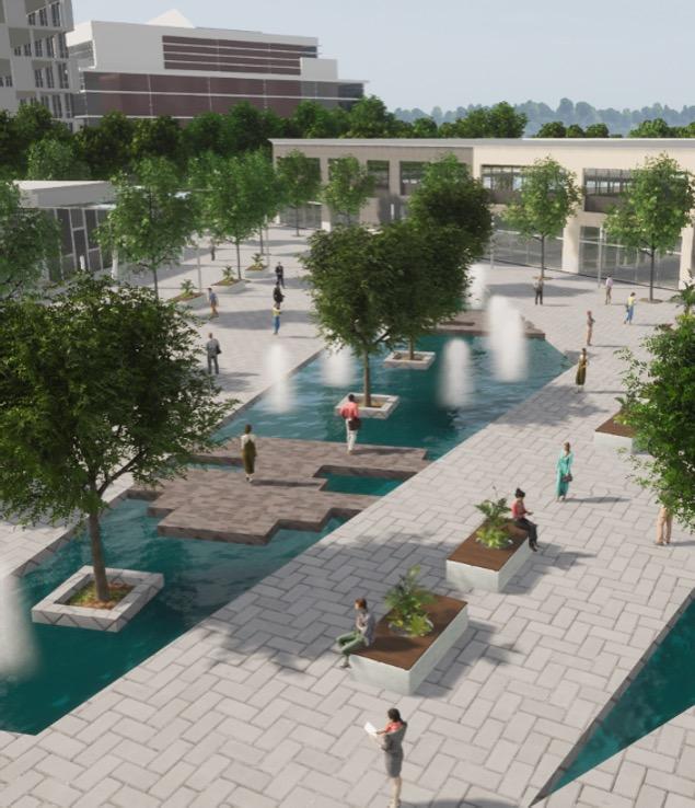
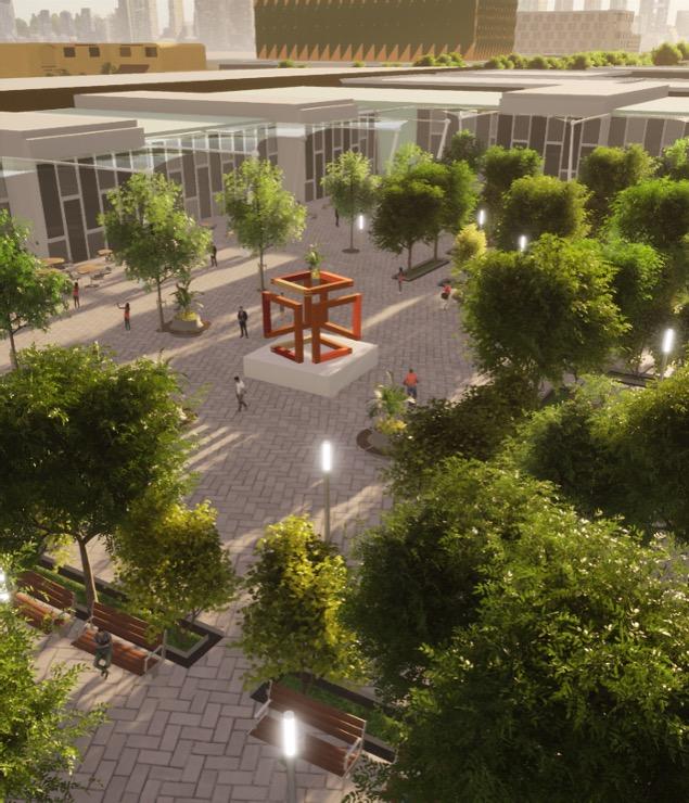


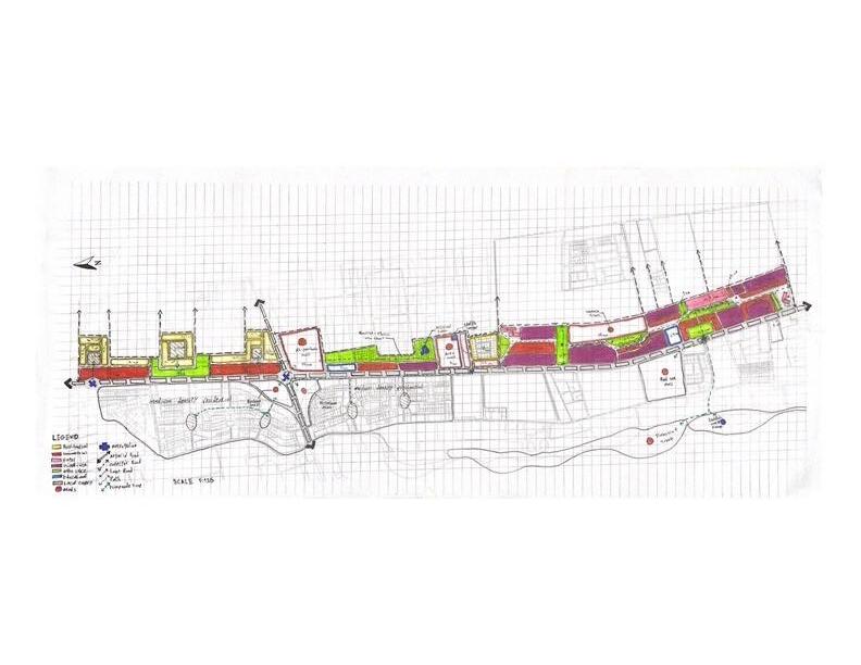


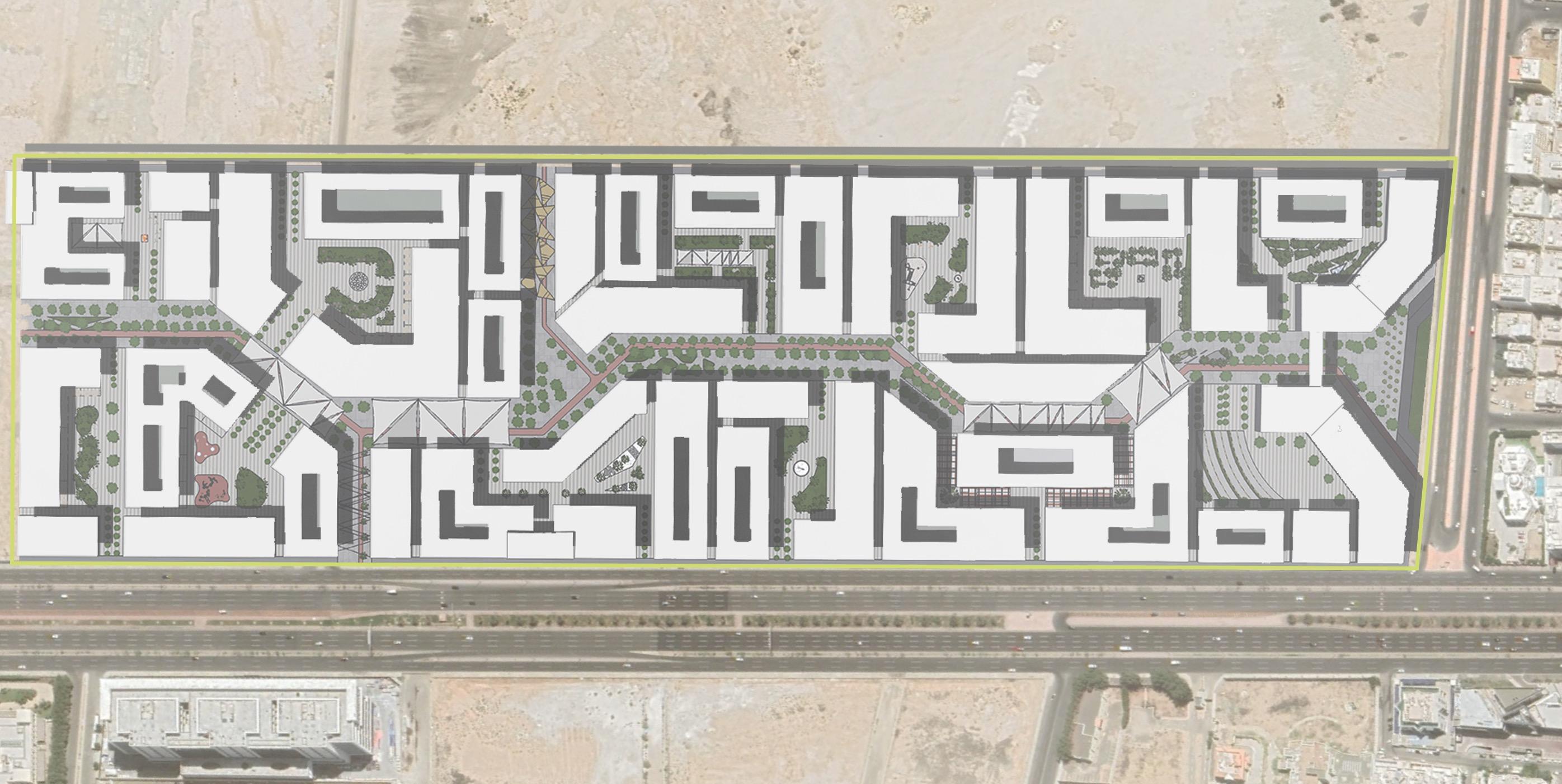
The design concept was based on Kevin Lynch’s principles and elements for creating spaces, which are: (Paths); the main path of the project was designed to be visually distinctive and easy to read and move through. (Landmark); attention was paid to the physical elements of buildings and models at varying distances to form a successive visual image along the path (Nodes); these are the gathering points and central squares, which were formed and distributed along the path with distinct characteristics and configurations for each one of them with the aim of creating different atmospheres for those nodes along the path.


Al-Aziziyah district is one of the most important and largest districts in Jeddah, with a population of approximately 720 thousand citizens and residents As a result, there is diversity among the population classes, which makes the district combine palaces, villas, apartment buildings, simple houses.
To understand this structure and the partial area by the study, the analyses will focus on the urban, social, traffic, and visual aspects, and processing and analyzing the data collected from the surveys to reach the indicators and measurements required to understand the area
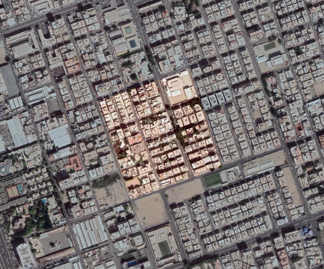
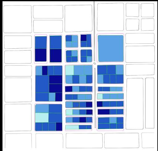
The largest percentage is buildings between 3-4 floors at 49%, followed by buildings less than 2 floors at 42%
The area is dominated by old buildings that are more than 25 years old by 76% of the buildings and are concentrated in the northern part of the area
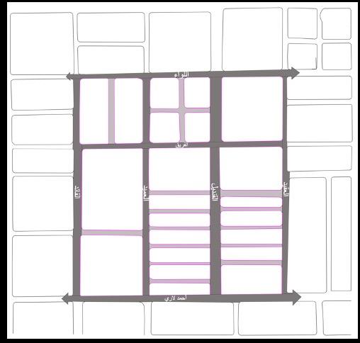
The road hierarchy in the area is excellent as most of the residential plots overlook to local roads and from there to the collector roads, which ensures the safety of the streets
The generators are located on the collector roads, as Al-Qandeel Street is considered the most active street, including commercial, educational, religious
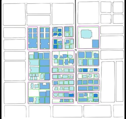
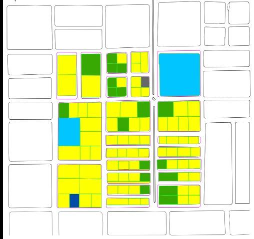
Residential lands constitute the largest proportion, at 77% of the number of land plots, and service areas are not cover the needs of the population
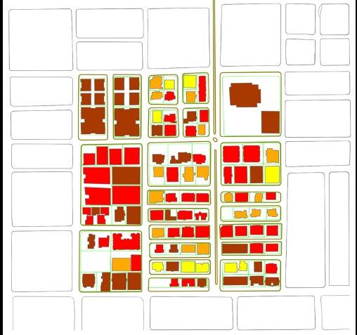
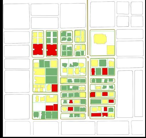
Buildings in excellent condition form 46% of the area, and the rest are buildings in middle to poor condition
Lands with a coverage of less than 25% (empty-lands) constitute 5% of area, which is a positive sign indicating good land use in the study area
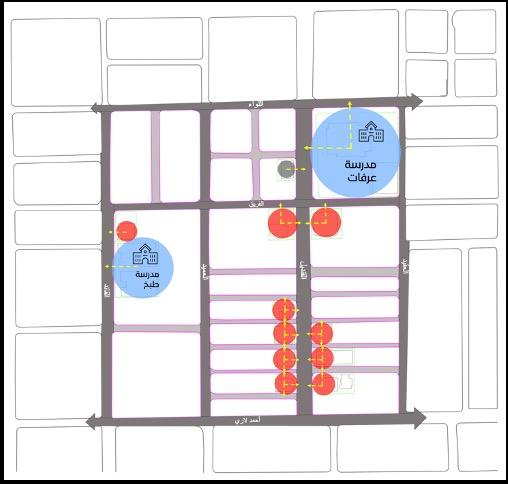
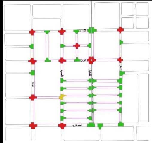
The most intersections in the area is the type (T) and they are the safest types, in contrast the intersections (X) are considered the most dangerous type and are spread at the north of the study area
As a result of the analysis of the urban, social and traffic characteristics of the study area, the following was concluded:
- The buildings in the study area are mostly residential, with a height between 3-4 floors, and are in excellent condition, but they are mostly buildings that are older than 25 years
- Following the social surveys of the area, it was found that the vast majority work outside the study area and mainly on their private car for transportation, and the family size ranges between 3-4 individuals, and they live in rented apartments
- Traffic wise, the area is considered as in good condition in terms of road hierarchy, the ratio of safe to dangerous intersections, and the reasonable size of generators


The study area is located north of Jeddah city in Al-Lulu district, and will be focus on determining the economic feasibility for the study area with an area of 16 hectares, 357 housing units have been identified for the project, and the expected population is 1,685 people.
The site will be studied spatially at the city level, the accessibility to the site, and the land market to identify similar projects in use around the area, and the real estate performance of the area
Finally, conducting financial studies to determine, is the project economically feasible?
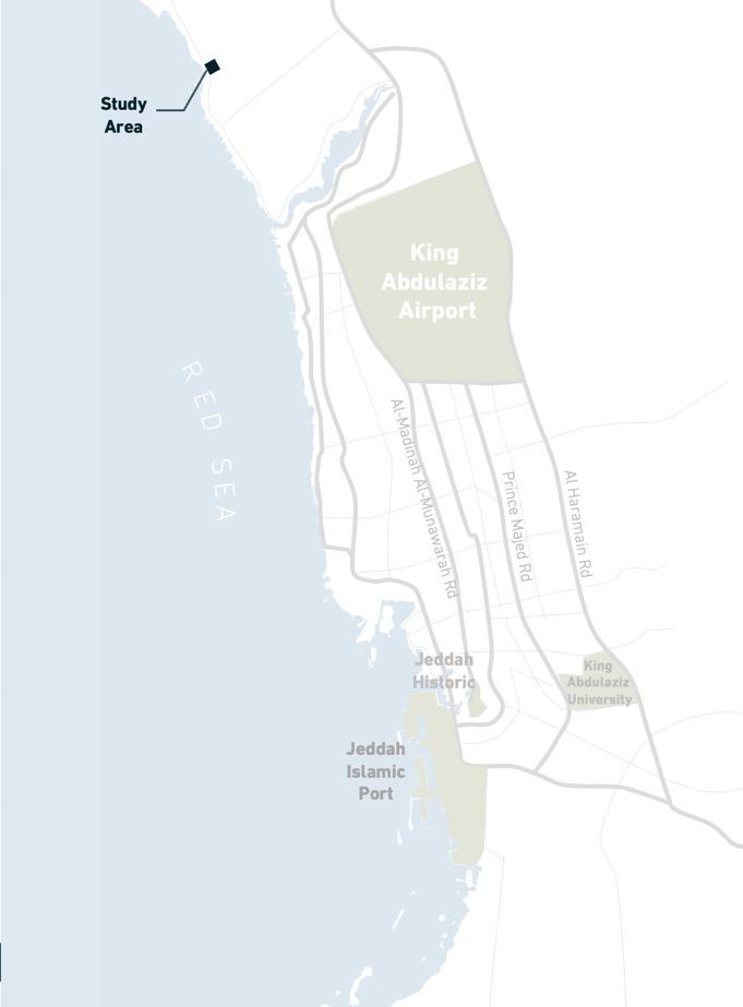
* The Study Area :